The THEIA catalogue — v1 provides access to all collections and datasets (satellite, airborne, drone, in situ) used by the Land Surfaces scientific community (biosphere and hydrosphere). It informs as well on their links with national and international research and observation programmes.
It consists of:
- a common metadata base fed by CD.O.S., IRs, observatories and structures that catalogue multi-source observation data;
- a user interface (full-text or multi-criteria search, etc.)
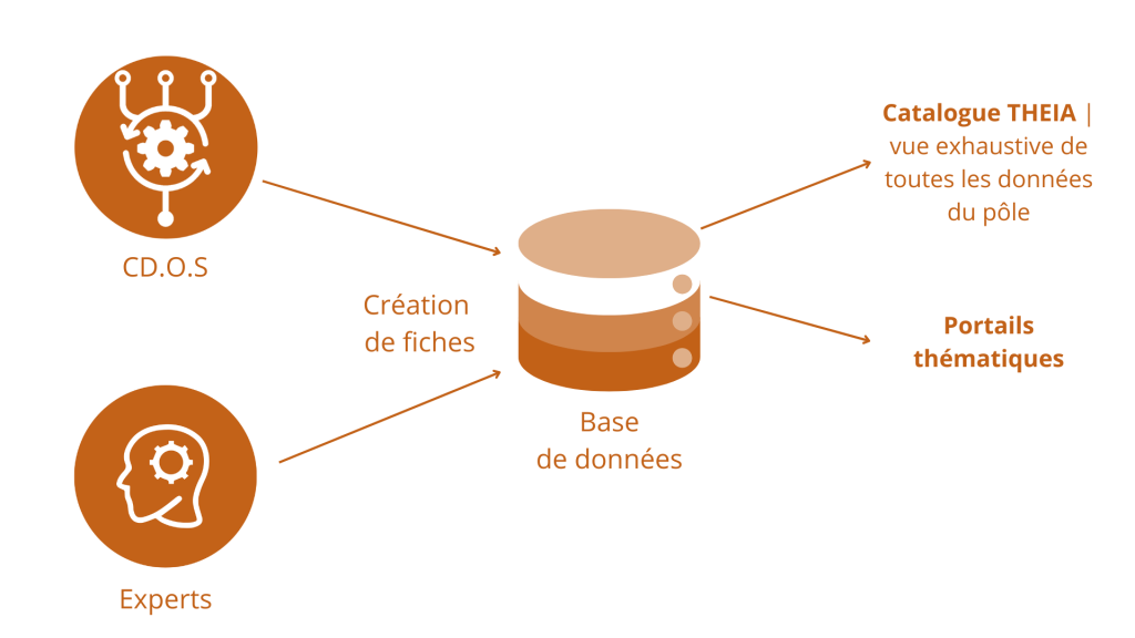
A filter system (project, themes, CD.OS, etc.) also allows a subset of the catalogue to be displayed on a project website, in particular by customising the search criteria offered.
Developments are on-going, pursuing the following objectives:
- Continue to implement the FAIR principles in THEIA
- Enhance interoperability among THEIA Data and Services Centres as well as with our partners (Data Terra…)
Schéma int