Theia’s news includes publications on products and both research and facilitation teams, events, and various announcements (jobs, internships, theses…).
Theia also publishes twice a year a Bulletin to which you can freely register here.
You are also welcome to follow us daily on Twitter, LinkedIn, ResearchGate and Youtube.
Publications
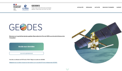
Hespérides and Geospatial Data Portals: Simplifying and Facilitating Access to Data
Access to spatial data is rapidly evolving — let’s take a closer look at the data and thematic products produced by CNES for THEIA.

AlTiS-NG: A new tool for analysing altimetry data in hydrology
Discover AlTiS-NG, THEIA new hydrological altimetry software presented on Tuesday 24 June on the Data Terra stand at the LPS.
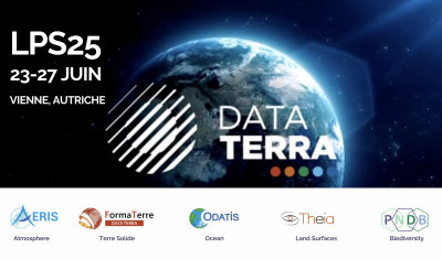
Data Terra, a major data player, awaits you at the Living Planet Symposium 2025
Join Data Terra at the heart of innovation at the Living Planet Symposium 2025! From June 23 to 27 in Vienna.
Engineer in remote sensing applied to monitoring tropical forest ecosystems
The INRAE offers a remote-sensing engineer position in TETIS laboratory, Montpellier, France.

SWOT : Understanding Our Rivers, Lakes and Floodplains
Two years after the launch of the French-American SWOT mission, what progress has been made in monitoring continental waters ?
NEW PRODUCTION AND DISTRIBUTION MEANS FOR THE CNES THEIA CDS
The CDS THEIA of CNES is opening new centers to improve access to and dissemination of Earth observation data.
Events
Hespérides and Geospatial Data Portals: Simplifying and Facilitating Access to Data
Access to spatial data is rapidly evolving — let’s take a closer look at the data and thematic products produced by CNES for THEIA.
AlTiS-NG: A new tool for analysing altimetry data in hydrology
Discover AlTiS-NG, THEIA new hydrological altimetry software presented on Tuesday 24 June on the Data Terra stand at the LPS.
Data Terra, a major data player, awaits you at the Living Planet Symposium 2025
Join Data Terra at the heart of innovation at the Living Planet Symposium 2025! From June 23 to 27 in Vienna.
Jobs, PhD & Post-Docs, Internships
Jobs
Hespérides and Geospatial Data Portals: Simplifying and Facilitating Access to Data
Access to spatial data is rapidly evolving — let’s take a closer look at the data and thematic products produced by CNES for THEIA.
AlTiS-NG: A new tool for analysing altimetry data in hydrology
Discover AlTiS-NG, THEIA new hydrological altimetry software presented on Tuesday 24 June on the Data Terra stand at the LPS.
Data Terra, a major data player, awaits you at the Living Planet Symposium 2025
Join Data Terra at the heart of innovation at the Living Planet Symposium 2025! From June 23 to 27 in Vienna.
PhD & Post-Docs
Hespérides and Geospatial Data Portals: Simplifying and Facilitating Access to Data
Access to spatial data is rapidly evolving — let’s take a closer look at the data and thematic products produced by CNES for THEIA.
AlTiS-NG: A new tool for analysing altimetry data in hydrology
Discover AlTiS-NG, THEIA new hydrological altimetry software presented on Tuesday 24 June on the Data Terra stand at the LPS.
Data Terra, a major data player, awaits you at the Living Planet Symposium 2025
Join Data Terra at the heart of innovation at the Living Planet Symposium 2025! From June 23 to 27 in Vienna.
Interships
Hespérides and Geospatial Data Portals: Simplifying and Facilitating Access to Data
Access to spatial data is rapidly evolving — let’s take a closer look at the data and thematic products produced by CNES for THEIA.
AlTiS-NG: A new tool for analysing altimetry data in hydrology
Discover AlTiS-NG, THEIA new hydrological altimetry software presented on Tuesday 24 June on the Data Terra stand at the LPS.
Data Terra, a major data player, awaits you at the Living Planet Symposium 2025
Join Data Terra at the heart of innovation at the Living Planet Symposium 2025! From June 23 to 27 in Vienna.