Description
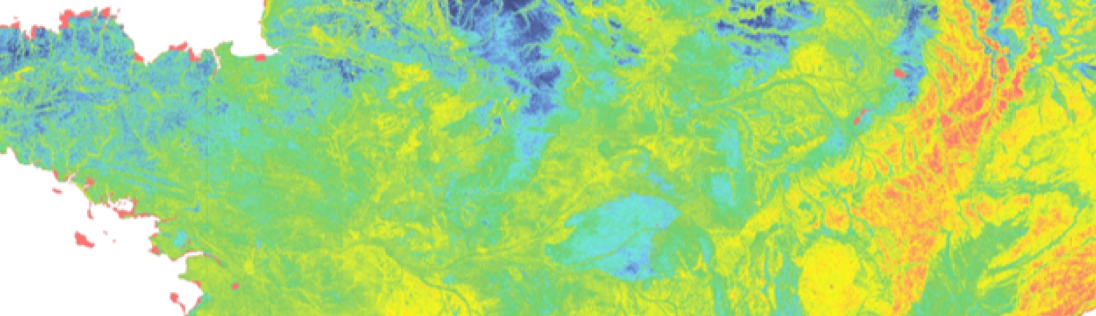
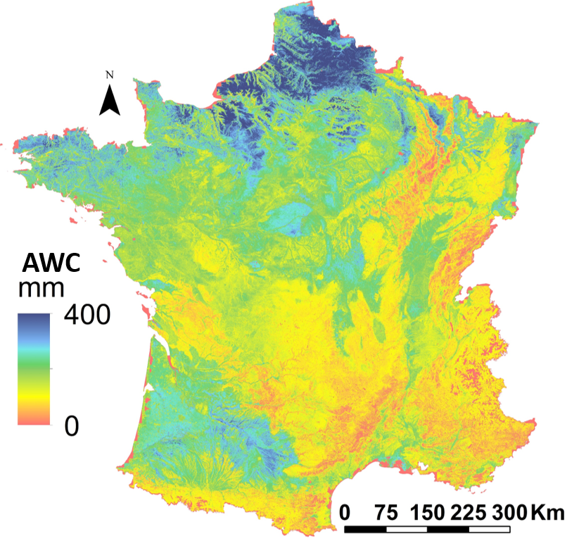
Theia Digital Soil Mapping CES produces a Map of the Soil Available Water Capacity in metropolitan France
The Water Capacity is calculated from a pedo-transfer function applied to soil characteristics estimated by digital mapping techniques.
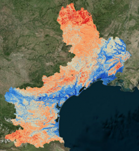
Focus on Languedoc-Roussillon is available
Soil Available Water Capacity of the Languedoc-Roussillon region
Contact

Anne Richer-de-Forges
INRAE | Info&Sols
ResearchGate
Contributions FR
References
Román Dobarco et al. (2019). Geoderma https://doi.org/10.1016/j.geoderma.2019.02.036).
Arrouays D., Cousin I., Pieri P., La Jeunesse I., Richer-de Forges A.C. (2022). La disponibilité en eau, le réservoir en eau utile des sols, les plantes et la vigne – Progrès et verrous de connaissance ; interrogations et enjeux dans le contexte du changement climatique. Article Technique. Revue des Œnologues 182. p. 19-20.