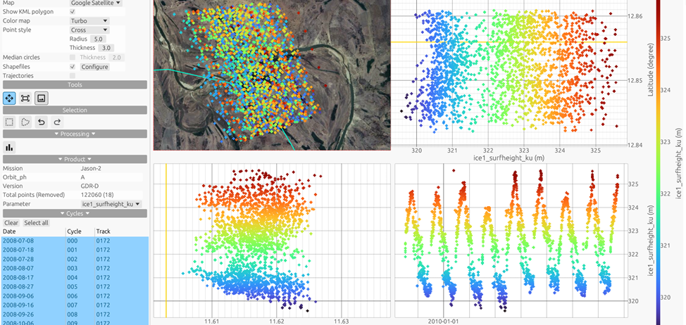
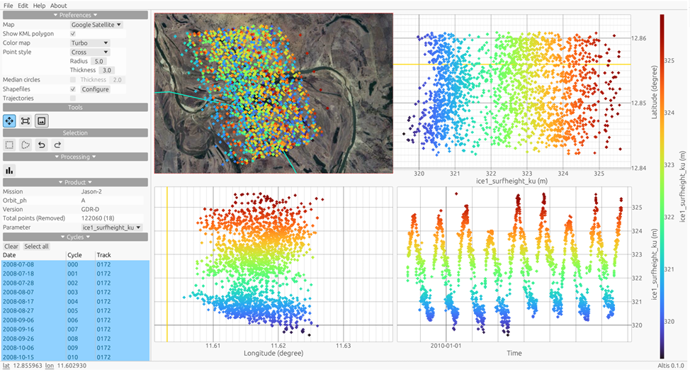
AlTiS-NG: A new tool for analysing altimetry data in hydrology
The Centre de Topographie des Océans et de l’Hydrosphère (CTOH), a French National Observation Service (SNO) of the LEGOS laboratory at the Observatoire Midi-Pyrénées (OMP) in Toulouse, has this year developed AlTiS-NG, a modernised version of the AlTiS software, already distributed by THEIA. This software, entirely redeveloped in Rust, facilitates the visualisation of altimetric data and the creation of time series of water level over rivers, lakes and flooded areas.
Radar altimetry is a powerful tool for hydrology, making it possible to generate time series of water levels. However, its use remains complex due to a number of challenges:
- Data complexity: Altimetry data is difficult to handle and requires a wide range of skills to read the products in netCDF format. They are spread across hundreds of files organised according to satellite orbit.
- Data selection : The selection of data measured on a body of water depends on its shape and the surrounding environment, which can interfere with radar measurements.
- Calculation of water level: The calculation of water level is specific to each altimetry product, as the names of the parameters and corrections are not standardised.
The AlTiS-NG software aims to make spatial altimetry accessible to hydrologists, enabling them to create their own time series of water levels in their study area.
The AlTiS-NG software is one of the new THEIA services presented on the Data Terra stand at the Living Planet Symposium. It is part of the work of THEIA’s Inland Waters Scientific Expertise Consortium.