AlTiS-NG: A new tool for analysing altimetry data in hydrology
Discover AlTiS-NG, THEIA new hydrological altimetry software presented on Tuesday 24 June on the Data Terra stand at the LPS.


Publications
Discover AlTiS-NG, THEIA new hydrological altimetry software presented on Tuesday 24 June on the Data Terra stand at the LPS.
Publications
Join Data Terra at the heart of innovation at the Living Planet Symposium 2025! From June 23 to 27 in Vienna.

Jobs
The INRAE offers a remote-sensing engineer position in TETIS laboratory, Montpellier, France.

Publications
Two years after the launch of the French-American SWOT mission, what progress has been made in monitoring continental waters ?
News
The CDS THEIA of CNES is opening new centers to improve access to and dissemination of Earth observation data.
News
The CDS THEIA Team at CNES is pleased to announce the resumption of value-added product production starting December 12, 2024, on its new production center. This production resumption, effective from […]
News
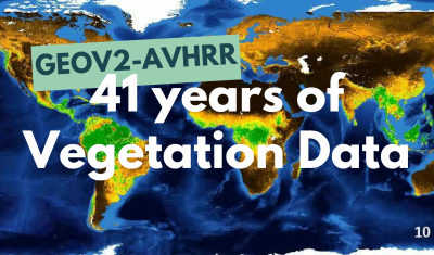
The GEOV2-AVHRR collection includes the 2022 version of 3 essential vegetation variables (LAI, FAPAR, FCOVER). The whole data processing has also been updated.

Publications
The Sentinel-2C satellite was launched by ESA and the Copernicus programme on 4 September 2024 on a VEGA launcher. As soon as it is operational, nominally following an estimated 3-month […]
Agenda
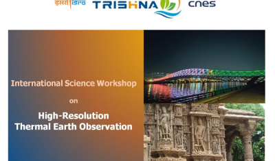
Save already the date for the coming 2nd French-Indian Workshp dedicated to HR thermal observation.
Publications
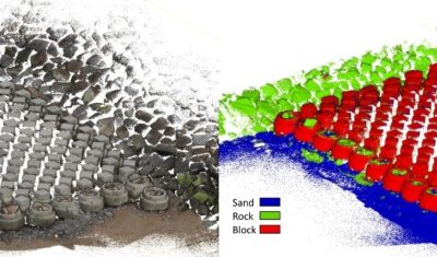
The THEIA portfolio of Lidar data processing tools has been extended with a new software tool for creating 3D point cloud classification models using machine learning: cLASpy_T cLASpy_T aims to […]
PhD & PostDoc
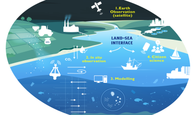
Thesis project aiming to integrate and interact high-frequency in situ data (COAST-HF, SYNAPSES) with water color satellite data (Sentinel 2/3 – Landsat – MODIS) to enhance our understanding of the land-sea interface.
Publications
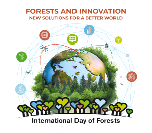
On this International Day of Forests, for which innovation has a major role to play in 2024, we are highlighting two tools dedicated to the management of aerial LiDAR data […]