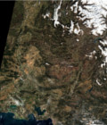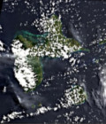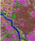
New version of fully automatic land cover map of France for 2014
The Scientific Expertise Center on Land Cover (CES OSO) has just released new land cover map examples of France produced using all the available Landsat8 data in 2014.
This land cover maps are available at http://osr-cesbio.ups-tlse.fr/~oso/ui-ol/bati-affine/layer.html. An user interface allows displaying and comparing the maps.
For more information on method for Land Cover maps production and their characteristics see https://www.cesbio.cnrs.fr/multitemp/?p=8009
More information: Land cover CESLand cover map