

Presentation

The Scientific Expertise Centre “Land Cover SEC” brings together teams from Cesbio, UMR Ispa, Dynafor, CNRM, UMR Tetis, IGN–Matis, Costel and Sertit whose common objective is to define and develop automatic algorithms for the production of land use maps from satellite imagery.
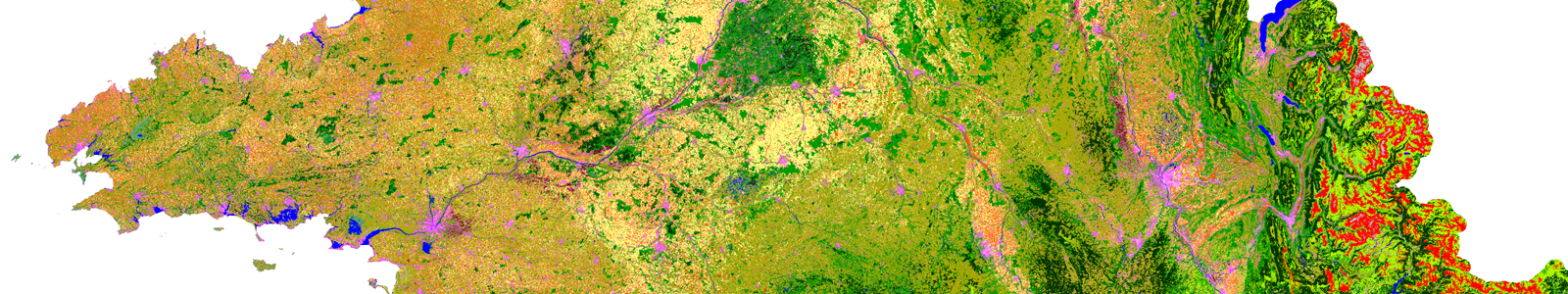
Main characteristics of the OSO Land Cover product
Production of national maps (mainland France)
- nomenclature with 17 classes (2016, 2017) and 23 classes since 2018
- spatial resolution between 10 m (raster) and 20 m (vector)
- annual update frequency
[metaslider id=9096 cssclass=””]
Input data
- multi-temporal optical image series with high spatial resolution (Sentinel-2 type, but also in the future SPOT-6/7, or even Pleiades),
- auxiliary reference data for calibration methods and product validation
The type of product described here has no equal in terms of scale in space or in time (update frequency).
- Corine Land Cover has a much lower update frequency
- The Copernicus products have simplified nomenclatures (High Resolution Layers) or limited geographical stretches (Urban Atlas)
Schedule
2019
- First autonomous production by the CNES operations team (training by CESBIO in 2018)
- Optimization of vectorization algorithms – Integration of THR and contextual classifications (R&D)
2020
- Extension of the nomenclature to 30 classes (addition of wetlands and more agricultural classes)
- Transition to THR operational
Contact

Vincent Thierion
INRAE | CESBIO
@V.Thierion
Contributions FR

Silvia Valero
CESBIO
Google Scholar
@S.Valero
Links
- OSO | France Land Cover Map
- Metadata and information https://www.cesbio.cnrs.fr/multitemp/
- WMS http://cyan.ups-tlse.fr:8080/geoserver/SudOuest/wms
- Research Gate | Theia Land Cover OSO