AlTiS-NG: A new tool for analysing altimetry data in hydrology
Discover AlTiS-NG, THEIA new hydrological altimetry software presented on Tuesday 24 June on the Data Terra stand at the LPS.
THEIA’ Scientific Expertise Centre in Land Water brings together a network of laboratories working on water monitoring on a national and international scale.
The aim is to develop and propose innovative methods to offer products and services tailored to the issues and needs of scientific users and local managers.

Publications
Discover AlTiS-NG, THEIA new hydrological altimetry software presented on Tuesday 24 June on the Data Terra stand at the LPS.
Publications
Join Data Terra at the heart of innovation at the Living Planet Symposium 2025! From June 23 to 27 in Vienna.

Publications
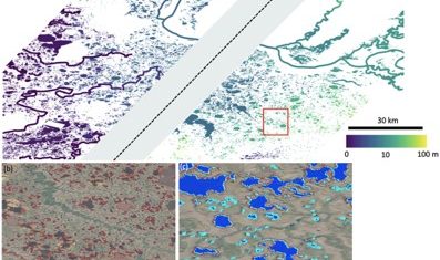
Two years after the launch of the French-American SWOT mission, what progress has been made in monitoring continental waters ?
PhD & PostDoc
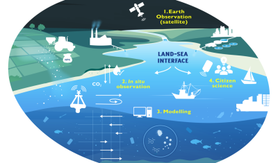
Thesis project aiming to integrate and interact high-frequency in situ data (COAST-HF, SYNAPSES) with water color satellite data (Sentinel 2/3 – Landsat – MODIS) to enhance our understanding of the land-sea interface.
Products
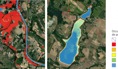
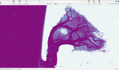
Discover Theia Surfwater Product now produced continuously for Sentinel-2 and available on hydroweb.next
Products
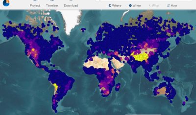
Discover the new hydroweb.next portal, which now include Theia Lake and River Water Level Products, Hydroweb
Products
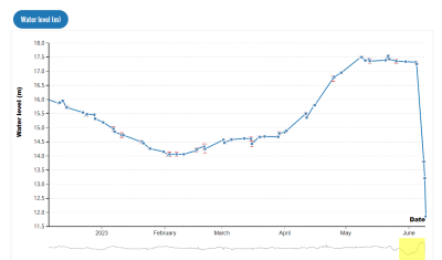
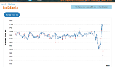
Hydroweb data is used to track the world’s major rivers and reservoirs. It documents the end of the Kakhovka reservoir.