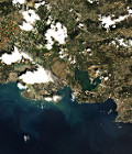
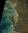
First Spot 5 (Take5) Ortho

The first Spot5 (Take5) image from the Lake Victoria image in Uganda has been ortho-rectified (L1C).

Registered with a similar product from Landsat 8, both images match very well, but we need to validate that much further.

We are starting to catch-up our late start due to the late definition of the sites. Most of the ancillary data for the 150 sites are ready (still missing the most Northern sites), and the first ortho-rectification was processed on the nominal configuration at Theia (CNES) by the Muscate exploitation team.

More information on : https://www.cesbio.cnrs.fr/multitemp/?p=4981
More information: 

More news

AlTiS-NG GUI with Jason-2 mission on the Komadugu river, Niger

AlTiS-NG: A new tool for analysing altimetry data in hydrology

Discover AlTiS-NG, THEIA new hydrological altimetry software presented on Tuesday 24 June on the Data Terra stand at the LPS.

Data Terra, a major data player, awaits you at the Living Planet Symposium 2025

Join Data Terra at the heart of innovation at the Living Planet Symposium 2025! From June 23 to 27 in Vienna.

Engineer in remote sensing applied to monitoring tropical forest ecosystems

The INRAE offers a remote-sensing engineer position in TETIS laboratory, Montpellier, France.

Search