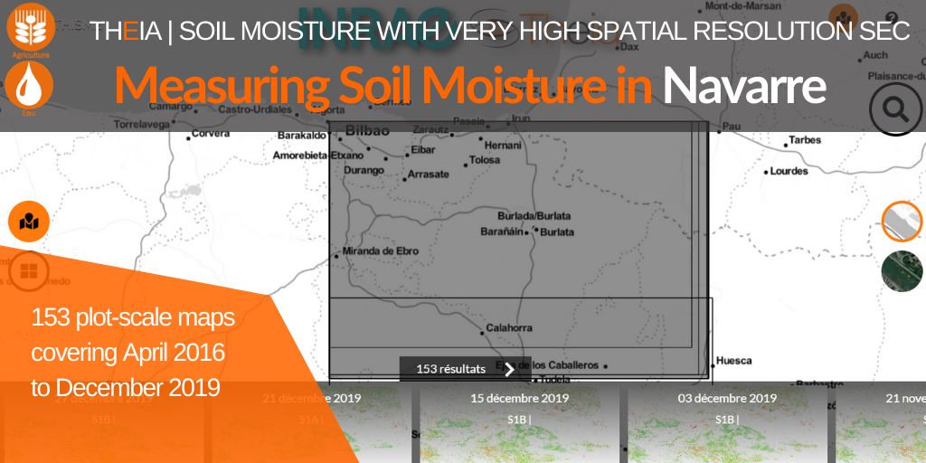
Measuring soil moisture in Navarre
A 15th site documenting three years of soil moisture with 153 maps.
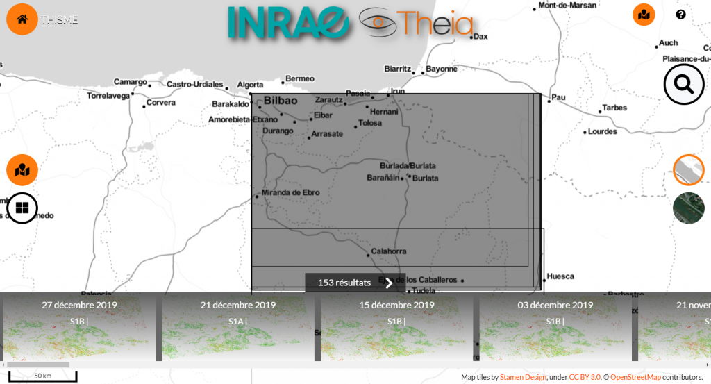
The Soil Moisture with very high spatial resolution SEC has just published a collection of maps for Navarre (Spain) covering the period 4 April 2016 to 27 December 2019.
As a result, maps documenting soil moisture at plot scale in Navarre are now available for almost three years. The Sentinel-1 sensors allow high repeatability (every 6 days). For Navarre, slightly fewer images have proved to be available.
With Navarre, the Soil Moisture product is now available for 15 different sites in Europe and around the Mediterranean. For Spain, a collection is also recently available for Catalonia.
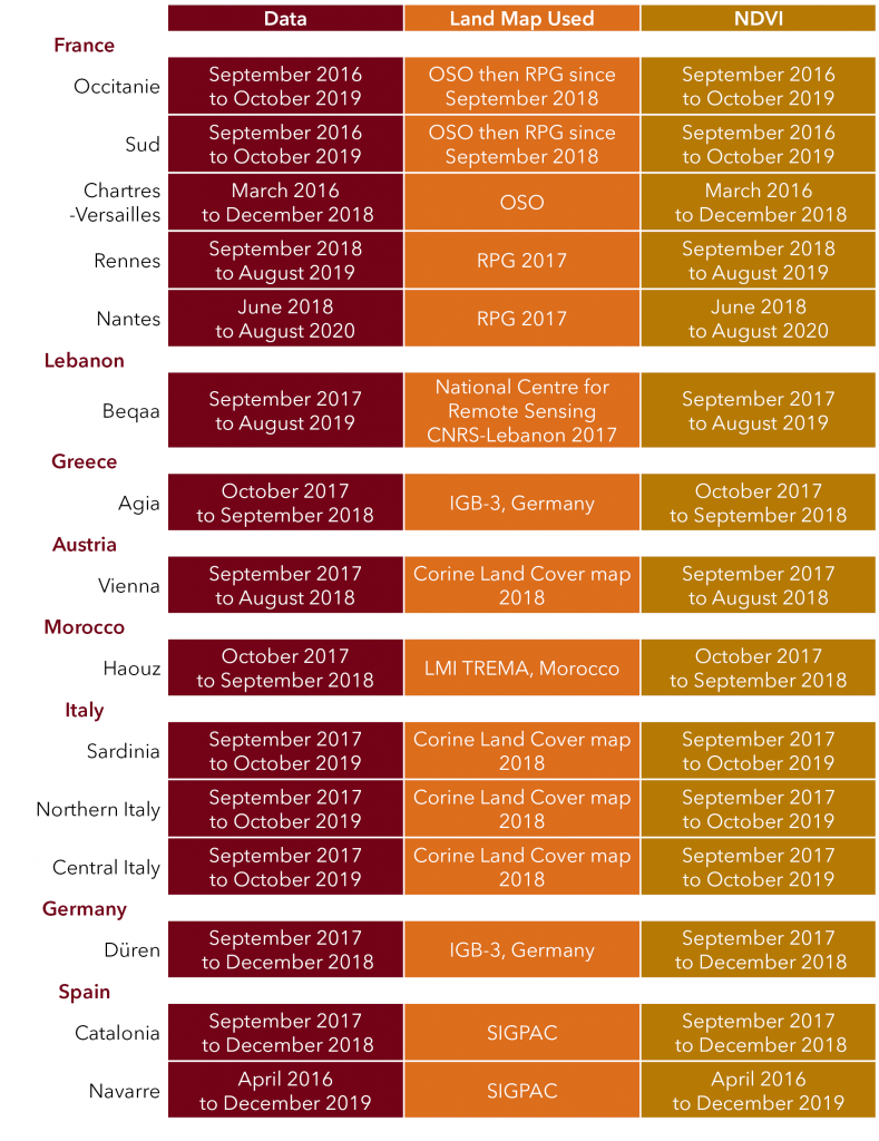
Registre parcellaire graphique (RPG)
National Center for Remote Sensing Lebanon
IBG-3 | Frank Hermann
Corine Land Cover | Copernicus
LMI TREMA Morocco | Vincent Simmoneaux
SIGPAC Spain
Available Data in Mach 2020
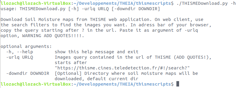
THISMEDownload.py : a dedicated tool for downloading
To facilitate entire collection download, an automatic THISMEDownload.py script has been developed by Loïc Lozac’h (INRAE engineer). The script is usable only on a Linux system because it contains dependencies (curl, wget) only available on this system. It allows batch downloading of the data present on the THISME web application.
Directions
- On the THISME web application, launch a search via the client interface.
- The query corresponding to this search is displayed in the address bar of your browser.
- Copy this address from the question mark (?)
- Use this query as an argument to the -urlq option in the THISMEDownload.py script
- Don’t forget to put the query in quotes.
For example, to download the collection corresponding to Central Italy, write :
THISMEDownload.py -urlq "q=%23Central-Italy&collection=SoilMoisture"
Contact

Nicolas Baghdadi
INRAE | Tetis
ResearchGate
Contributions

Mehrez Zribi
CNRS | Cesbio
ResearchGate
@M.Zribi
Contributions
Team

Ghaith Amin
INRAE | Tetis
LinkedIn

Hassan Bazzi
INRAE | Tetis
ResearchGate

Mohamad El-Hajj
INRAE | Tetis
ResearchGate

Loïc Lozac’h
INRAE | Tetis
@L.Lozach