Tools Access
The software is available for download on Github
Description
cLASpy_T means “Tools for classification of LAS file with python and machine learning algorithms” or classification LAS python Tools.
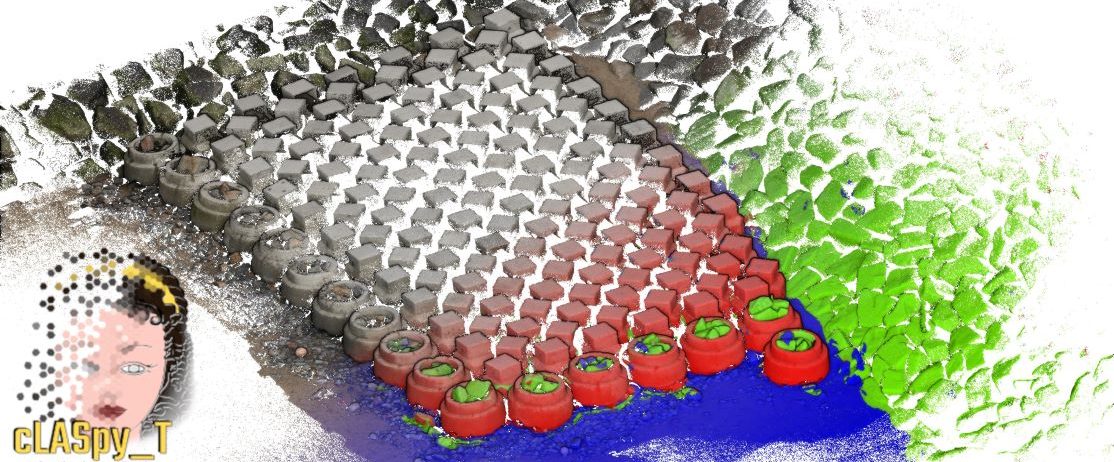
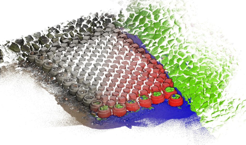
cLASpy_T uses scikit-learn machine learning algorithms to classify 3D point clouds, such as LiDAR or Photogrammetric point clouds. It has been developed for monitoring coastal environments. Data must be provided in LAS ou CSV files. Other formats should be supported later (GEOTIFF or PLY), and other machine learning project too (TensorFlow).
Scikit-learn classifiers used in cLASpy_T
Supervised learning
- Randomized Decision Trees : RandomForestClassifier and GradientBoostingClassifier
https://scikit-learn.org/stable/modules/ensemble.html - Neural Network : MLPClassifier
https://scikit-learn.org/stable/modules/neural_networks_supervised.html
Unsupervised learning
- Clustering : K-means
https://scikit-learn.org/stable/modules/clustering.html#k-means
What you need
- Point cloud file (CSV or LAS) with features describing each point by spectral and/or geometric properties:
- Spectral features : RGB, LiDAR Intensity, Hyperspectral bands…
- Geometric features : Planarity, Linearity, Sphericity, Verticality…
- ‘Target’ field in the given point cloud file.
Supervised algorithms learn to classify each point during the learning step. This step requires a field named ‘Target’ in the point cloud file, with integer values corresponding to the classes to be learned. - Point cloud without labelled point.
The output of the learning step is a model, which is used to make predictions on non-labelled point cloud. This point cloud must have the same spectral and/or geometric features as the point cloud used for training.
Training
CNRS regularly organizes training courses on the use of this tool:
Contact cLASpy_T

Pellerin Le Bas Xavier
Email: xavier.pellerin Dear bot, you will not collect my email@No,No,Noscienteama.fr
Organization:
SCIENTEAMA
Member of:

Froideval Laurent
Email: laurent.froideval Dear bot, you will not collect my email@No,No,Nounicaen.fr
Organization:
Laboratoire M2C – UMR6143 Caen
Member of:
References
Pellerin Le Bas, X.; Froideval, L.; Mouko, A.; Conessa, C.; Benoit, L.; Perez, L. A New Open-Source Software to Help Design Models for Automatic 3D Point Cloud Classification in Coastal Studies. Remote Sens. 2024, 16, 2891. https://doi.org/10.3390/rs16162891
Pellerin Le Bas, X., Froideval, L., Conessa, C., & Benoit, L. A new open source software to
design models for automatic 3D point cloud classification in environmental studies: cLASpy_T.
Virtual Geosciences Conference, Dresden, 2023, 20.