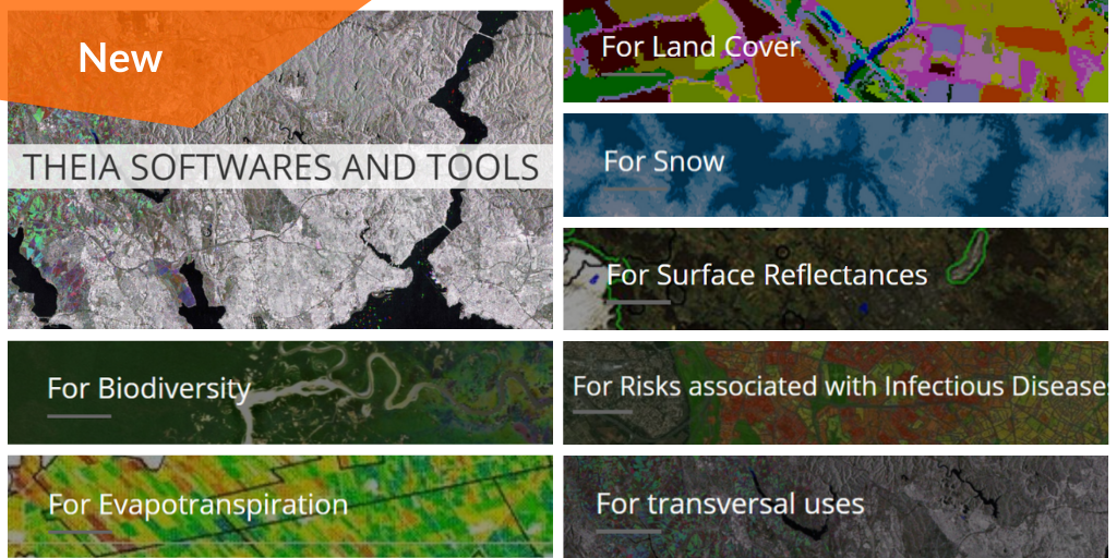
Theia Software and Tools

You already know all about Theia products! But Theia SECs are also producing software as well as treatment, mapping or modelling tools!

The better part of them is produced to respond to thematic needs (biodiversity, evapotranspiration, land cover, snow cover, reflectance, infectious disease, etc.) but some are designed to much larger use than thematic applications.

A brand new page on Theia website lists them all.

More news

Hespérides and Geospatial Data Portals: Simplifying and Facilitating Access to Data

Access to spatial data is rapidly evolving — let’s take a closer look at the data and thematic products produced by CNES for THEIA.

AlTiS-NG GUI with Jason-2 mission on the Komadugu river, Niger

AlTiS-NG: A new tool for analysing altimetry data in hydrology

Discover AlTiS-NG, THEIA new hydrological altimetry software presented on Tuesday 24 June on the Data Terra stand at the LPS.

Data Terra, a major data player, awaits you at the Living Planet Symposium 2025

Join Data Terra at the heart of innovation at the Living Planet Symposium 2025! From June 23 to 27 in Vienna.

Search