Measuring the albedo of mainland France from Sentinel-2
THEIA’s Albedo team has developed a method for calculating high-resolution (HR) albedo using Sentinel-2 data. The method has already been used as part of the Copernicus Global Land Service program, considering PROBA-V data (Roujean et al., RSE, 2018, doi.org/10.1016/j.rse.2018.05.015). THEIA is now distributing a series of Albedo Sentinel-2 products using L2A Reflectance products from MAJA for metropolitan France and neighboring regions. A fine CESBIO collaboration to produce an essential climate variable.
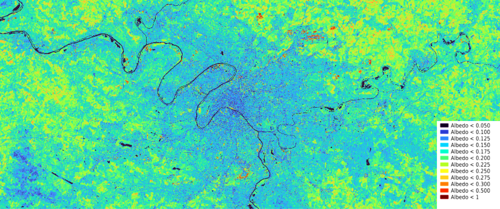
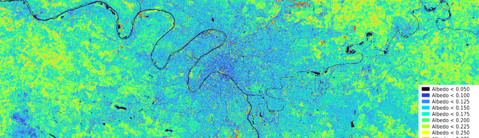
Values range from 0.12 (dark pixels) to 0.27 (red pixels).
A tool for climate mitigation policies
Albedo is an essential climatic variable (ECV) defined by the hemispherical or bi-hemispherical light energy flux reflected in relation to the incident flux. Several angular sighting and solar observations are required to obtain it, and BRDF (Bidirectional Reflectance Distribution Function) models are commonly used to reconstitute the complete directional spectrum from a few space observations. Spectral integration from Sentinel-2 spectral albedos is used to estimate the solar albedo.
Albedo is the third lever for mitigating global warming, after reducing greenhouse gases and storing carbon in the soil. It highlights the reflective power of surfaces to reduce heat storage. The ALBEDO-prairies project, led by IDELE (Institut de l’Élevage – Livestock Institute ) and financed by CASDAR (Special Appropriation Account for Agricultural and Rural Development), supported the development of a HR (High Resolution) albedo product to demonstrate the “cooling” effect of grasslands. The SCO SatBDNB (National Building Database) project, piloted by the CSTB (Centre Scientifique et Technique du Bâtiment – Scientific and Technical Building Center), then made the method operational and ensured initial national production. A better understanding of albedo in urban environments also means a better understanding of urban heat islands (UHIs), and thus a better prioritization of building retrofits.
The SCO SatBDNB project will also be followed by ADEME’s Surcarto project for the “Plus fraîche ma ville – My City Cooler” program, which will use multi-year albedo production to assess the evolution of UHIs in France.
Contact

Jean-Louis Roujean
CESBIO
@J-L.Roujean