
Challenges
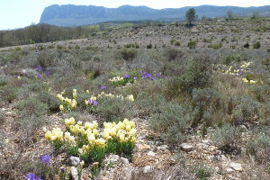
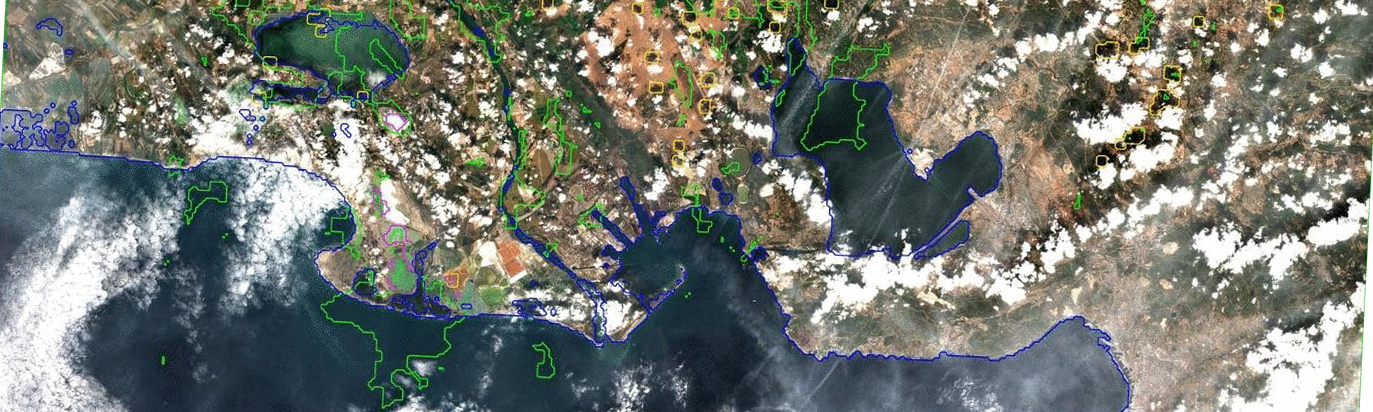
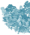
Mas-de-Londres – spring scrubland at the foot of Pic Saint-Loup (34) © S.Alleaume
Preserving biodiversity is one of the major challenges to sustainable development on a national, European (Natura 2000 and the Habitats Directive) and international scale (Convention on biological diversity, 2011-2020).
Natural habitats and the species that live there are under strong pressure from urban growth, artificiality, closing of open environments or the introduction of alien invasive species, leading to their degradation, fragmentation and thus threatening the balance of ecosystems.
Research issues
Stakeholders in the preservation of biodiversity are faced with substantial knowledge needs. They need to know as much as possible about the condition and evolution of biodiversity, in addition to the pressures to which it is subjected on all scales, from international down to local. To obtain a synoptic view of natural habitats and better assess their conservation, it is essential to use remote sensing and associated techniques. The arrival of images from new sensors with different swaths and a variety of spatial and temporal resolutions provides promising prospects for studying the diversity of natural habitats, their phenology and distribution on different spatial scales. We could quote, for example, images taken by drones or aerial photographs with a ten-centimetre resolution; images of Pleaides satellites with a metric resolution; or satellites with decametric resolutions such as Landsat, SPOT or the Sentinel satellites (from 2014), with their 5-day revisit frequency.
In this context, given the wide range of satellite and aerial images currently available, remote sensing can begin addressing these issues, such as:-
- characterising the state of natural habitats and their evolution through, for instance:
- mapping natural habitats, and determining changes to their surface area, distribution, connectivity and phenological dynamics etc.
- measuring biophysical and physical variables (e.g. LAI, biomass, water content and snow) which provide information on the state of plant cover.
characterising pressure on natural habitats, such as measurements of urban sprawl, the fragmentation of natural habitats or the forest’s invasion of open habitats essential for biodiversity…characterising services that biodiversity provides humankind, for example by mapping ecosystem services.
It is also important to take into account these elements of knowledge when monitoring and evaluating public policies to preserve biodiversity and optimise these policies.
The development of innovative methods to integrate multi-source, multi-resolution and multi-temporal imagery offers promising prospects for taking the different ecosystem scales into consideration. In other words, the products derived from remote sensing help determine temporal and spatial indicators for improved knowledge and management of natural habitats.
Some Theia Products on Biodiversity
Relevant Theia SECs
Variables & products
Albedo
Incubating SEC
Fire SEC
Variables & products
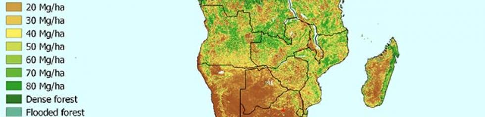
Forest biomass and changes in forest cover
Producing SEC
Land cover SEC
Incubating SEC
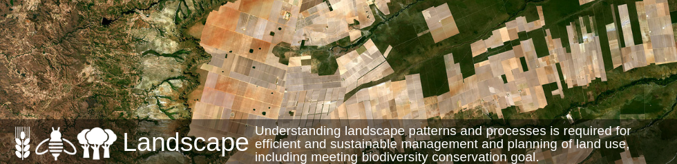
Landscape SEC
Producing SEC
Risks associated with infectious diseases SEC
Variables & products
Surface Reflectance
Variables & products
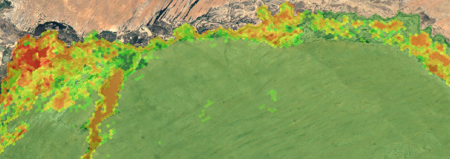
Variables for Biodiversity
Variables & products
Vegetation biophysical variables
Variables & products
Vegetation Optical Depth
Theia News on Biodiversity
News
GEOV2-AVHRR: updated and consolidated plant data
The GEOV2-AVHRR collection includes the 2022 version of 3 essential vegetation variables (LAI, FAPAR, FCOVER). The whole data processing has also been updated.
Products
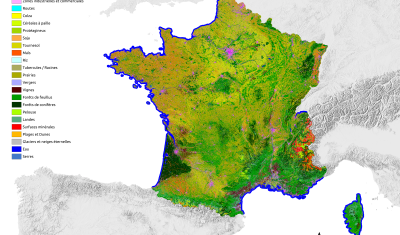
OSO 2023 Data : a little more patience ahead
THEIA Land Cover product is produced each year by CESBIO and CNES. It provides a 24-class typology of land cover, downloadable by department for mainland France. Production begins in January […]
Theia Regional Animation Network
A new GeoDEV website, with resources tailored to your profile
The website of the ART GeoDEV, the Theia Regional Animation network that CIRAD, IRD and CNES have been leading since 2017 in the direction of Southern countries, is evolving to […]
Jobs
JOB POSITION: DATA ANALYST TO OPERATIONALIZE BIODIVERSITY INDICATORS USING EARTH OBSERVATION SATELLITES INFORMATION
Please apply before June, 30th.
News
DISCOVER VENUS M5 PRODUCTS NOW AVAILABLE ON THEIA
VENµS M5 reflectance products are now available through Theia with over 100 documented sites worldwide.
Publications
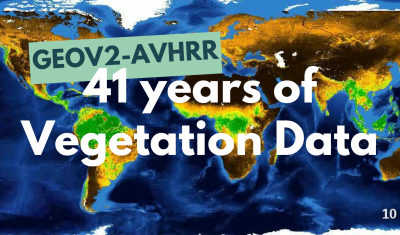
GEOV2-AVHRR: the 2021 version is available
The GEOV2-AVHRR product has been updated for the year 2021. This means that 40 years of global vegetation data are now available.
Data Terra
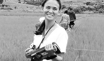
Using satellite imagery to establish a link between the environment, the habitats that are favourable to these species, and the human and animal populations at risk
Annelise TRAN, CIRAD researcher and THEIA Risks associated with Infectious Diseases SEC, shares her vision of Theia consortium, its achievements as well as the challenges ahead.
Data Terra
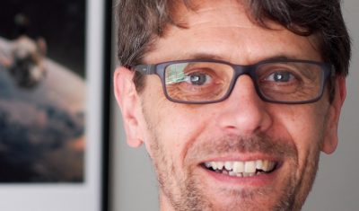
“What motivates my interest in THEIA, but also in the very idea of data consortia, are the ever-changing activities and the associated challenges.”
Arnaud Sellé, CNES-Partner Interoperability Manager for DINAMIS, Theia & ForM@Ter, gives us his vision of Theia contributions and challenges.
PhD & PostDoc
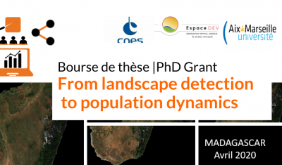
[PhD grant] From Landscape detection to population dynamics
CNES is offering a PhD grant for a project aiming to improve knowledge of human population dynamics in rural areas through the recognition of landscape indicators derived from high-resolution image processing.
Publications
Do you know the SCO?
The SCO facilitators discuss the Space Climate Observatory project, through which several THEIA SECs and RANs projects have been labelled.
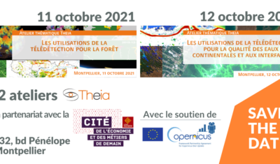
Theia Forest and Water Quality Workshops
Theia organized two thematic workshops in October, focusing on applied products for the monitoring of Forests and Water Quality.
Publications
GEOV2-AVHRR: 2020 data now available
The GEOV2-AVHRR product has been updated for the year 2020. There are now 39 years of global vegetation change data available.
Publications
Providing key information for environmental studies to document changes and trends
Meet with Silvia Valero, the new facilitator for Theia Land Cover SEC. She shares here her ambitions and expectations.
Publications
GEOV2-AVHRR: Monitoring Changes in Vegetation on a Global Scale over the last 38 Years
Long-term global monitoring of the terrestrial biosphere has raised an increasing interest in recent years. The Global Climate Observing System (GCOS 2010) identified a set of Essential Climate Variables (ECV) […]
Publications
SMOS L4RZSM, an operational product dedicated to root zone humidity
Discover or rediscover the Root Zone Moisture product developed at Cesbio from SMOS data for Theia Surface Soil Moisture SEC.
Publications
Just released Theia Bulletin n°14
Read Theia Bulletin n°14 and all the news from the network.
Publications
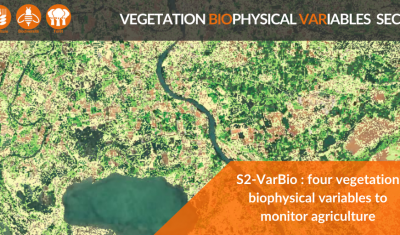
S2-VarBIO: four biophysical variables to monitor crops and vegetation
The first S2-VarBio demonstration products are now available on Theia.
Publications
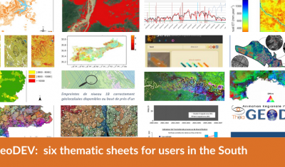
GeoDEV: six thematic sheets for users in the South
Theia GeoDEV RAN proposes thematic sheets with Southern users’ needs in mind.
Publications
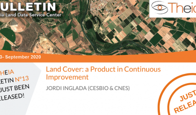
Land Cover: a Product in Continuous Improvement
Jordi Inglada tells us about the latest developments of Theia Land Cover product.
Publications
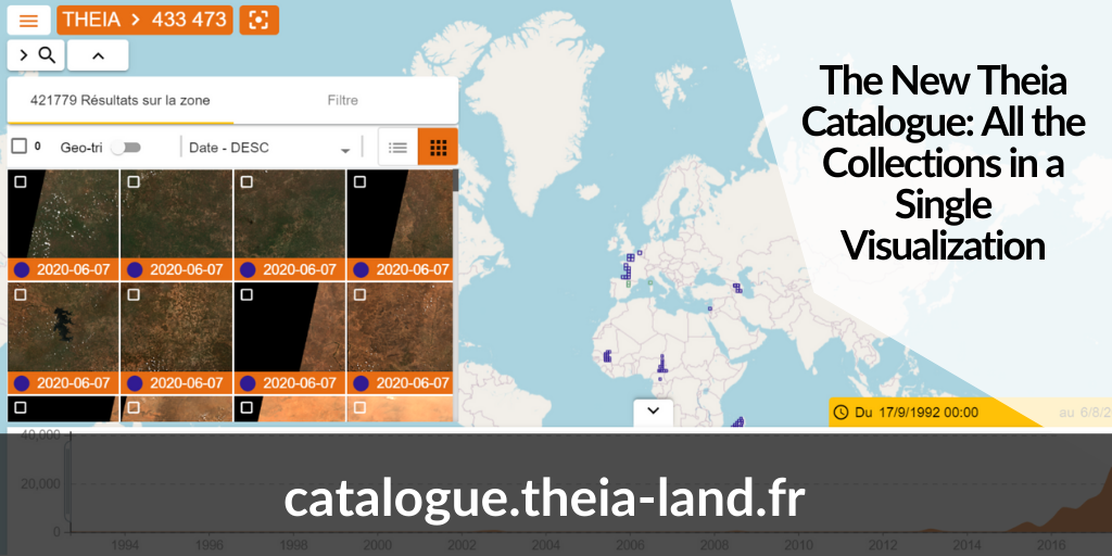
The New Theia Catalogue: All the Collections in a Single Visualization
Discover the new Theia catalogue offering a centralised access to SECs products as well as advances search functions and image visualisation tools.
Publications
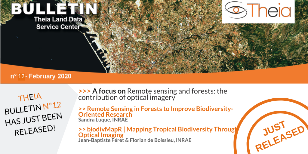
Remote sensing and forests: the contribution of optical imagery
A focus on the use of remote sensing for forests, including the contribution of the biodivMapR tool.
Publications
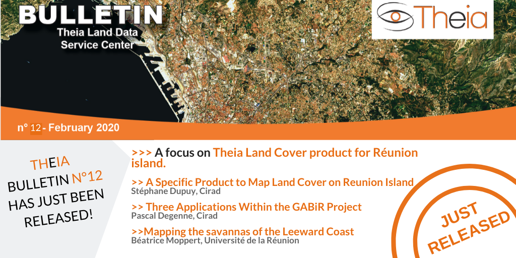
Land Cover on Reunion Island
A focus on Theia Land Cover on Reunion Island product, its methods and uses.
Publications
Theia Bulletin n°12
Discover the content of Theia Bulletin n°12.
Publications
Documenting in essential variables for biodiversity by remote sensing
A focus on Samuel Alleaume & Sandra Luques research representing both Theia Variables for Biodiversity and Landscape SECs.
Publications
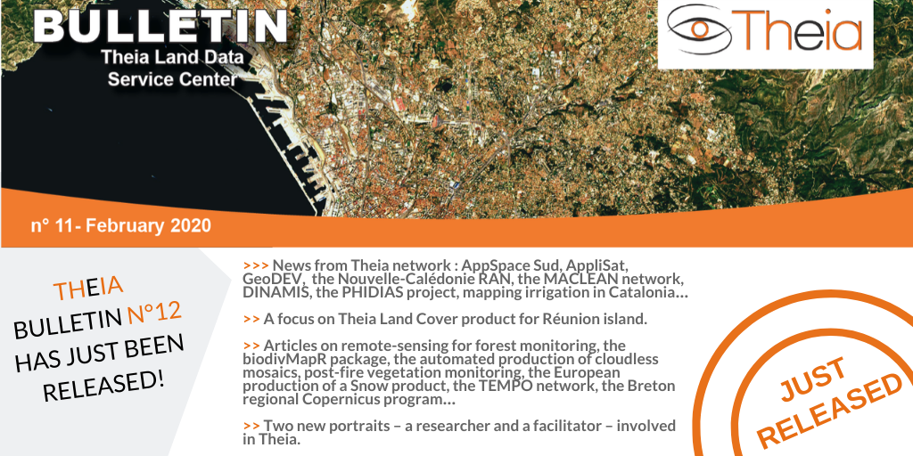
Just released: Theia Bulletin n°11
Read all the news from Theia network.
Publications
2018 Land Cover Product
Discover the Land Cover Product and the novelties of the 2018 reference year.
Publications
Improving Biodiversity Monitoring Using Satellite Remote Sensing
‘ ‘, by , ,
Agenda
Thematic School: remote sensing and biodiversity
The Labex CEBA is organising its thematic school on remote sensing and its potential uses in the study of biodiversity. It will be held at the Hotel des Roches in Kourou (French Guiana) as from the 25th to the 29th of September 2017.
Applications
Current projects
- National CarHab project: mapping of natural and semi-natural vegetation in France. The French Ministry of Ecology initiated CarHab in 2011 in order to have by 2015 a 1:25000 map of natural and semi-natural vegetation throughout France.
For more information, see www.irstea.fr
- GEOSUD project: the goal is to develop an international research and transfer centre for remote sensing and satellite information to promote sustainable development. This projet contributes to the development of thematic methods (mapping of natural habitats) and their formalisation through methodological guides.
- CHAMOIS project: the goal here is to map the spatial distribution and diversity of flora in high-altitude natural habitats in the Isère department (eastern France) by trialling remote sensing methods and using graph theory to analyse vegetation survey databases.
For more information, see projet CHAMOIS - Agropastoral fabric of the Massif Central region (central France): maintaining biodiversity in the Massif Central by preserving the quality and functionality of grasslands (IPAMAC association). The project aims to develop as detailed cartographic inventory methods of flora in grasslands as possible. It applies to both aerial and satellite imagery (Worldview2, Pleiades, SPOT) with a spatial resolution from 0.30 to 2.5 m recorded at different periods of the growing cycle, in addition to lidar data and spatialized phytosociological surveys.
- Tel-IAE project: to develop methods and tools based on satellite imagery for the identification and characterisation of agro-ecological infrastructures for R&D players and public authorities.
- ASTERIX project (Analyse Spatio¬temporelle pour la Télédétection de l’Environnement par Reconnaissance dans les Images compleXes – http://anr-asterix.irisa.fr). This project is designed to provide methods, algorithms and software for image analysis and automatic learning to help recognise environmental objects in complex images by explicitly taking into account the specificity of remote sensing imagery. It seeks to define a methodological framework to process data at various spatial and temporal scales. As part of this project, a study is currently being carried out on the dynamics of ash tree colonisation of pastures in the Hautes-Pyrénées region.
Past projects
- European MS.MONINA project – Multiscale Service for MONItoring NAtura 2000 habitats of European community interest. The project proposed setting up observation and management services for Natura 2000 sites and other habitats of interest to Europe.
- European BIO_SOS project (Biodiversity Multi-SOurce Monitoring System: From Space To Species). The main goal was to develop an efficient pre-operational multi-year monitoring system for Natura 2000 sites and their surrounding areas, subject to different and combined pressures.
- Regional RhoMeO project: observatory on the state of wetlands in the Rhône-Mediterranean basin (2011-2013). It set up monitoring and analysis tools for these wetlands based on biological indicators and human pressure.
- FORGECO project. This project focused on ecological intensification in a multifunctional context of forested areas. One of the objectives was to set up methods to help in decision-making for inventorying forest habitats and analysing their past and future evolution.
Thesis
Current thesis
- Cartographie des écosystèmes de montagne et analyse des changements de phénologie en lien avec les changements climatiques-utilisation de séries temporelles d’images satellitaires
Emmanuelle Cano
LETG – Rennes Costel - Evaluation la restauration écologique des cours d’eau par télédétection à très haute résolution spatiale et temporelle : développement d’une approche multicapteurs
Marianne Laslier
LETG – Rennes Costel - La cartographie des services écosystémiques : un nouvel outil d’intégration des relations homme-milieu dans la gestion environnementale ?
Solen Leclerch
LETG – Rennes Costel - Impact du changement climatique sur la biodiversité des zones humides : l’analyse des politiques publiques au Brésil et en France dans les parcs du Pantanal et de la Grande Brière
Heloisa de Camargo Tozato
LETG – Rennes Costel - Exploitation de séries temporelles d’images satellites à haute résolution spatiale pour le suivi des prairies en milieu agricole
Pauline Dusseux
LETG – Rennes Costel
Past thesis
- Délimitation et caractérisation fonctionnelle des zones humides à l’échelle du bassin versant pour une gestion raisonnée et intégrée : évaluation de la télédétection à très haute résolution sur la Dordogne
Sébastien Rapinel
6 sept. 2012 – LETG – Rennes Costel - Diversité, organisation spatiale et fonctionnelle des communautés de papillons (lépidoptères, rhopalocères) en milieu urbain et périurbain (Rôle des espaces artificialisés en terme de conservation et de connectivité)
Marie-Hélène Lizee
2011 – Université de Provence ; Ecole Doctorale Sciences de l’Environnement, Marseille
- Analyse à l’échelle régionale de l’impact de l’occupation du sol dans les corridors rivulaires sur l’état écologique des cours d’eau
Thierry Tormos
2010 Cemagref Montpellier UR LCMO UMR Tetis FRA - Suivi multi-échelle par télédétection et spectroscopie de l’état hydrique de la végétation méditerranéenne pour la prévention du risque de feu de forêt
Fabien Dauriac
2004 – Doctorat Sciences de l’eau, ENGREF, Montpellier - Distribution potentielle des grands mammifères dans le parc du W du Niger
Thomas Rabeil
2003 – Université Paris Diderot – Paris 7 - Descripteurs du paysage dérivés d’images satellitales et leur utilisation dans la cartographie de la biodiversité
Guillem Chust
2002 – Université Paul Sabatier, Faculté des sciences pharmaceutiques, Toulouse - Télédétection et agroécologie, un essai de cartographie destinée à la gestion des milieux herbacés de haute montagne : application au Parc national des Ecrins
Aline Cherpeau
1996, Cemagref Grenoble AMGR
Articles
Séminaire Biodiversité, organisé le 20 mars 2014 par l’IGN avec le concours du Pôle Theia (à Saint Mandé):
- Biodiversité et politiques publiques : Jennifer Amsallem (UMR TETIS)
- Les potentialités de l’imagerie radar pour la caractérisation des continuités écologiques: Application au réseau bocager dans un contexte agricole : Julie Betbeder (COSTEL-LETG)
- Le projet CarHab, apport de la recherche pour le projet : Loïc Commagnac (IGN/SAI)
Other publications :
- La modélisation des espèces et de leurs habitats
- Télédétection et milieux humides (Pôle-relais lagunes méditerranéennes, 2016)
- Theia en zone sèche méditerranéenne : retour sur l’utilisation d’une nouvelle source d’information d’occupation du sol (Les Ecologistes de l’Euzière)
- A Sourcebook of Methods and Procedures for Monitoring EBVs in Tropical Forests with Remote Sensing (GOFC-GOLD)