Access
Presentation
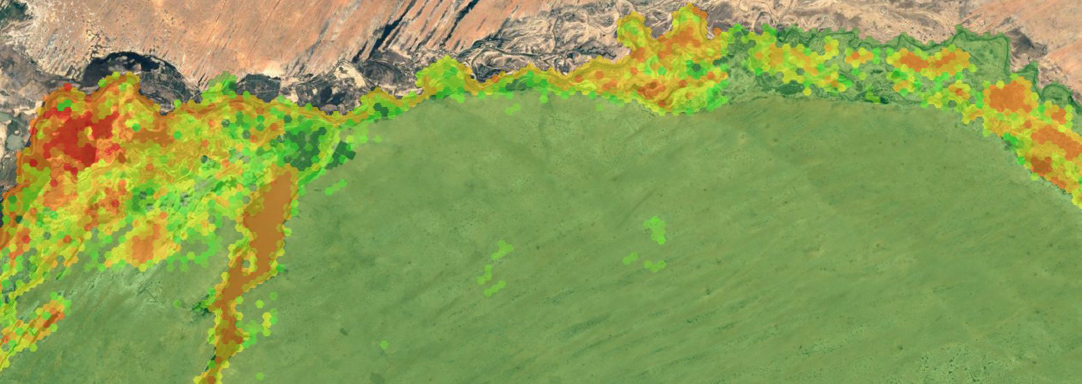
Theia Risks associated with infectious diseases SEC has established a spatial modeling of mosquito vectors for Rift Valley fever virus in Northern Senegal. The mapping tool proposes geographical layers derived from a model of mosquito population dynamics applied to three vector species of Rift Valley fever in Senegal: Aedes (Aedimorphus) vexans, Culex (Culex) poicilipes and Culex (Culex) tritaeniorhynchus (2014-2016).

Format
Shapefile
Reference
Tran A., Fall A.G., Biteye B., Ciss M., Gimonneau G., Castets M., Talla Seck M., Chevalier V.. 2019. Spatial modeling of mosquito vectors for rift valley fever virus in northern Senegal: Integrating satellite-derived meteorological estimates in population dynamics models. Remote Sensing, 11 (9) (1024) : 24 p. doi: 10.3390/rs11091024