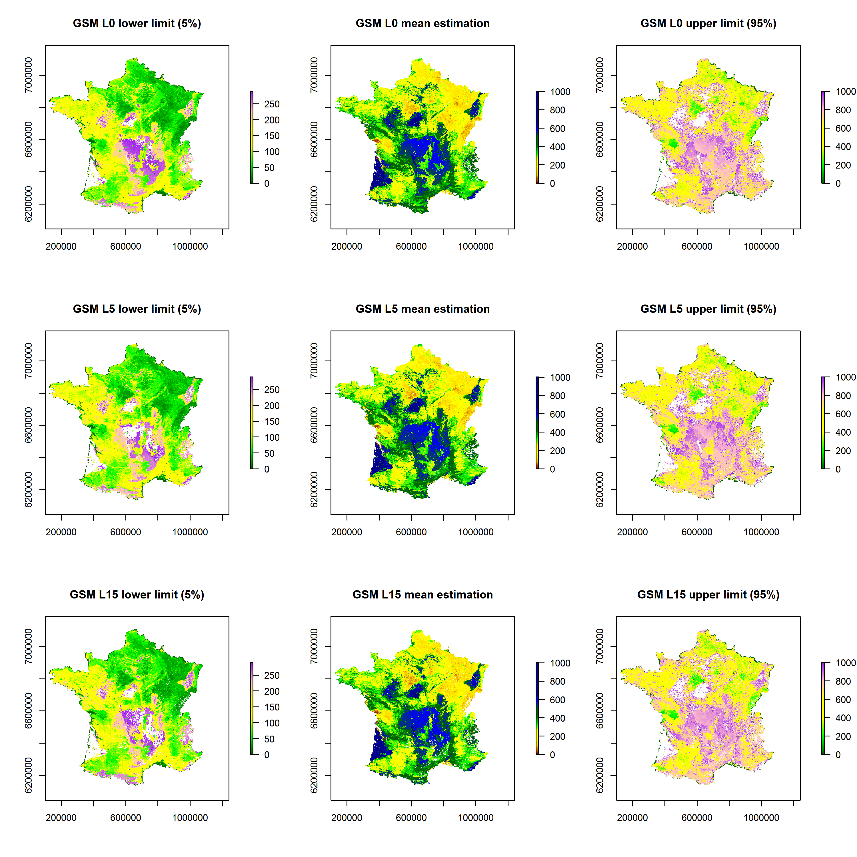
Theia Digital Soil Mapping CES produces a series of maps of soil particle size fractions (clay, silt, sand) and coarse element content for metropolitan France.
Data at 90 m intervals are available on: https://entrepot.recherche.data.gouv.fr/dataset.xhtml?persistentId=doi:10.57745/N4E4NE