GEOV2-AVHRR: the 2021 version is available
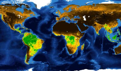
The GEOV2-AVHRR product has been updated for the year 2021. This means that 40 years of global vegetation data are now available.
The GEOV2-AVHRR product has been updated for the year 2021. This means that 40 years of global vegetation data are now available.
Theia Digital Mapping SEC offers new educational resources and Soil Properties Maps.
Flavien GOUILLON & Lionel ZAWADZKI from CNES gave an update on the evolution of the Theia data and services infrastructure to meet the needs of hydrological data processing and dissemination.
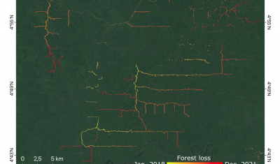
The Tropisco projects build on methods developed in THEIA Forest Biomass and Cover Change SEC.

Annelise TRAN, CIRAD researcher and THEIA Risks associated with Infectious Diseases SEC, shares her vision of Theia consortium, its achievements as well as the challenges ahead.

Arnaud Sellé, CNES-Partner Interoperability Manager for DINAMIS, Theia & ForM@Ter, gives us his vision of Theia contributions and challenges.
>>>News from the network: Nomination of Anne Puissant as Theia new Scientific Director; Theia workshop on irrigated areas; Trishna Days ; GAIA Data and Terra Forma Kick-Offs, Critical Zone Award, […]
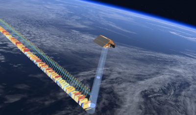
Hydroweb product continuity is already ensured with the integration of Sentinel-6A data in place of Jason-3.
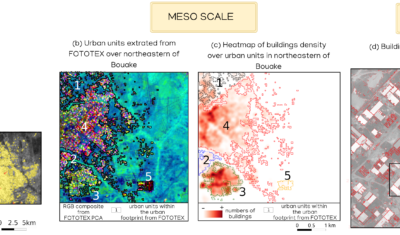
FOTOTEX, developed within Theia Risks Associated with Infectious Disease Risks and Urban SECs, proposes a unique, rapid and unsupervised method for characterising urban areas at three overlapping scales.