
Access to software and data
Presentation
AlTiS-NG (Altimetry Time Series – New Generation) is a software designed for the visualization and processing of altimetry data to create time series of water levels on various bodies of water such as rivers, lakes, and flooded areas.
AlTiS-NG is a new release of the AlTiS software (2019-2024). It has been entirely redeveloped in Rust by the Centre for Topography of Oceans and the Hydrosphere (CTOH), a National Observation Service (SNO) of the LEGOS laboratory. The use of the Rust language significantly enhances the performance and ergonomics of the graphical interface.
This software can process a wide range of official GDR level 2 products from nadir altimetry missions in LRM and SAR modes, provided by CTOH. It is compatible with products from historical missions such as Topex, Jason-1/2/3, Envisat, as well as current missions like Sentinel-6 and SWOT nadir. AlTiS-NG is also an important tool for validating altimetry data using in situ measurements and assessing the consistency between historical mission data and new SWOT observations. It can be customized for various applications, including coastal altimetry and monitoring backscatter over ice-covered lakes.
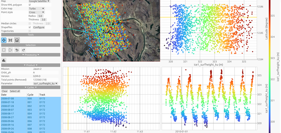
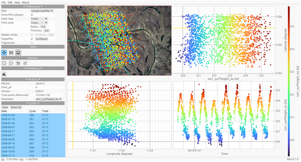
The interface of AlTiS-NG allows users to:
- Display numerous altimetric measurement parameters: height, distance between the satellite and the surface, atmospheric and geophysical corrections, backscatter coefficient, and waveform peak width.
- Calculate the altimetric height of the water and configure the applied corrections.
- Manually select valid altimetric measurements, facilitated by high-resolution map backgrounds (Google Maps, Sentinel-2, OpenStreetMap, Ersi, etc.).
- Create time series of water levels.
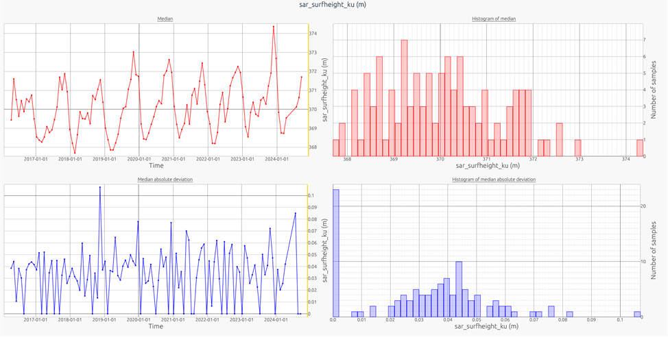
With over 100 users worldwide, AlTiS-NG has become an essential tool for many hydrologists. It enables them to easily process time series data on rivers and lakes using over three decades of spatial observations.
AlTiS-NG is free and open-source software. It is multi-platform, compatible with Windows 10/11 and Linux, and its installation is simplified.
Contact

Fabien Blarel
LEGOS | CTOH
ResearchGate
Documentation
Documentation : https://ctoh-docs.sedoo.fr/AlTiS-NG/docs/wiki/AlTiS-NG-Wiki-ia.html
Reference
Frappart, Frédéric & Blarel, Fabien & Fayad, Ibrahim & Bergé-Nguyen, Muriel & Cretaux, J. & Shu, Song & Schregenberger, Joël & Baghdadi, Nicolas. (2021). Evaluation of the Performances of Radar and Lidar Altimetry Missions for Water Level Retrievals in Mountainous Environment: The Case of the Swiss Lakes. Remote Sensing. 13. 2196. 10.3390/rs13112196.