Publications
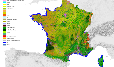
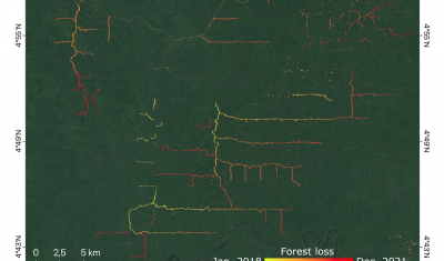
Assessing forest resources, characterizing changes in cover and vegetation to manage environmental risks.

Softwares & algorithmes
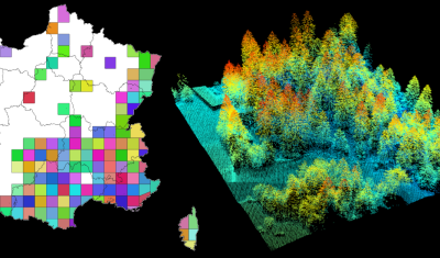
lidaRtRee is an R package that provides functions for forest analysis using airborne laser scanning (LiDAR remote sensing) data:
News
VENµS M5 reflectance products are now available through Theia with over 100 documented sites worldwide.
SCO
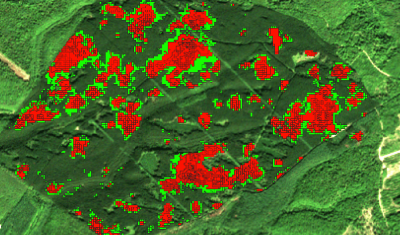
The Tropisco projects build on methods developed in THEIA Forest Biomass and Cover Change SEC.
Data Terra
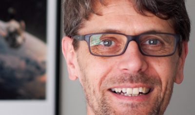
Arnaud Sellé, CNES-Partner Interoperability Manager for DINAMIS, Theia & ForM@Ter, gives us his vision of Theia contributions and challenges.