Challenges
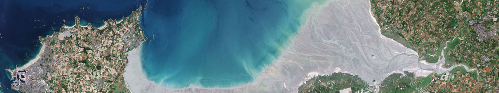
The frontier between two environments, the outlet for rivers and catchment areas, coastal areas are ecologically rich, whether at sea or on land. They are also exposed to various types of pollution, including pressure on natural resources, degradation and direct discharges into the sea.
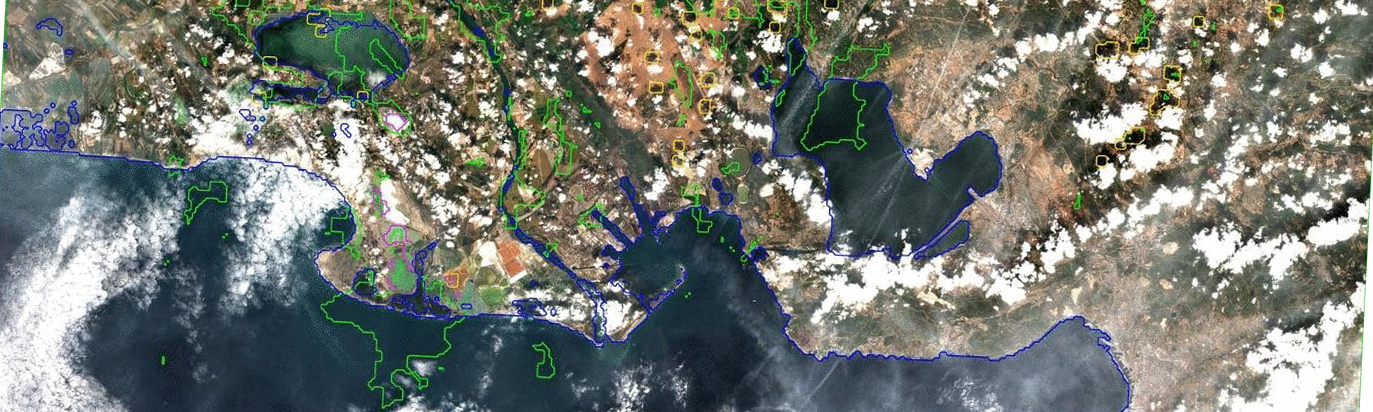
Coastal regions host various activities and are put to many uses—tourism, development, urbanisation, conservation of the shoreline and preservation of biodiversity, fishing, farming and livestock rearing to name a few—but the coastline is also an area where natural hazards induced by climate change (the rise in sea level, stronger and more frequent storms etc.) require close monitoring. Coastal areas, and the coastline in particular, tend to change rapidly due to erosion eating away several metres per year in certain more crumbly parts. The coastline suffers the increased assaults by the sea during storms which amplify the intensity of erosion and lead to flooding in lowlands which cause damage to both the populations and local economy.
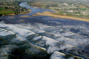
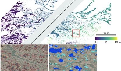
Mouth of the Laita river © E.Le Cornec / Geos AEL © Franck Garestier, UMR 6143 M2C
Numerous local, national, European and international bodies have taken up coastal issues. Among these, we can mention:
The Integrated Coastal Zone Management (ICZM process based on recommendations at an international level (UN Conference on Environment and Development in Rio de Janeiro, 1992, and the World Summit on Sustainable Development in Johannesburg, 2002) and European level, with the European parliament and Council Recommendation of 30 May 2002 on the implementation of an integrated coastal zone management policy in Europe.
France’s national integrated coastline management strategy conducted by the Ministry of Sustainable Development. The goal is to relocate activities and properties following the commitments taken at the Grenelle Oceans round table meetings in July 2009.
So, while there is a real consciousness among local, national and international political structures as to the need to act on behalf of the shoreline, the scientific community is sometimes at a loss to provide the concrete elements needed to define practical coastline management policies due to the numerous scientific barriers.
Research issues
The research issues relating to the morphodynamic changes in the coastline may be divided into two categories.
The first concerns complex interactions between:
- the different hydrodynamic processes (waves, currents and water levels),
- hydrodynamic processes and sediment transport (turbidity, flows),
- hydrodynamic forcing and the coastline’s morphological response (sand dynamics and coastline mobility)
The second is directly linked to understanding coastal behaviour when affected by paroxysmal forcing: it is difficult to say whether the hydro-morphodynamic processes currently identified under moderate forcing remain valid and identical under extreme forcing (rare high-energy events).
Answering these academic questions remains an ambitious challenge needing combined approaches:
- Observation at various temporal and spatial scales in order to monitor and quantify changes in the environments,
- Laboratory or in situ experimentation to analyse and understand the mechanisms and processes involved,
- Modelling to test scenarios and forecast their impact.
Under such conditions, remote sensing data are essential not only for the quantitative observation of coastline hydro-morphodynamics, but also for the construction of numerical or even physical models in order to initiate forward-looking research to forecast the future of coastal systems.
Theia Products for Coastline
Concerned Theia SECs
Prototyping SEC
Colours of the continental waters SEC
Producing SEC
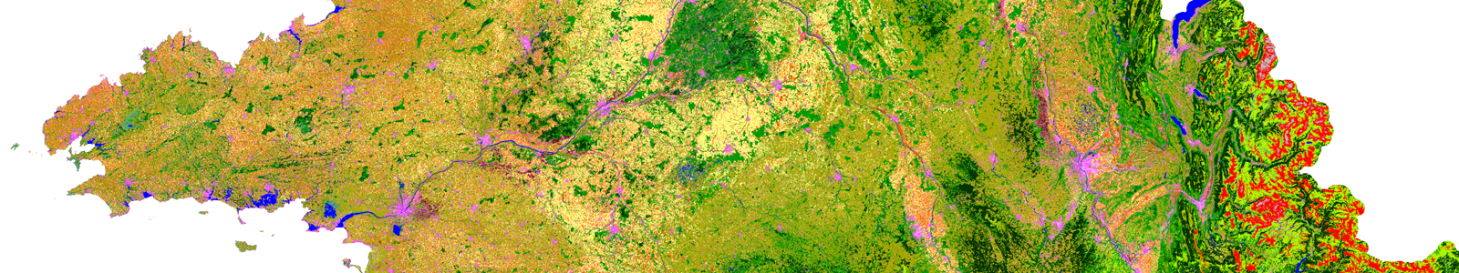
Land cover SEC
Variables & products
Surface Reflectance
Theia News on Coastline
Publications
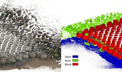
clASpy_T : a 3D point cloud classification tool for estuary monitoring
The THEIA portfolio of Lidar data processing tools has been extended with a new software tool for creating 3D point cloud classification models using machine learning: cLASpy_T cLASpy_T aims to […]
PhD & PostDoc
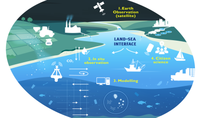
[PhD] Spatio-temporal dynamics of suspended particulate matter in the estuary/coastal sea continuum
Thesis project aiming to integrate and interact high-frequency in situ data (COAST-HF, SYNAPSES) with water color satellite data (Sentinel 2/3 – Landsat – MODIS) to enhance our understanding of the land-sea interface.
News
SWOT data that exceeds expectations
The SWOT space mission was launched at the end of 2022 by CNES and NASA to document the water masses of the entire planet – oceans and continental waters. Data […]
Products
OSO 2023 Data : a little more patience ahead
THEIA Land Cover product is produced each year by CESBIO and CNES. It provides a 24-class typology of land cover, downloadable by department for mainland France. Production begins in January […]
Applications
The DYNALIT national observation system (SNO DYNALIT)
Most of the academic players active in the coastal theme on a national scale are found within the DYNALIT national observation system (SNO – Service National d’Observation) supported by INSU, the French national institute for universe sciences. DYNALIT manages the long-term acquisition, collection and harmonisation of high-quality metrological data from 26 workshop sites (sandy coasts, cliffs and river mouths) spread along the whole French coastline.
Sites :
- Sandy odds : Agon, Pointe de Gatseau, Pointe de La Coubre, Pointe d’Arçay, Espiguette, Maguelone-Aresquiers, Merville-Franceville, Porsmilin, Pays de Monts, Baschamps, Hyères, Guisseny, Suscinio, Dunkerque Est, Biscarrosse, Truc Vert, Anglet, Ermitage (La Réunion).
- Cliff : Mesnil-Val, Vaches noires, Ailly/Puys, Socoa
- Estuary: Rhone, Loire, Gironde, Seine
Observatoire de l’Univers (OSU) : Institut Universitaire Européen de la Mer (Brest)
Partners :
- 8 OSU : OSUNA (Nantes), OASU (Bordeaux), PYTHEAS (PACA), OREME (Montpellier), OSU Réunion, IUEM (Brest), Observatoire Midi Pyrénées, Observatoire de Lyon
- 20 Universities : Cote Opale, Caen Basse-Normandie, Le Havre, Brest, Bretagne Sud, Nantes, Bordeaux, Aix-Marseille, Montpellier, Grenoble, Toulon, Pau Adour, La Réunion, Perpignan, La Rochelle, Lyon, Toulouse, Rouen, Angers, Rennes.
- 18 UMR : LOG (Wimereux), M2C (Caen, Rouen), LOMC (Le Havre), Géosciences (Montpellier), LDO (Brest), LETG (Brest, Caen, Nantes, Rennes, Angers), LEGI (Grenoble), EPOC (Bordeaux), CEREGE (Marseille), MIO (Toulon), LPG (Nantes, Angers), IPGP (Réunion), Espace-Dev (la Réunion), CEFREM (Perpignan), LIENSs (La Rochelle), LGL (Lyon), LEGOS (Toulouse), GET (Toulouse)
More information on www.dynalit.fr
The coastline observation system (SO LTC)
The SO LTC coastline observation system is dedicated to analysing the hydrodynamics and sediment dynamics of coastal systems. It is supported by OSU OREME (universe sciences observatory focusing on the Mediterranean area) at the University of Montpellier, the Languedoc-Roussillon DREAL environment directorate, the Languedoc-Roussillon region and the INSU institute for universe sciences.
It was set up to ensure the acquisition, qualification, storage, dissemination and scientific exploitation of long-term, high-quality measurements in coastal areas in addition to their coupling with numerical and forecasting models of coastal hydro-morphodynamics.
The SO LTC is also working on two main international issues:
- the analysis of extreme events such as tsunamis or cylones, with partners mostly in Asia and in particular the THL and NCKU in Taiwan;
- the study of shallow water bodies (SWB) which behave like huge coastlines, e.g. the Lac St Jean in Quebec, Canada, or Lake Chad in the Sahel region of Africa) in close partnership with the University of Strasbourg’s EOST Earth sciences observatory.
The coastline dynamics observation service (SODYC)
The SODYC, coordinated by the University of Caen Basse-Normandie, monitors seven main workshop sites. They also cover secondary sites such as the small bay of Mont-Saint-Michel. This observation service covers a broad range of coastal environments in a tidal sea with different degrees of human influence and varied exposures.
The parameters measured are:
- The X,Y and Z position of the coastline at time t
- Foreshore and near-shore topography
- The main external forcing, particularly hydrodynamic forcing
As regards instrumentation, laser topography campaigns are carried out intermittently, while various sensors operate continuously off the workshop sites.
More information on www.unicaen.fr/sodyc
Thesis
- Morphodynamique à l’échelle régionale d’une avant-côte microtidale à barres sédimentaires – le cas du languedoc-Roussillon à l’aide de la technologie LIDAR
Nicolas Aleman
2013 – Université Perpignan Via Domitia. 200 p. - Assimilation de données et inversion bathymétrique pour la modélisation de l’évolution des plages sableuses
Florent Birrien
Mai 2013 – Université Bordeaux I - Comportement morphodynamique des plages de poche en milieu mésotidal semi-abrité : exemple des plages méridionales de la Presqu’Ile de Rhuys, Bretagne sud
Alexandre Dubois
Thèse soutenue le 10/12/2012 - Etude pluridisciplinaire d’une perturbation industrielle dans l’estuaire de la Gironde: Implications du transport et de la dynamique de dégradation des débris végétaux sur le fonctionnement de la source froide du CNPE du Blayais
Ana Fuentes-Cid
2014 – Thèse de l’Université de Bordeaux, 312 p - Impacts morphologiques des surcotes et vagues de tempêtes sur le littoral méditerranéen
Mathieu Gervais
2012 – Université Perpignan Via Domitia. 399 p. - Techniques d’observation et de mesure haute résolution des transferts sédimentaires dans la frange littorale
Marion Jaud
Octobre 2011 – Université Brest - Les glissements de terrain côtiers du Pays d’Auge (Calvados): Morphologie, fonctionnement et gestion du risque
Candide Lissak
2012 – Thèse de doctorat, Université de Caen Basse-Normandie, Caen, France, 312 p. - Le recul des falaises crayeuses haut-normandes et les inondations par la mer en Manche centrale et orientale : de la quantification de l’aléa à la caractérisation des risques induits
Pauline Letortu
2013 – Thèse de doctorat, Université de Caen Basse-Normandie, Caen, France, 408 p. - Analyse multiscalaire et multifactorielle de l’évolution du comportement géomorphologique des systèmes côtiers sud bretons
Soazig Pian
Université Bretagne Sud, Thèse soutenue le 09/09/ 2010
Contact

Lucie Cocquempot
Université de Brest
@lucie.cocquempot
Christophe Delacourt
Université de Brest
@christophe.delacourt
Bertrand Lubac
Université de Bordeaux
@bertrand.lubac