Challenges
Forests are an essential part of the world’s landscape. They cover nearly 4 billion hectares worldwide, amounting to 30% of the surface area of land according to FAO data (2010). This global figure may be broken down into tropical forests (52%), sub-tropical forests (9%), temperate forests (13%) and boreal or polar forests (25%).
Throughout the world, the major challenges to society lie in preserving the key roles played by forests (with respect to economics, biodiversity and maintenance of major balances, for example). Forests play a key role in socioeconomic development through the production of wood for numerous applications (construction, cellulose for paper, softwood lumber, firewood, etc.), revenue linked to ecological services, ecotourism, etc. Forests also provide the population with food—especially in tropical areas—and are, to a greater or lesser degree, a source of revenue through, for example, the sale of softwood lumber, firewood, medicinal plants and foodstuffs (3rd report by France’s national group on tropical forests (GNFt), 2012).
Forests represent the planet’s main reservoir of biological plant and animal diversity. For instance, rainforests alone host about 50% of living species. It is essential to preserve this diversity for the ecological balance of the forests themselves but also to showcase their resources (food, fuel, industrial wood, fibers, substances from which to make medicines etc.) (ONF, 2014).
Forests play a major role in maintaining global ecological balance. They store over half of the carbon of land surfaces and thus play a vital role in the regulation of atmospheric carbon dioxide. The forest ecosystem also plays a role in the water cycle (by regulating flow and limiting soil erosion) and water quality (by filtering and purifying it, etc.)
However, the major role of forests in keeping a global ecological balance is currently threatened on most continents. Increasing pressure due to ongoing climate change and numerous natural perturbations such as fire, storms or phytosanitary incidents or, more frequently, to human activities (deforestation, exploitation, fragmentation and degradation, etc.) affect forest ecosystems. The major challenge on both national and international levels is related to the conservation, adaptation and sustainable management of forests, and the attenuation and reduction of CO2 emissions. There is a real need to plan ahead, especially as forests are long-term, slow-growing ecosystems.
Research issues
In the light of these challenges, remote sensing is a major asset due to its global, repetitive monitoring capabilities. All the current or upcoming sensors in the different wavelength ranges and over a broad spectrum of spatial and temporal scales are called upon to confront these issues, with a particular focus on the following areas of research:
Estimating forest resources, particularly in terms of biomass
The goal is to locate, quantify the resource and follow its evolution over time, whether on a global scale (monitoring carbon stocks) or regional scale (biomass available for industry or energy needs). Research efforts are concentrating on the potential of radar and lidar data, which are the most suitable for estimating forest biomass and the vertical structure of forest stands.
While awaiting the BIOMASS mission’s P-band synthetic aperture radar (SAR) that will provide in 2020 estimations of biomass up to 500 tonnes/ha (see “Biomass” theme), L- or C-band radar sensors will be used to assess biomass for low-density stands (< 150 tonnes /ha).
Numerous activities are focused on analysing the potential of airborne lidar data for developing quantification methods for forest parameters such as height and biomass and for describing the 3D structure of vegetation at individual tree and forest stand levels. Ongoing projects are working on new satellite sensors.
All this work is in keeping with global initiatives to improve the evaluation and monitoring of carbon stocks in forest ecosystems in relation with programmes such as Global Forest Observation Initiatives (GFOI), REDD+, UNREDD, Kyoto and Carbon Initiatives (JAXA), GlobBiomass (ESA), etc. It is also in keeping with regional dynamics to foster use of renewable forest biomass for the forest and wood products sector.
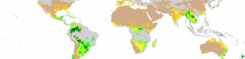
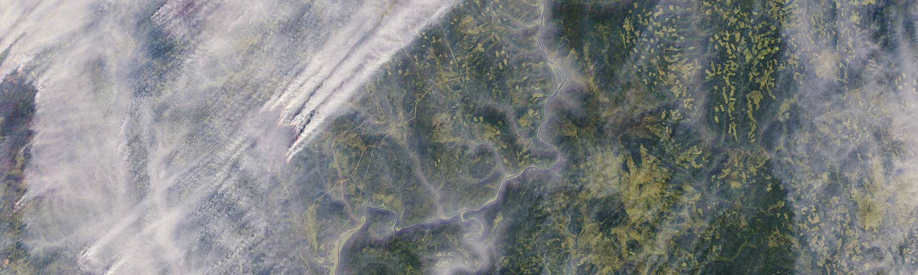
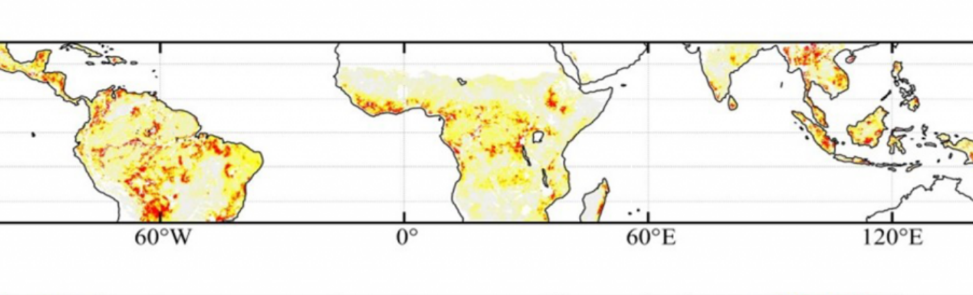
Characterising changes in forest cover (deforestation, degradation and fragmentation)
Numerous methods based on change detection algorithms have been developed and are applied almost operationally using high- and medium-resolution optical and radar observations providing several images per year. The goal is to characterise the dynamics of change on a yearly basis. The characteristics of the Sentinel-1 (radar) and Sentinel-2 (optical) sensors are promising in this regard and should reveal changes at a forest stand level.
Monitoring the vegetation phenology of forests: an indicator of global change
Can trees in a forest context adapt quickly and well enough to confront climate change? As a marker of the impact of climate change on vegetation, phenology is critical to this question. The long-term time series of medium-resolution optical data (NOAA AVHRR, SPOT, VEGETATION, MODIS, etc.) have been greatly used to evaluate the contribution of remote sensing in monitoring the phenological cycle of forest species over the past few decades. However, these observations often mix the phenological response of different species and include both accidental development perturbations such as drought and manmade perturbations due to deforestation or crop rotations etc., and cannot therefore be used to go into details when interpreting surface processes. The research issues to be explored include the spatial disaggregation of these processes. Sentinel-2 will provide series at a greater spatial resolution to better distinguish the adaptation (natural or via technical itineraries) or non-adaptation (change in range) of forest stands to global change.
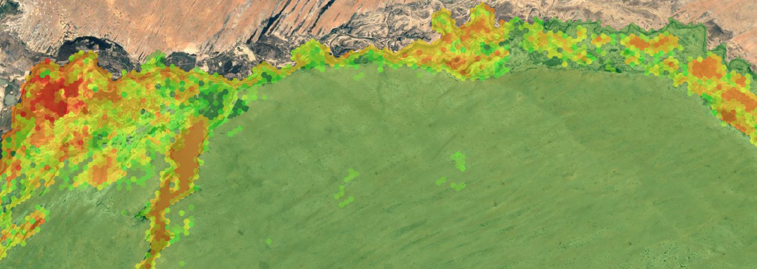
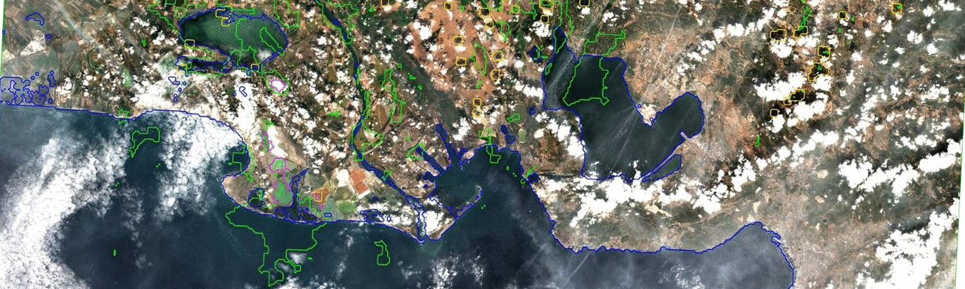
Monitoring biodiversity
This entails characterising and mapping forest ecosystems (forest species, characterisation of fragmentation of stands and ecological connectivity between habitats) and monitoring changes (see “Biodiversity”). The development of innovative methods is focused on the integration of high- or very-high-resolution multi-source, multi-resolution and multi-temporal images.
Evaluating and managing environmental hazards
Remote sensing data have great potential for assessing the state of water stress and vulnerability to fire of forest stands. The water content of vegetation may be assessed using microwave observations (monitoring soil moisture), thermal infrared observations (via the surface temperature measurement), or indirectly by vegetation stress indicators via observation of the green LAI dynamics in the optical spectrum (visible, NIR, etc.).
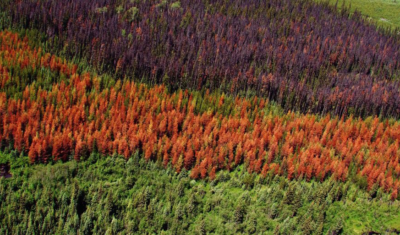
Remote sensing is also used to assess other natural hazards such as drought, pests and storms.
Numerous studies in the optical range have investigated these subjects, from local to regional scales but these studies are heterogeneous and focus on very specific issues.
There is no generic approach to systematically monitor large forested areas over time.
The water and carbon cycles
For the water cycle, the current low-resolution microwave sensors (SMOS, ASCAT and SMAP) have a limited penetration capability in dense forests. This problem will be partly resolved by the P-band data available from the future BIOMASS mission. This capability—particularly to monitor the fraction of free water over time—is currently being assessed. At the same time, the optical time series offer good potential via the estimation of biophysical variables (LAI, fPAR, etc.) to monitoring how forests function and how the carbon cycle functions over a broad range of spatial scales (from regional to global scales).
Some Theia Forest Products
Thematic products and tools
Products
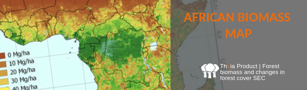
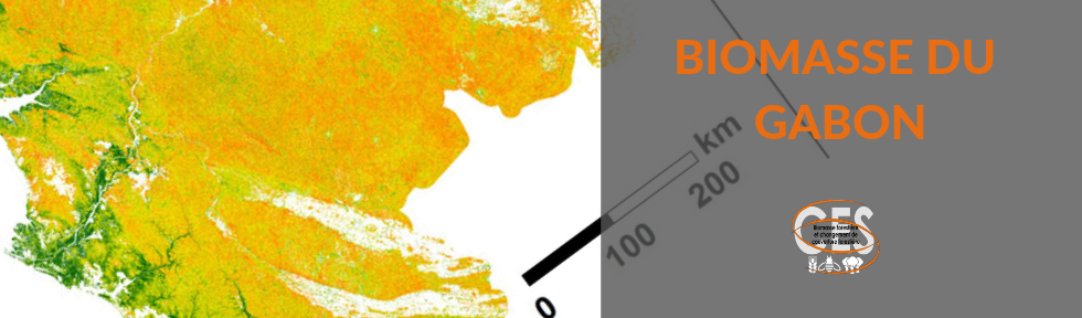
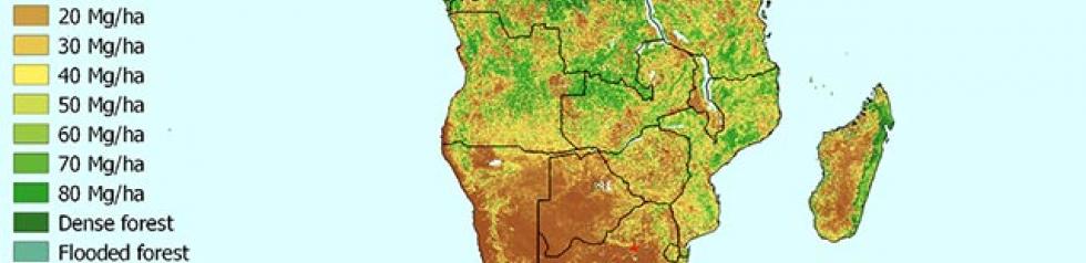
African Biomass Map
Products
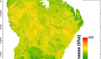
Biomass for French Guiana
Products
Biomass for Madagascar
Softwares & algorithmes
fordead | a python package for vegetation anomalies detection from SENTINEL-2 images
Products
Gabon Biomass Map
Products
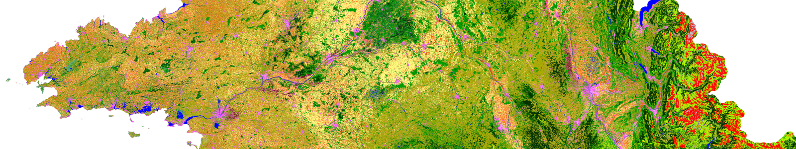
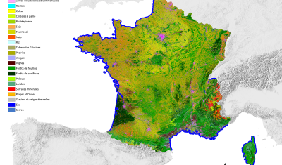
Land Cover Map
Products
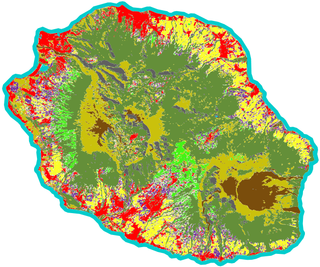
Land Cover on Reunion Island
Products
Land Units at National Scale
Products
Landsat Surface Reflectance
Softwares & algorithmes
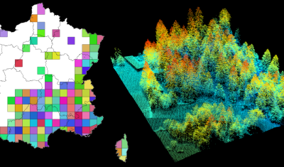
lidarHD | an R package to manage and download HD lidar files

Softwares & algorithmes
lidaRtRee | an R package providing forest analysis tools
Satellite Data
Radar (CSM – TSX)
Products
Sentinel-2 Surface Reflectance
Products
Spot 5 (Take 5) Surface Reflectance
Products
Vegetation variables (Postel)
Products
Venus Surface Reflectance
Concerned Theia SECs
Variables & products
Albedo
Variables & products
Changes and Health of Temperate Forests
Variables & products
Digital Soil Mapping
Incubating SEC
Fire SEC
Variables & products
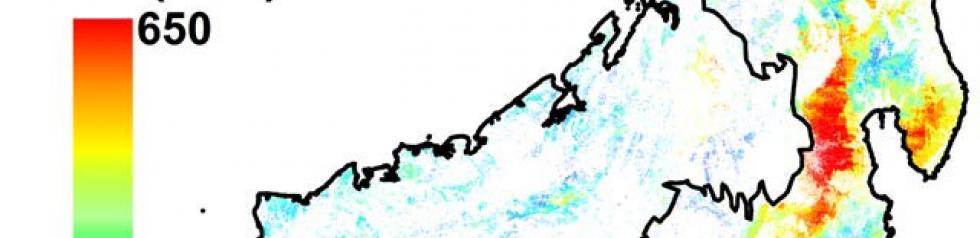
Forest biomass and changes in forest cover

Producing SEC
Land cover SEC
Incubating SEC
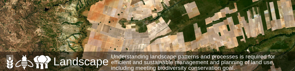
Landscape SEC
Producing SEC
Risks associated with infectious diseases SEC
Variables & products
Surface Reflectance
Variables & products
Variables for Biodiversity
Variables & products
Vegetation biophysical variables
Variables & products
Vegetation Optical Depth
Theia News on Forest
Publications
Two THEIA LiDAR tools for forest monitoring
On this International Day of Forests, for which innovation has a major role to play in 2024, we are highlighting two tools dedicated to the management of aerial LiDAR data […]
Products
OSO 2023 Data : a little more patience ahead
THEIA Land Cover product is produced each year by CESBIO and CNES. It provides a 24-class typology of land cover, downloadable by department for mainland France. Production begins in January […]
Theia Regional Animation Network
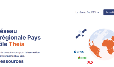
A new GeoDEV website, with resources tailored to your profile
The website of the ART GeoDEV, the Theia Regional Animation network that CIRAD, IRD and CNES have been leading since 2017 in the direction of Southern countries, is evolving to […]
News
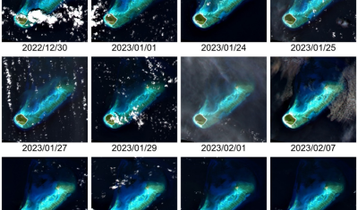
DISCOVER VENUS M5 PRODUCTS NOW AVAILABLE ON THEIA
VENµS M5 reflectance products are now available through Theia with over 100 documented sites worldwide.
Applications
- STELLA project (Aquitaine region) and STELLA-THR (TOSCA) (2011-2013): C. Germain, S. Boukir, D. Guyon, V. Lafon. Mapping and monitoring of changes in land use of aquatic and terrestrial systems through VHR data on the STELLA site in the Aquitaine region: preparation for using Pleiades.
- FORESEE project (Forest Resource Estimation For Energy) (2010-2014). Development of tools to assess the characteristics and dynamics of forest resources (biomass), and conditions for its exploitation in catchment areas, particularly with a view to power production.
For more information, see http://foresee.fcba.fr
Thesis
- Caractérisation et cartographie de la structure forestière à partir d’images satellitaires à très haute résolution spatiale
Benoit Beguet
Université de Bordeaux (06/10/14)