Through treatment chains or distribution service, Theia adds value to a large panel of spatial products, presenting various spatial resolution and techniques.
All Theia SECs production is listed here by themes.
To download certain products, you will be asked to create a Theia account. The creation is free and open to all. If you encounter any difficulties, please make sure you have followed all the steps.
You can also choose to browse the Theia catalogue offering you to search by theme, date, sensor or geographical place. If you are a GIS users, you may be interested to use Theia WMS catalogue.
If you have question, don’t hesitate to ask for information or help.
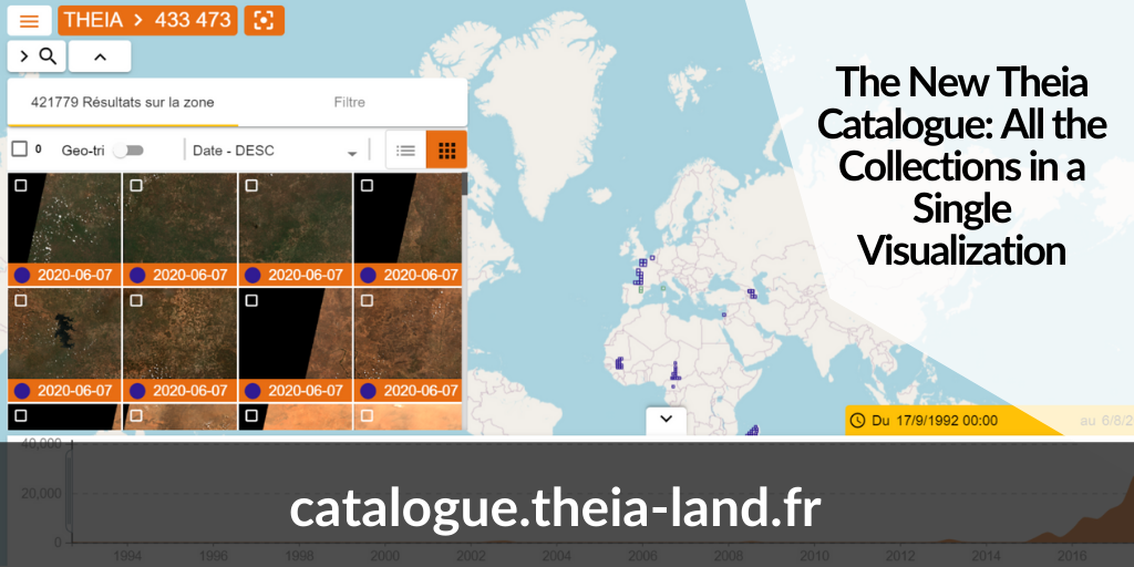
catalogue.theia-land.fr
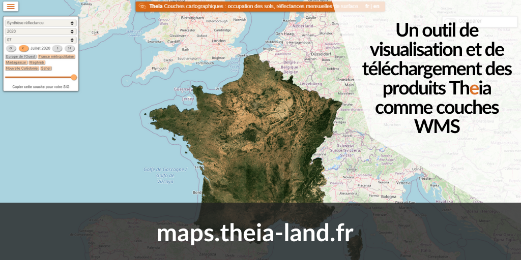
maps.theia-land.fr
Surface Reflectance
| Product | Area | Time | License | Access |
|---|---|---|---|---|
| Sentinel-2 Surface Reflectance (Level 2) | France and others zones in the world | 2016>Now | ETALAB V2.0 | catalogue.theia-land.fr |
| Sentinel-2 Surface Reflectance (Level 3) | France and others zones in the world | 2018>Now | ETALAB V2.0 | catalogue.theia-land.fr |
| Landsat-5/7 Surface Reflectance (Level 2) | France | 2005>2011 2013>2017 | ETALAB V2.0 | theia.cnes.fr |
| Landsat-8 Surface Reflectance | France | March 2017 >Now | ETALAB V2.0 | catalogue.theia-land.fr |
| Venus Surface Reflectance (Level 2) | 110 sites | 2017>Now | CC BY-NC 4.0 | catalogue.theia-land.fr |
| Venus Surface Reflectance (Level 3) | 110 sites | 2017>Now | CC BY-NC 4.0 | catalogue.theia-land.fr |
| Spot 4 (Take 5) Reflectance | 45 sites worldwide | February>June 2013 | Open Licence | catalogue.theia-land.fr |
| Spot 5 (Take 5) Reflectance | 150 sites worldwide | April>September 2015 | Open Licence | catalogue.theia-land.fr |
Moisture
| Product | Area | Time | License | Access |
|---|---|---|---|---|
| Soil Moisture at Very High Spatial Resolution | 19 sites in Europe and around the Mediterranean sea | 2016 > Now | ETALAB v.2.0 | catalogue.theia-land.fr |
| Soil moisture at 25 km resolution | Global | 2002 > Now | CC BY-NC 4.0 | catds.fr |
| Soil moisture at 25 km resolution (homogeneous product, SMOS-IC) | Global | 2010-2018 | CC BY-NC 4.0 | ib.remote-sensing.inrae.fr |
| Soil moisture in the root zone | Global | 2010 > Now | CC BY-NC 4.0 | catds.fr |
| Drought index | Global | 2010 > 2017 | CC BY-NC 4.0 | ftp.ifremer.fr |
| Water cycle variables (Postel) | Continental to Global | 1992 > 2005 | All users | postel.theia.cnes.fr |
Continental Hydrology
| Product | Area | Time | License | Access |
|---|---|---|---|---|
| Water levels of rivers and lakes (Hydroweb) | Global (lakes and rivers altimetry) | 1992 > Now | ETALABV2.0 | catalogue.theia-land.fr |
| SurfWater | Dynamic Follow-up for Water Surface | Mainland France and Neighbors countries | 2019>présent | ETALABV2.0 | thisme.cines.teledetection.fr |
Cryosphere
| Product | Area | Time | License | Access |
|---|---|---|---|---|
| Annual Glacier Equilibrium-Line Altitude | 240 glaciers in the European Alps | 2000 > 2016 | ETALAB 2.0 | Zipped files |
| Rate of Glaciers Elevation Changes | Worldwide | 2000 > 2019 | CC-BY-NC 4.0 | maps.theia-land.fr sedoo.fr |
| Glacier Ice Thickness Distribution | Worldwide | 2017-2018 | CC-BY-NC 4.0 | maps.theia-land.fr sedoo.fr |
| Glacier surface flow velocity | Worldwide | 2017-2018 | CC-BY-NC 4.0 | maps.theia-land.fr sedoo.fr |
| Snow (level-2) | Alpes, Pyrénées, Haut-Atlas | July 2016 > Now | ETALAB 2.0 | catalogue.theia-land.fr |
| Snow (level 3) | Alpes, Pyrénées, Haut-Atlas | July 2016 > Now | ETALAB 2.0 | theia.cnes.fr |
| Current Snow Cover based on last 20-days observations | Metropolitan France | Last 20 days | ETALAB 2.0 | maps.theia-land.fr |
| Fractional Snow Cover Copernicus (level 2) | 39 countries members of the European Economic Aera | September 2016 > Now | Copernicus | cryo.land.copernicus.eu |
| Persistant Snow Area Copernicus | 39 countries members of the European Economic Aera | September 2016 > Now | Copernicus | cryo.land.copernicus.eu |
| Mapping of frozen surfaces in agricultural areas | North-East of France | novembre 2019 > présent | ETALAB 2.0 | thisme.teledetection.fr |
Land Cover
| Product | Area | Time | License | Access |
|---|---|---|---|---|
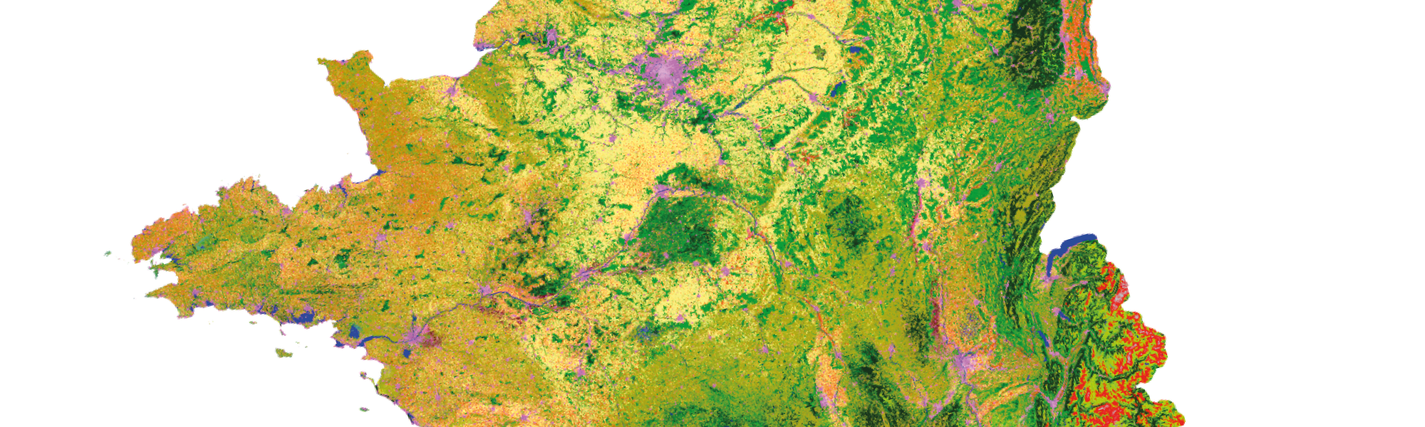
| Metropolitan France Land Cover | Metropolitan France | 2009 >2011 2014 2016 > 2017 2018 2019 | ETALAB 2.0 | catalogue.theia-land.fr |
| Land Cover on Réunion Island | La Réunion | 2016 > Now | CC BY | aware.cirad.fr |
| Land Unit at National Scale | Brazil, Burkina Faso, France | 2013, 2016, 2011 | CC BY-NC 4.0 | Brazil, Burkina Faso, France (.zip) |
| Land cover (Globcover) 2005-2006 | Global | 2005-2006 | All users | postel.theia.cnes.fr |
Land Cover Map for Irrigation
| Product | Area | Time | License | Access |
|---|---|---|---|---|
| Irrigation | South-West of France | 2015 | All users | peps-vizo.cnes.fr |
| Adour, Tarn | 2017 | All users | peps-vizo.cnes.fr | |
| Catalonia, Spain | 2018 | All users | peps-vizo.cnes.fr |
Land Cover Maps for Health Issues
| Product | Area | Time | Licence | Access |
|---|---|---|---|---|
| Water Surfaces | Hwangue National Park, Zimbabwe | 2018 | CC BY-NC 4.0 | Hwangue Gonarezhou North Kruger |
| Zimbabwe National Parks Land Cover | Hwangue, Gonarezhou & North Kruger National Park, Zimbabwe | 2018 | CC BY-NC 4.0 | Hwange Gonarezhou North Kruger |
| Land Cover | Buriram, Thailand | 2006-2008 | CC BY-NC 4.0 | aware.cirad.fr |
| Land Cover | Loei, Thailand | 2007-2008 | CC BY-NC 4.0 | aware.cirad.fr |
| Land Cover | Luang Prabang, Laos | 2006-2007 | CC BY-NC 4.0 | aware.cirad.fr |
| Land Cover | Mondolkiri,Cambodge | 2008 | CC BY-NC 4.0 | aware.cirad.fr |
| Land Cover | Nan, Thailand | 2006-2007 | CC BY-NC 4.0 | aware.cirad.fr |
| Land Cover | Champasak, Laos | 2007 | CC BY-NC 4.0 | aware.cirad.fr |
| Land Cover | Preah Sihanouk, Cambodge | 2006-2007 | CC BY-NC 4.0 | aware.cirad.fr |
| Land Cover | Chiang Rai, Thailand | 2010-2012 | CC BY-NC 4.0 | aware.cirad.fr |
| Land Cover | Kalasin, Thailand, | 2011-2013 | CC BY-NC 4.0 | aware.cirad.fr |
| Land Cover | Lapsik, Laos | 2010-2012 | CC BY-NC 4.0 | aware.cirad.fr |
| Land Cover | Prachuap Khiri Khan, Thailand | 2011-2013 | CC BY-NC 4.0 | aware.cirad.fr |
| Land Cover | Tha Wang Pha, Thailand | 2016 | CC BY-NC 4.0 | aware.cirad.fr |
| Land Cover | Tonle Sap Lake, Cambodge | 2012-2014 | CC BY-NC 4.0 | aware.cirad.fr |
| Land Cover | Kanchanaburi, Thailand | 2011-2013 | CC BY-NC 4.0 | aware.cirad.fr |
| Land Cover | Kandal, Cambodge | 2014-2015 | CC BY-NC 4.0 | aware.cirad.fr |
| Land Cover | Brasilia, Brasil | 2017 to 2019 | CC BY-NC 4.0 | GeoDEV |
| Land Cover | Guyane-Brasil Border | Since 2017 | CC BY-NC 4.0 | GeoDEV |
Urban
| Product | Area | Time | Licence | Access |
|---|---|---|---|---|
| Urba-Opt | France | – | CC BY-NC 4.0 | a2s-earthobservation.eu |
| Buildings Footprint | France | – | ETALAB V2.0 | thisme.cines.teledetection.fr |
| Thermocity | France | – | ETALAB V2.0 | thisme.cines.teledetection.fr |
Land Units at National Scale
| Product | Area | Time | Licence | Access |
|---|---|---|---|---|
| Land Units at National Scale | Brazil | – | CC BY-NC 4.0 | Zip Data |
| Burkina Faso | – | CC BY-NC 4.0 | Zip Data | |
| France | – | CC BY-NC 4.0 | Zip Data |
Vegetation
| Product | Area | Time | License | Access |
|---|---|---|---|---|
| Vegetation bio-geophysical variables | Metropolitan France | From 2019 on | All users | Forthcoming |
| Vegetation variables (Postel) | Continental to Global | 1998 > now | All users | postel.theia.cnes.fr |
| Series of vegetation variables (GEOV2-AVHRR) | Global | 1981 > now | ETALAB V2.0 | postel.theia.cnes.fr |
Biomass products
| Product | Area | Time | License | Access |
|---|---|---|---|---|
| Biomass for Madagascar | Madagascar | All users | ids.equipex-geosud.fr | |
| Africa Biomass Map | Africa | 2010 | All users | drive.google.com |
| Gabon Biomass Map | Gabon | 2010 | All users | ids.equipex-geosud.fr |
| Biomass for French Guiana | French Guiana | All users | ids.equipex-geosud.fr | |
| Canopy Height for French Guiana | French Guiana | All users | ids.equipex-geosud.fr |
Radiation and Surface Roughness
| Product | Area | Time | License | Access |
|---|---|---|---|---|
| Radiation variables (Postel) | Continental to Global | 1998>2005 | All users | postel.theia.cnes.fr/ |
| Surface Roughness | Global | 2010 > Now | CC BY-NC 4.0 | ftp.ifremer.fr |