


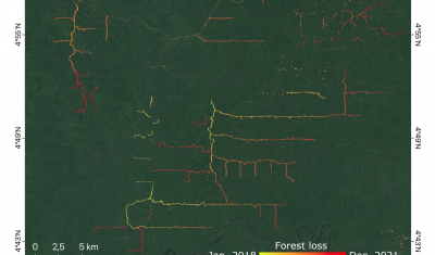
TropiSCO: Monitoring Forest Cover Loss in Dense Forests
The Tropisco projects build on methods developed in THEIA Forest Biomass and Cover Change SEC.
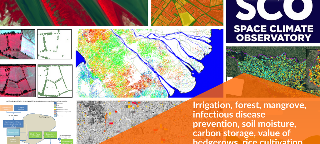
Irrigation, forest, mangrove, prevention of infectious diseases, soil moisture, carbon storage, value of hedgerows, rice cultivation… various projects carried out by Theia SECs and RANs have been awarded the Space Climate Observatory (SCO) label following the ONE Planet summit on 11 January 2021. A French initiative implemented by CNES, the SCO supports and finances the development of operational tools for monitoring and adapting to climate change.
The project focuses on monitoring the water quality of small water reservoirs by remote sensing. With the implementation of indicators on the trajectory of these surfaces through the aggregation of multi-source data, it aims to improve our knowledge and raise awareness of the impacts of climate change on these water reservoirs, essential for many uses.
It is carried by the Colours of the continental waters SEC, and some of the methods used in this project are also being developed with UNESCO as part of the “World Water Quality Portal” initiative.
Go further
Dedicated page of the Xtrem Quality project on the SCO website
The Space4Irrig project aims to provide water managers with indicators that will enable them to optimise the management of water resources on their territory and to identify climate change adaptation strategies adapted to local specificities.
With the support of Theia production infrastructure and of some of the work carried out by Theia Irrigation SEC and Theia Soil Moisture with very high spatial resolution SEC, the project will propose a map of soil moisture at very high spatial resolution (plot scale), irrigated crops and crop water requirements in the two experimental territories: the Tarn-Aval catchment area (81) and the Durance Valley catchment area (13). These humidity maps will be updated every month between 2017 and 2022.
Description of SPACE4IRRIG project on SCO website
ARBOCARTO-2 is an application initially intended for health actors, which makes it possible to target places where the risk of abundance of mosquitoes, vectors of human arboviroses, is very high, in order to target social mobilisation actions for vector control and to adjust the actions of the field teams to the areas at risk. The project covers three study areas: metropolitan France, Réunion and Martinique.
ClimHealth aims to integrate climate and environmental information from satellites into health surveillance systems to develop early warning and guide disease control. The first phase of the project has built an operational demonstrator to predict leptospirosis-prone environments in Yangon, Myanmar (https://leptoyangon.geohealthresearch.org/). This application produces a prediction model every 5 days, as soon as a new Sentinel-2 image is acquired over the area, using the Sen2Chain and Sen2Extract tools developed in the framework of the TOSCA S2-Malaria project. The second phase of ClimHealth aims to produce a module for the DHIS2 information system, which is widely used throughout the world. This project is led by the UMR Espace-Dev (IRD and University of La Réunion) in partnership with CNES.
Both projects build on the work carried out by Theia Risks associated with Infectious Disease SEC.
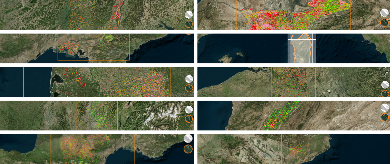
Within the TropiSCO project, the deforestation detection method developed by CESBIO, GlobEO and CNES (Bouvet et al., 2018; Ballère et al., 2021) will be applied to rainforests in all the tropics, and possibly to temperate and boreal forests. TropiSCO will thus provide a deforestation monitoring tool with a resolution of 10m, allowing both warning of new logging and annual statistical monitoring. This observation tool will be ready within 18 months and the data produced will be public.
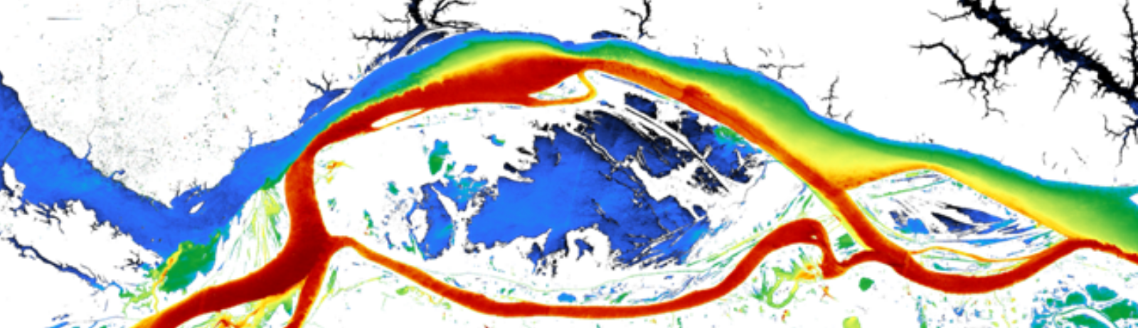
Understanding and monitoring mangroves is a constant priority: organising the management of their natural resources, characterising the links between global changes and the state of the environments, ensuring their preservation. Using Copernicus and THRS data, the project is aimed at institutional stakeholders in these coastal environments of great economic, heritage and environmental value. Three terrains – Madagascar, the Antilles and French Guiana – will be studied. Theia GeoDEV RAN is part of the project.
The BOSCO project aims, on the one hand, to monitor changes in soil water content on the scale of the Brittany region and, on the other hand, to co-construct diagnostic, analysis and service tools with stakeholders and managers in order to assist public decision-making in terms of adaptation: water resources, agriculture, preservation of ecosystems.
BOSCO will deploy the approved Theia satellite product Soil Moisture at very high spatial resolution in order to monitor soil water content over the Brittany region. It will provide relevant indicators of water availability at local and regional scales to meet the needs of agriculture, resource management and ecosystem monitoring. An integrated dissemination and visualisation platform will enable training and support for stakeholders in the appropriation of the products.
Description of BOSCO Britanny project on SCO website
The EagleHedge project aims to set up various services to monitor and develop hedgerows. A first operational service will make it possible to extract the surface areas and lines of hedges in a territory in order to monitor their evolution and to update the BOCAGE database. A second operational tool will allow the characterisation of hedges from a morphological, structural and functional point of view in order to evaluate the various roles and ecosystem services provided, particularly in terms of carbon sequestration.
The HedgeTools software (QGIS toolkit or plugin) for calculating the indicators, which will be developed within the framework of the project in collaboration with Theia Land Cover SEC and Theia Variables for Biodiversity SEC, will be made available on the Theia website.
The Quantification of Additional Carbon Stored in Soils (2021-2023) project, Quantica, aims on the one hand to quantify the biomass of intermediate crops buried in the soil between two crops, in order to evaluate what fraction of this biomass will allow the soil to be enriched sustainably in organic matter, and on the other hand to co-construct a tool making it possible to offer an operational service to end-users wishing to be part of a Low Carbon Label approach. This project is the result of collaboration between Airbus, E2L, CESBIO, Arvalis Institut de Végétal, ASP, IGN, APCA, the Occitanie Regional Chamber and the Gers and Tarn Chambers of Agriculture. At the end of the QUANTICA project, the data produced will be available free of charge via a THEIA portal dedicated to the carbon footprint of field crops.
Description of Quantica project on SCO website
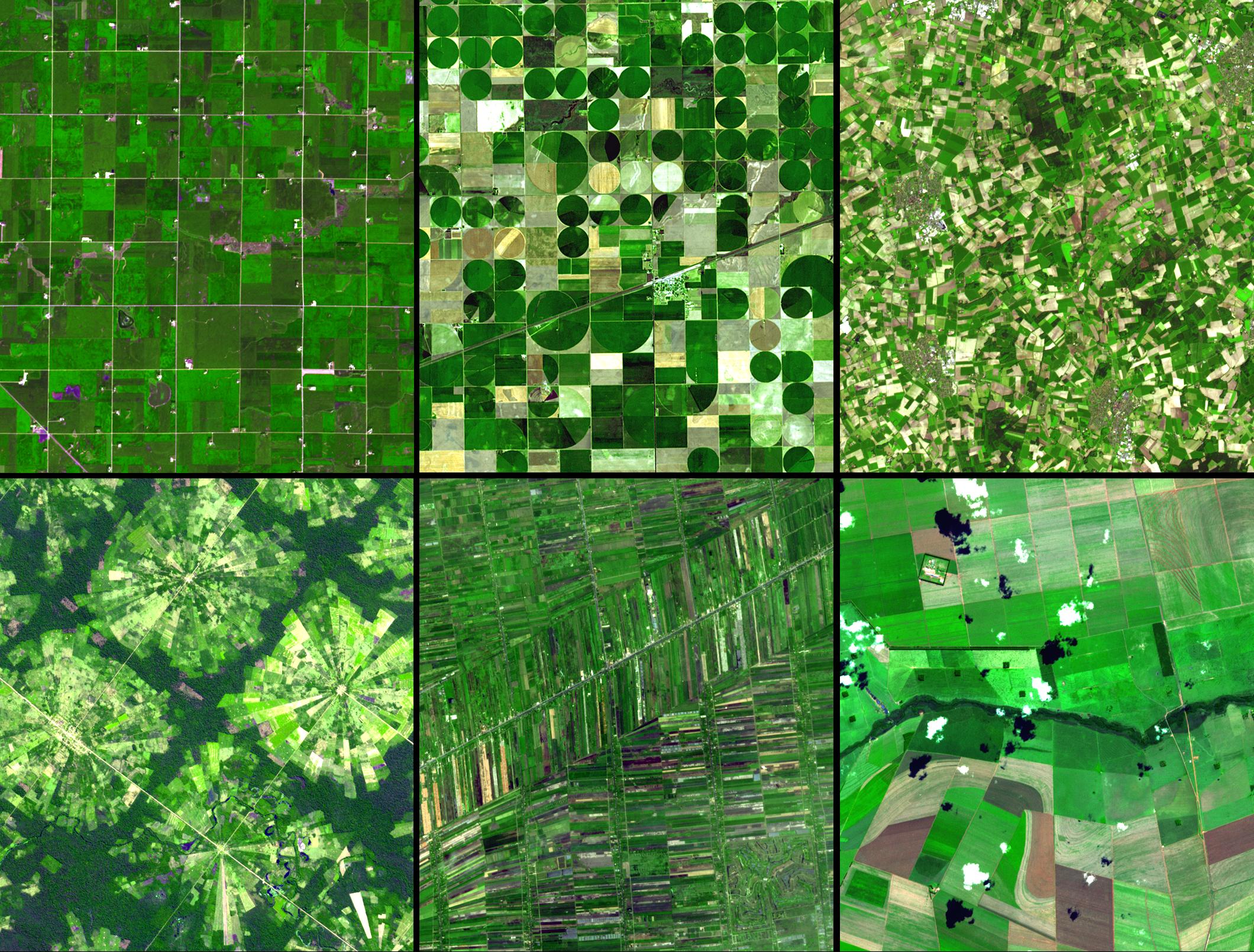
The VIMESCO-Rice project aims to provide national managers of rice production in Vietnam with tools for monitoring rice-growing areas by radar remote sensing (dynamic mapping of the sown area, growth status, crop calendar, productivity indicators, number of harvests per year). This information should enable short-term monitoring of production status and harvest forecasts under climate effects, and in the longer term, to define mitigation and adaptation measures to climate change.
Description of VIMESCO Rice project on SCO website
The objective of the Viet-ARRO (Vietnam Agriculture Resilient Recovery Observatory) project is to set up an Observatory for post-disaster monitoring of agriculture in Vietnam. The project will provide local and national managers with regularly updated geospatial data based on earth observation to improve the assessment of damage to agriculture following an extreme hydro-meteorological event and the monitoring of post-disaster recovery.
Description of VIET-ARRO project on SCO website
The project will also provide a tool to monitor the recovery of agriculture in Vietnam.
The Tropisco projects build on methods developed in THEIA Forest Biomass and Cover Change SEC.
The SCO facilitators discuss the Space Climate Observatory project, through which several THEIA SECs and RANs projects have been labelled.
Irrigation, forest, mangrove, infectious disease prevention, soil moisture, carbon storage, value of hedgerows, rice cultivation… Update of SCO projects related to Theia SECs and RANs.