Publications
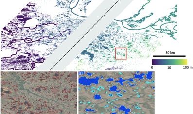
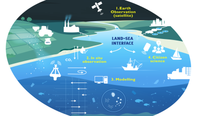
Monitoring and quantifying the evolution of coastlines to contribute to the numerical and physical modelling of their future.
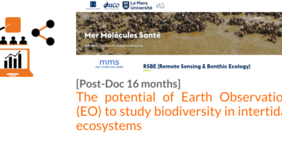
PhD & PostDoc
Thesis project aiming to integrate and interact high-frequency in situ data (COAST-HF, SYNAPSES) with water color satellite data (Sentinel 2/3 – Landsat – MODIS) to enhance our understanding of the land-sea interface.
Data Terra
Arnaud Sellé, CNES-Partner Interoperability Manager for DINAMIS, Theia & ForM@Ter, gives us his vision of Theia contributions and challenges.
Agenda
Go to Bonn with Theia’s Living Planet programme in your pocket!

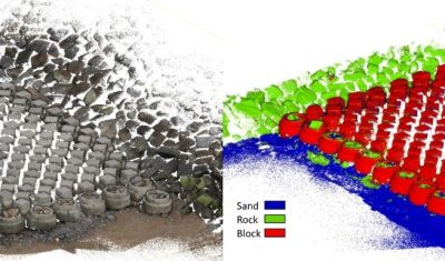
Softwares & algorithmes
The AlTiS-NG software allows the visualisation of altimetry data and the creation of water level time series on rivers, lakes and flooded areas.
Publications
The SCO facilitators discuss the Space Climate Observatory project, through which several THEIA SECs and RANs projects have been labelled.