Urban
Agenda
Theia programme at Living Planet Symposium
Go to Bonn with Theia’s Living Planet programme in your pocket!
Softwares & algorithmes
Fototex
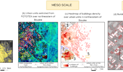
FOTOTEX, developed within Theia Risks Associated with Infectious Disease Risks and Urban SECs, proposes a unique, rapid and unsupervised method for characterising urban areas at three overlapping scales.
Publications
FOTOTEX: An Unsupervised Method for Urban Areas
FOTOTEX, developed within Theia Risks Associated with Infectious Disease Risks and Urban SECs, proposes a unique, rapid and unsupervised method for characterising urban areas at three overlapping scales.
Publications
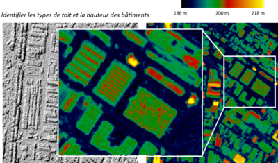
Monitoring of Land Soil Sealing by Remote-Sensing
Discover the work on soil sealing carried out by the TETIS team within Theia Urban SEC. And in particular the new product broadcast on Theia: “Buildings footprint”.
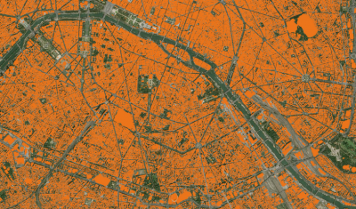
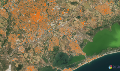
Buildings Footprint
A footprint of buildings for metropolitan France, at 1.5 m spatial resolution, updated annually.
Publications
Just Released: Theia Bulletin n°15
Read the new Theia Bulletin with all the network news, a selection of focuses on products and much more.
Publications
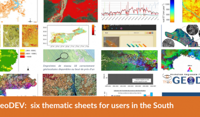
GeoDEV: six thematic sheets for users in the South
Theia GeoDEV RAN proposes thematic sheets with Southern users’ needs in mind.
Publications
Organizing the scientific community to face the technical challenge of exploiting data and disseminating its own research results.
Rémi Cresson, contributor to two Theia SECs, tells us the reasons for his commitment and his vision of the challenges ahead.
Publications
Processing massive data stream of satellite imagery for end-users and transferring the results of research laboratory in a relevant and usable form
Anne Puissant shares the reasons for her multiple involvement in Theia and gives us her vision of where the future lies in urban remote-sensing.