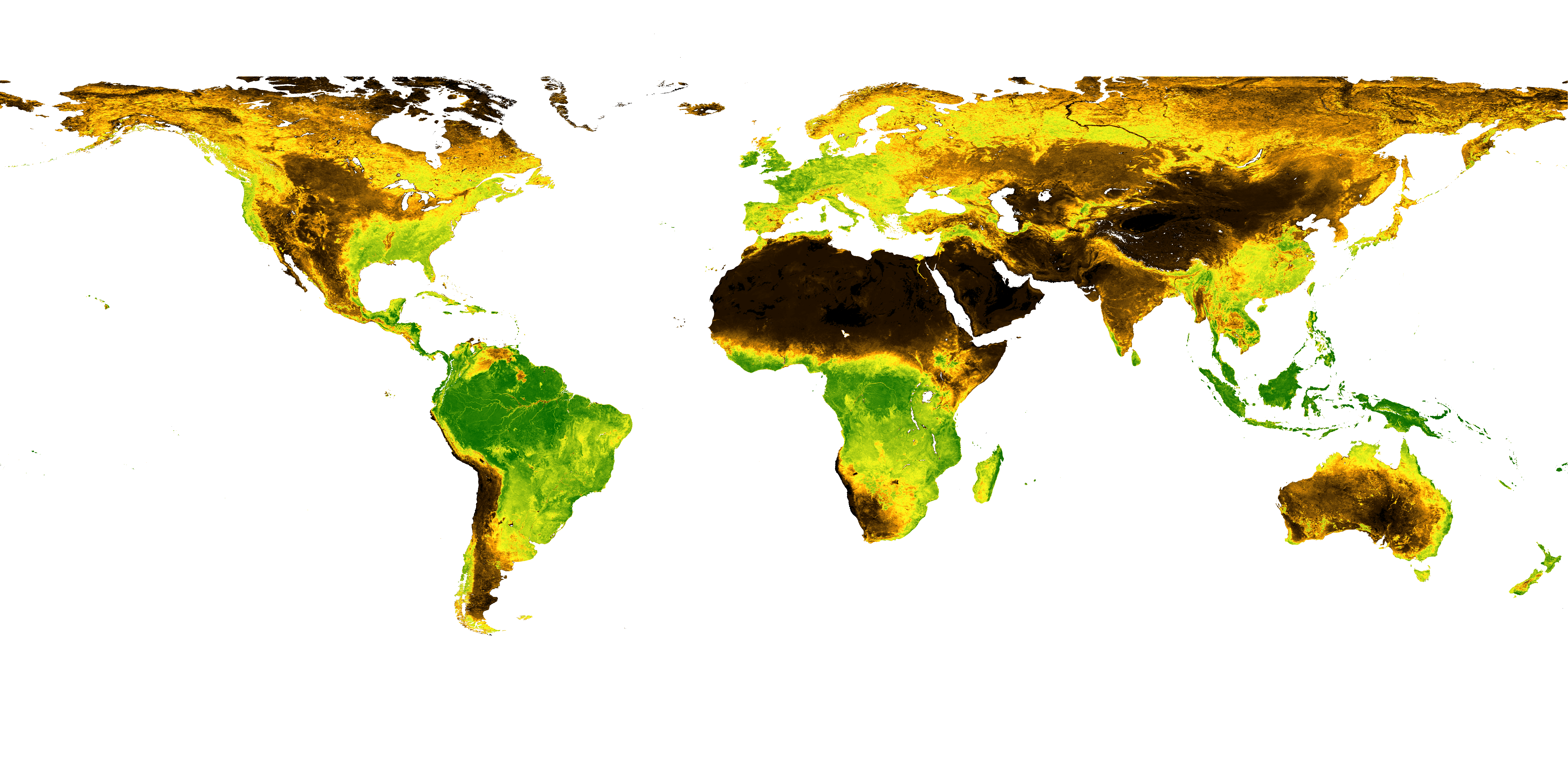
GEOV2-AVHRR: Monitoring Changes in Vegetation on a Global Scale over the last 38 Years
Long-term global monitoring of the terrestrial biosphere has raised an increasing interest in recent years. The Global Climate Observing System (GCOS 2010) identified a set of Essential Climate Variables (ECV) accessible from remote sensing observations including Leaf Area Index (LAI) and the fraction of Absorbed Photosynthetic Active Radiation (fAPAR). These ECVs play a key role in several processes, including photosynthesis, respiration and transpiration.
- LAI is defined as one half the total green leaf area per unit horizontal ground surface area. It controls the exchanges of energy, water and greenhouse gases between the land surface and the atmosphere.
- fAPAR is defined as the fraction of photosynthetically active radiation that is absorbed by the green parts of the canopy.
- The cover fraction (FCover) defined as the fraction of background covered by green vegetation as seen from nadir is used in surface energy balance models to separate the contribution of the soil from that of the canopy.
Going back in time
Version 2 of Copernicus Global Land Service 1km products of LAI, fAPAR and FCover (called hereafter GEOV2-CGLS) was recently developed from SPOT/VEGETATION and PROBA-V data for the period 1999-present.
Because of the good performances of the GEOV2-CGLS products it was decided to extend the time series back in time using the Advanced Very High Resolution Radiometers (AVHRR) Long Term Data Record (LTDR). CNES and CREAF have developed GEOV2-AVHRR: long term (1981-2019) global LAI, fAPAR and FCover products consistently with GEOV2-CGLS. We are pleased to announce that the GEOV2-AVHRR products are now available on the Theia download platform:
An improvement in terms of temporal consistency and continuity is achieved in GEOV2-AVHRR products as compared to the other existing products derived from AVHRR data. Their main interest is to provide continuously expanding time-series for the last forty years at the global scale to document the changes in vegetation occurring over the globe under both the direct impact of human activities and the effect of climate change.
All the documentation about the GEOV2-AVHRR product is available on the Theia website.
Contact

Philippe Pacholczyk
CNES Theia