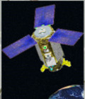
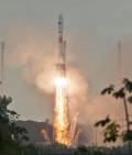
EgyptSat-2 launched

The Egyptsat-2 satellite, built by RKK Energiya for Egypt’s National Authority for Remote Sensing and Space Science, was launched on 16th April 2014 by a Soyuz-U from Baïkonour Cosmodrome, into a 435 x 703 km orbit.

This orbit prevents the satellite obtaining global covergae, but allows more frequent imaging of Egypt than possible in a standard orbit.

It carries a 1-metre resolution imager, and has now acquired its firts images of Autralia.


More information: 

More news

A World Glacier Atlas to understand glacier mechanisms in a global warming context

The 3 glacier products available on Theia offer an unprecedented global overview of the evolution of glaciers.

Land cover Theia product update

Like every year at this time, you’re invited to discover the new version of the OSO product, from the S.E.C Land cover. The 2022 version was released a few days […]

Exemple de traitement Arbocarto pour Mayotte, avril 2023

May 2023, Montpellier | Arbocarto user meetings

Three days of workshops for users of the Arbocarto tool were organised in Montpellier and in “hybrid” mode, from 9 to 12 May 2023. These days were organised in hybrid […]

Search