Land Surface Remote Sensing in 6 volumes
Series of books on remote sensing applied to continental surfaces has just been published with ISTE-Elsevier editors entitled « Land Surface Remote Sensing ».
Each book of this series contains a dozen chapters :
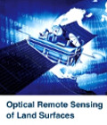
- Optical Remote Sensing of Land Surfaces
- Microwave Remote Sensing of Land Surfaces
- Land Surface Remote Sensing in Agriculture and Forest
- Land Surface Remote Sensing in Continental Hydrology
- Land Surface Remote Sensing in Urban and Coastal Areas
- Land Surface Remote Sensing: Environment and Risks
This series is designed for those who wish to discover or intensify their knowledge of remote sensing applied to continental surfaces.
This series edited by Nicolas Baghdadi and Mehrez Zribi is the result of a rich collaboration with world-class researchers in different topics.
More details exist in these two sites iste.co.uk ou store.elsevier.com (search by author Baghdadi or Mehrez)