A new version of Spot4 (Take5) products is available

The THEIA Land Data center just released the version 2.0 of SPOT4 (Take5) time series.
 
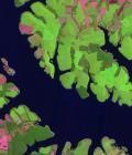
This data set provides time series of SPOT4 images acquired every 5th day over 45 sites, between February 2013 and June 2013.
 
The obtained time series simulate the time series that Sentinel-2 will deliver. The data were produced at MUSCATE production center, and are available here.
 
The new features of this version are described on the blog dedicated to the SPOT4 (Take5) experiment, as well as the product format which slightly evolved..More information: 

More news

[PhD] Spatio-temporal dynamics of suspended particulate matter in the estuary/coastal sea continuum

Thesis project aiming to integrate and interact high-frequency in situ data (COAST-HF, SYNAPSES) with water color satellite data (Sentinel 2/3 – Landsat – MODIS) to enhance our understanding of the land-sea interface.

Two THEIA LiDAR tools for forest monitoring

On this International Day of Forests, for which innovation has a major role to play in 2024, we are highlighting two tools dedicated to the management of aerial LiDAR data […]

SWOT data that exceeds expectations

The SWOT space mission was launched at the end of 2022 by CNES and NASA to document the water masses of the entire planet – oceans and continental waters. Data […]

Search