New Sentinel-2 products on the Maghreb
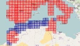
50 new Sentinel-2 tiles processed at level 2A including all the coastal regions of Maghreb can be download from theia.cnes.fr.
Zones where Theia provides Sentinel-2 A and B L2A products has been extended. L2A products provide surface reflectances after correction of atmospheric effects and with a high quality cloud mask. The products we deliver are provided by MAJA processor.
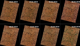
We just released all the data acquired on the Maghreb coastal zone, from Morocco to Tunisia. A few missing tiles have also been added in South Morocco, and on Cap Bon in Tunisia. With these new tiles, we now monitor all the lands that surround the occidental part of Mediterranean sea, adding 50 tiles to those already processed.
The processing started with the images acquired on the 1st of November 2017, to allow the monitoring of 2017-2018 crop season. The processing will go on in real time. We will also try to provide the data acquired before that date, but a little later.
For more information see cesbio.ups-tlse.fr/multitemp
More information: Sentinel-2