Alex Storm and flash floods in the French Maritime Alps: Spatial imagery for crisis management
After having swept over western France, Storm Alex led to an exceptional Mediterranean rainfall episode in the Maritime Alps during the night of the 2nd to 3rd October 2020. Flash floods of a rare force devastated several valleys, notably those of Vésubie, Roya and Tinée. The human and material damage was considerable, with many dead and missing and ravaged, isolated villages due to disrupted communication and transport networks.
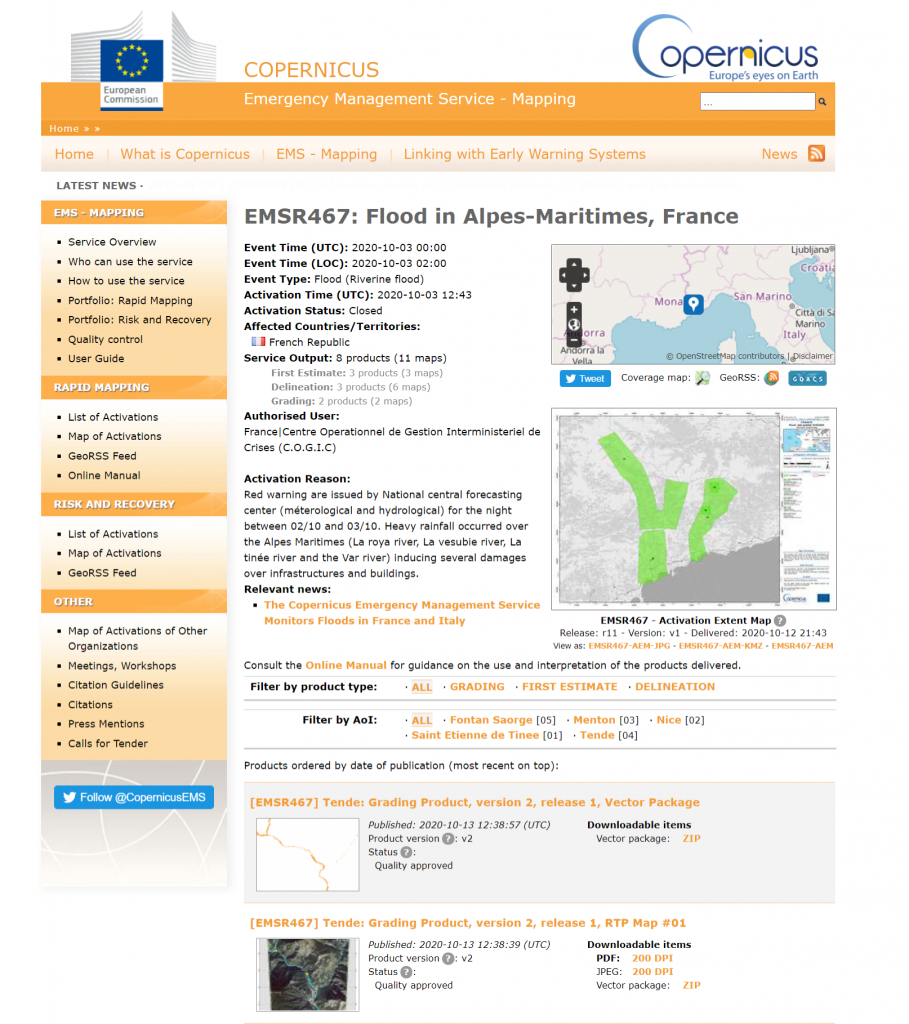
As soon as the event occurred, the COGIC, Centre Opérationnel de Gestion Interministérielle des Crises (Operational Centre for Inter-ministerial Crisis Management), called on space-based resources to obtain useful information for the implementation of relief operations, both on the location of the affected areas and on their accessibility. The European Copernicus Emergency Management Service – Rapid Mapping system was launched on 3 October to map flooding and damage to urban infrastructure. At the same time, the CNES activated the Pleiades satellites in order to image the various affected areas. The Pleiades system has demonstrated on numerous occasions its effectiveness in monitoring natural disasters and assessing urban damage, thanks to its very high spatial resolution and revisit frequency.
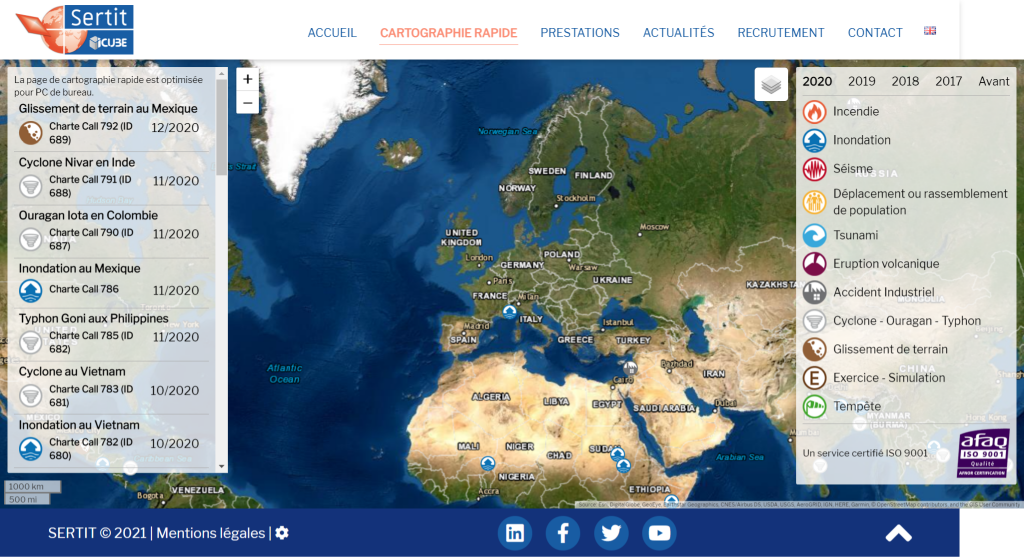
ICube-SERTIT’s (University of Strasbourg) operational 24/7 Rapid Mapping Service, was immediately asked by the CNES to use the Pleiades images to produce maps of the extent and impact of the event and to deliver the results in a few hours to the civil security services. SERTIT was also involved in the Copernicus EMS Rapid Mapping system, complementing the work carried out at the request of the CNES.
The analysis of damage linked to a disaster is carried out systematically by comparing a pre-event imagery with that of crisis or post-event imagery in order to identify changes specific to the event. Indeed, in long-term events, such as lowland flooding or large , it is necessary to monitor during an event. Depending on event-types, the use of particular spectral bands can also help interpretation. In the case of the Maritime Alps, the flash floods were so intense and devastating that the before-after comparison leaves little doubt about the damage and the difficulty of access to the affected sites.
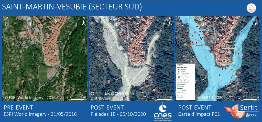
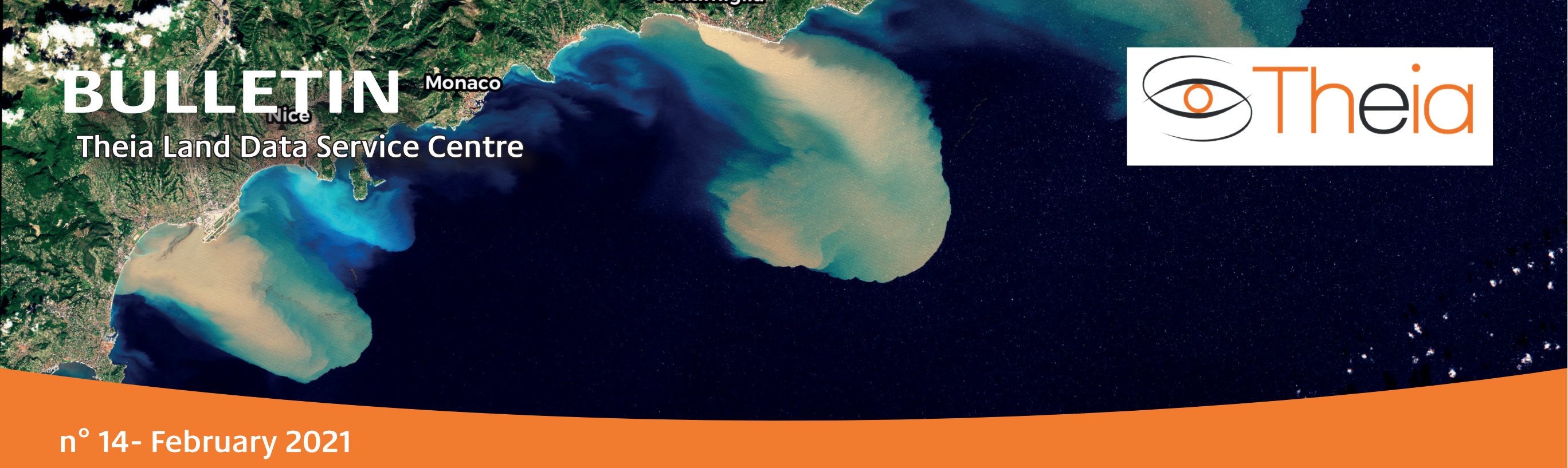
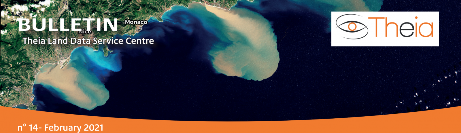
The Pléiades images acquired on the 5th of October 2020 were used to produce several maps highlighting the flooded and eroded areas, the destroyed, damaged or probably affected buildings, roads and bridges in the devastated valleys, notably close to the villages of Saint-Martin-Vésubie, Breil-sur-Roya, Roquebillière, Saint-Dalmas de Tende or Fontan. This information also makes it possible to identify unaffected areas where aid posts could be set up, and possible alternative routes to access the villages.
The products are delivered in the form of maps, in several formats and printing resolutions, and vector files, which can be directly integrated into users’ Geographic Information Systems. Satellite images can also be supplied on request, with the agreement of the CNES for Pleiades data. The products were urgently delivered to COGIC and CNES once they were produced. Pierre Chastanet, head of the TI2G Cluster (Crisis Planning and Management Department, Transversal Geographic Information and Geomatics Cluster, COGIC), congratulated the emergency mapping systems and space assets for their valuable assistance. These maps were used by a wide range of actors and widely disseminated in the media after the event. The Pléiades images, also a tool to assist in the management of relief operations, were distributed to the COGIC, as well as to the emergency services, prefectures, DREAL (Regional Directorates for the Environment, Planning and Housing), network managers (ENEDIS) and other State services (ONF, Cerema, etc.).
Stéphanie BATTISTON, Stephen CLANDILLON & Mathilde CASPARD
ICube-SERTIT, Rapid Mapping Service
sertit.unistra.fr/
Claire TINEL
CNES representative to the International Charter on Space and Major Disasters