FOTOTEX: An Unsupervised Method for Urban Areas
The French UMR Espace-dev has just published an article entitled “Fast Unsupervised Multi-Scale Characterization of Urban Landscapes Based on Earth Observation Data” in the journal Remote Sensing, presenting the use of an algorithm dedicated to the study of urban areas by remote sensing based on texture information.
Three nested scales
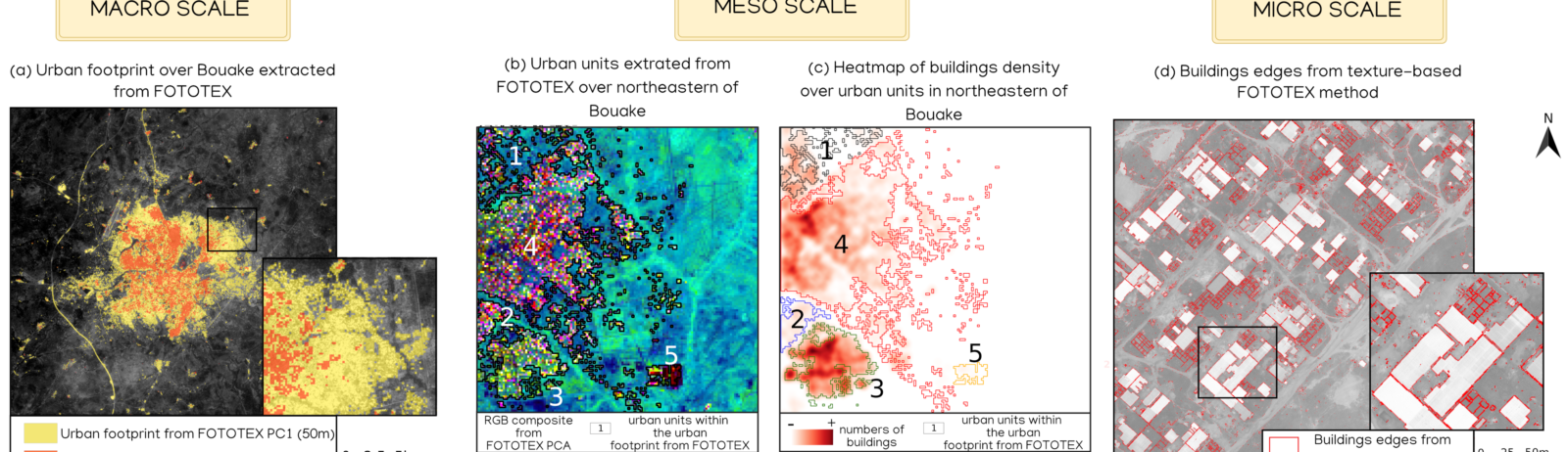
With FOTOTEX, this paper introduces a unique, fast and unsupervised method to characterize urban areas at three nested scales: macro-scale (urban footprint), meso-scale (“neighbourhoods”) and micro-scale (urban objects). FOTOTEX combines Fourier’s Transform and Principal Component Analysis to convert the spatial signal (patterns in the image) into a frequency signal (number of times the pattern is repeated in a defined area). [Figure 1]
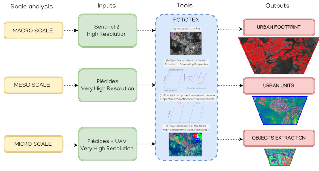
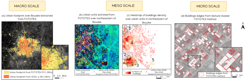
The results on Bouaké (Ivory Coast) [Figure 2] and Brasília (Brazil) have shown that a single Sentinel-2 image delineates the urban footprint (macro scale) better than some global products based on time series. Pleiades images identify different neighbourhoods and urban objects (meso- and micro-scales) using the texture signal, which is correlated with parameters such as building density, proportions of buildings and vegetation.
Research work based on FOTOTEX has been carried out in the framework of the TOSCA CNES APUREZA and DELICIOSA projects and is linked to the activities of the UMR Espace-Dev in the framework of Theia Risks Associated with Infectious Disease Risks SEC and Urban SEC.
Contact

Thibault Catry
IRD | Espace DEV
ResearchGate
Contributions FR
Risks Associated with Infectious Disease Risks SEC | Urban SEC | FOTOTEX
Reference
Teillet, C.; Pillot, B.; Catry, T.; Demagistri, L.; Lyszczarz, D.; Lang, M.; Couteron, P.; Barbier, N.; Adou Kouassi, A.; Gunther, Q. ; et al. Fast Unsupervised Multi-Scale Characterization of Urban Landscapes Based on Earth Observation Data. Remote Sens. 2021,13, 2398. doi.org/10.3390/rs13122398.