Theia innovates for the processing and dissemination of hydrological data
Flavien GOUILLON & Lionel ZAWADZKI from CNES gave an update on the evolution of the Theia data and services infrastructure to meet the needs of hydrological data processing and dissemination. A thematic portal, hydroweb.next, and a new processing centre, HYMOTEP, are ready to be opened soon.
hydroweb.next: Almost Ready for SWOT
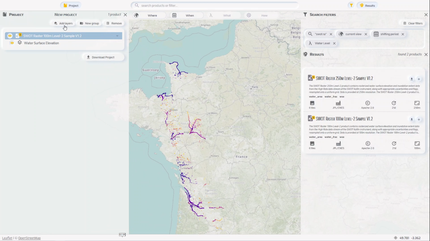
hydroweb.next is the hydrological web portal of the THEIA continental surface thematic consortium. This portal, financed initially by the SWOT-Aval downstream programme and then by THEIA, aims to facilitate access to multi-sensor and multi-source (i.e. in-situ, model, satellite) hydrological data.
The objective is to centralise a maximum of hydrological data and to provide advanced functions, in particular to search, compare, extract and manipulate these data. Note that hydroweb.next will be one of two portals, along with that of NASA’s Jet Propulsion Laboratory (JPL), to disseminate the hydrological data of the SWOT mission, which is due to be launched next December.
To contact us and take part in its development: hydroweb-ng@cnes.fr
Ergonomic, intuitive, built with users The development of hydroweb.next started a little less than a year ago. Thanks to the collaboration of many users, hydroweb. next now offers an ergonomic and intuitive interface. It is already possible to search, view and download a number of data, including the simulated SWOT data. The aim is to have the portal open to beta testers for the first time in March to April 2022. This will be used to gather user feedback to further improve hydroweb.next. A wider opening is planned for mid-2022.
A presentation (in French) is available.
HYMOTEP: Producing for Hydrology, but not only
A production centre for hydrology within THEIA is being built: HYMOTEP, for HYsope II iMplementation Of TrEatments and Production. The main objective of this centre is to realise the hydrological production plans of the THEIA continental surface data consortium. It should also, in the long term, offer a replacement solution for the Muscate production workshop, which produces the production plans for the other THEIA themes (i.e. vegetation).
HYMOTEP will allow a run-of-the-mill production of continental hydrology products (i.e. acquisition of input data, activation of scientific chains, and provision of the generated products for subsequent dissemination on the hydroweb.next portal).
The centre will host products from hydrological chains such as LIS (snow), SurfWater (water surface) and Obs2Co (water quality/temperature), as well as the upstream chains necessary for these productions (S1-tiling, MAJA). The objective is to move towards continental coverage to meet the CAL/VAL needs of future missions including SWOT.
Contact

Lionel Zawadzki
CNES
@L.Zawadzki
Ambitious production objectives for the coming year
The development of HYMOTEP began in October 2021. It is now able to generate products from MAJA and the LIS chain and soon SurfWater on a day-to-day basis in well-defined areas. The goal is to have day-to-day on all the chains mentioned in the summer of 2022, with active supervision by the operators of the production activities and consolidated metrics on the availability of HYMOTEP.