VHSR Soil Moisture: All Series are up to date (or almost)
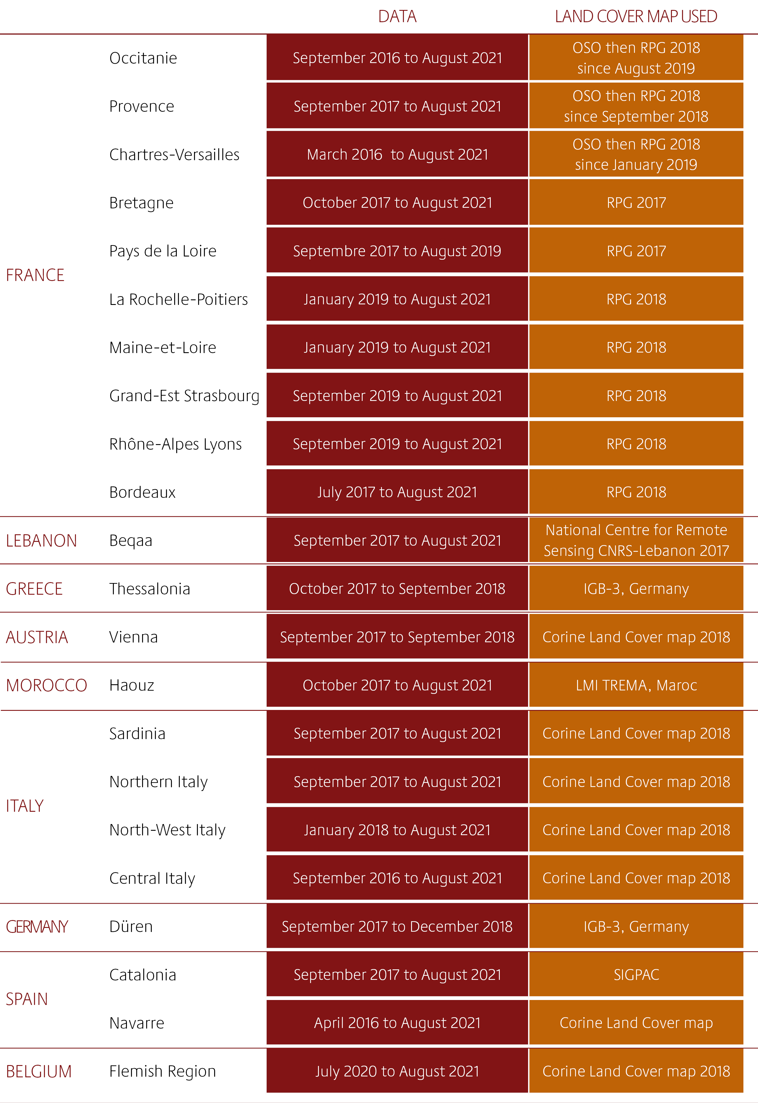
By optimising production, the Soil Moisture with Very High Spatial Resolution SEC has been able to update 20 of the 22 available series documenting soil moisture at the plot level every six days (and in some cases even more frequently!) using Sentinel-1 data.
These 20 series all include, at least, data for August 2021. The product archive thus now amounts to 8444 maps. The objective is to obtain a more regular and global production of the product to better meet the needs of users.
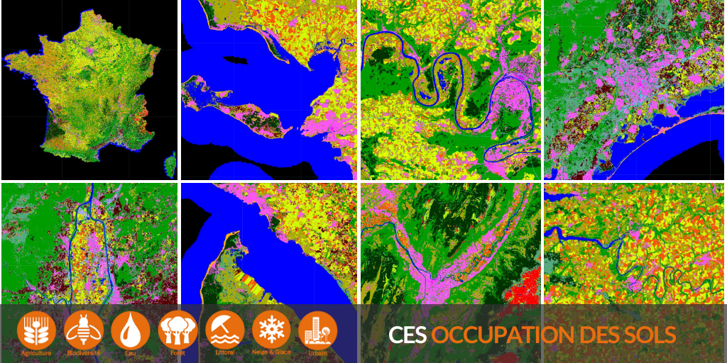
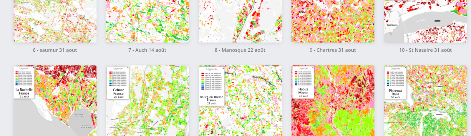
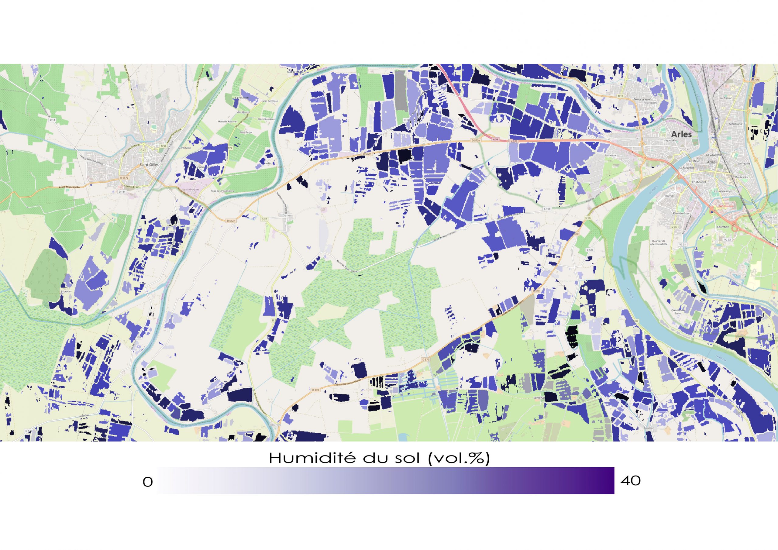
Soil moisture at the plot level at the end of August 2021

More about the product
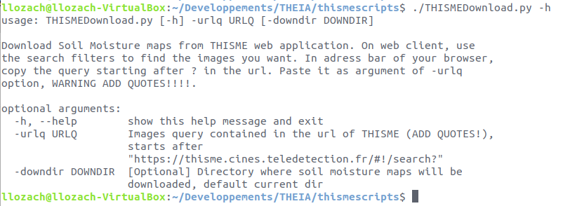
THISMEDownload.py : a dedicated tool for downloading
To facilitate entire collection download, an automatic THISMEDownload.py script has been developed by Loïc Lozac’h (INRAE engineer). The script is usable only on a Linux system because it contains dependencies (curl, wget) only available on this system. It allows batch downloading of the data present on the THISME web application.
Directions
- On the THISME web application, launch a search via the client interface.
- The query corresponding to this search is displayed in the address bar of your browser.
- Copy this address from the question mark (?)
- Use this query as an argument to the -urlq option in the THISMEDownload.py script
- Don’t forget to put the query in quotes.
For example, to download the collection corresponding to Central Italy, write :
THISMEDownload.py -urlq "q=%23Central-Italy&collection=SoilMoisture"