What Hydroweb data shows about the Kakhovka dam failure
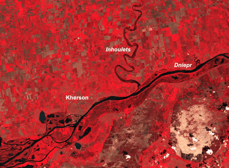
On 6 June 2023, the Kakhovka hydroelectric dam on the Dniepr river was destroyed by an explosion, causing extensive flooding in downstream areas, including the town of Kherson.
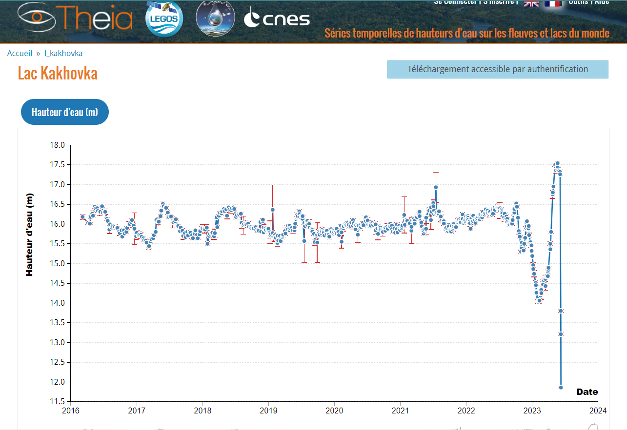
Theia Hydroweb data has been widely used to illustrate the recent variation in the Kakhovka dam reservoir on social networks, with comments sometimes going far beyond what the data can actually indicate.
Thanks to the support of CNES, Hydroweb offers continuous long-term time series on the level of the world’s large lakes, reservoirs and rivers. Operational altimetry measurements are updated every 1.5 days: the altitude of the satellite above the water surface is deduced as a function of the round trip time of the wave. These data are internationally recognised for their quality and accuracy.
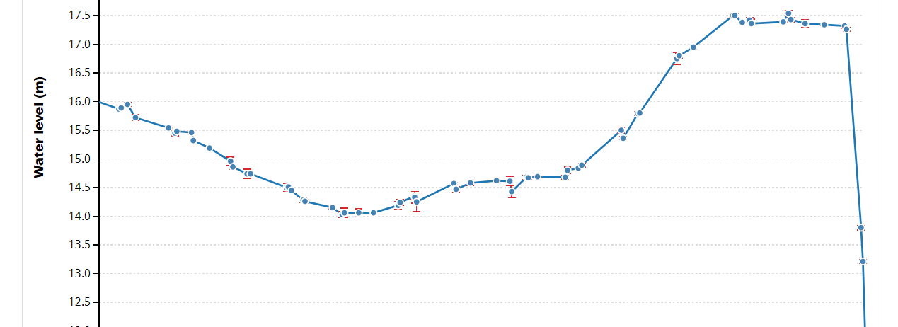
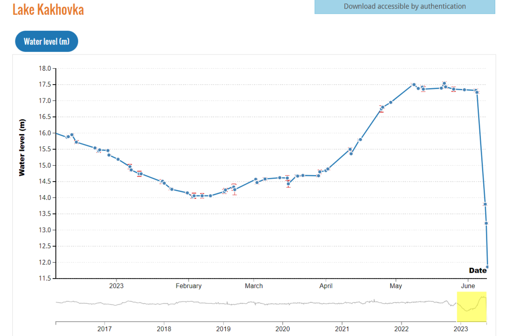
In the case of the Kakhovka dam, for example, they show that the level of the reservoir fell by 3.5 metres in the three days following the explosion, and by 2 metres every day since. This gives an indication of the colossal amount of water released.
Long-term hydrological data
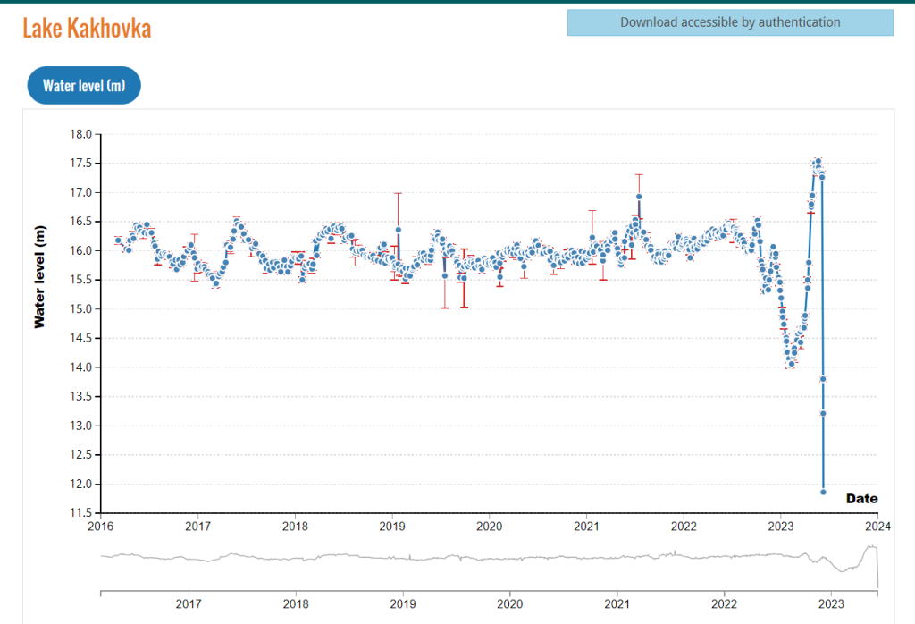
These data, available since 2016, also allow inter-annual comparisons, well beyond the anomalies linked to the conflict in the region. The graph above does not show a single annual pattern for the reservoir since 2016: the level of water in the dam often varies according to cyclical and seasonal needs and human management decisions. The available data shows that since the dam has been at the heart of the conflict, changes in the reservoir level have been very different from previous years, reflecting even more human decisions, the effects of which a satellite can only observe.
Further information
Download Hydroweb Data
To be able to download, you will need to register for a free account.