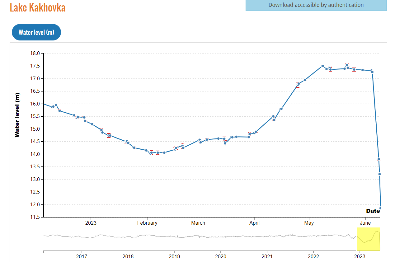
Kakhovka: HYDROWEB data shows a reservoir turned back a river
The Hydroweb database – https://hydroweb.theia-land.fr/ – has been designed to monitor changes in water levels over time on large lakes, reservoirs and rivers, based on altimetry measurements. These data are intended for a variety of user communities: scientists, basin managers, water resource monitoring services in different regions, international bodies such as the WMO or the International Office for Water, etc.
Hydroweb was not originally designed to monitor the degradation of reservoirs, either naturally or as a result of destruction, such as at the Kakhovka dam on the Dniepr river. Although it did provide relevant and accurate information on the evolution of the reservoir in the days following its recent explosion.
Robust, exacting products
Hydroweb products are regularly validated using in situ data. This validation means that they achieve sub-decimetric accuracy for large lakes and reservoirs and a resolution of 10-20 .cm for smaller ones. This order of magnitude may vary from one lake to another. The data available since 2016 allow interesting inter-annual comparisons to be made to identify trends and anomalies.
The Hydroweb team noticed very early on (before the Kakhovka dam was destroyed) that the variations in level since October 2022 had an abnormal behaviour compared with the variations of previous years. At no time did these variations lead us to anticipate that the dam would subsequently be destroyed. Since the dam was destroyed, particular attention has been paid to monitoring the lake, using both Hydroweb data on the spectacular fall in water levels and other space-based data on flooding downstream of the dam (mainly using images from the Sentinel operational programme).
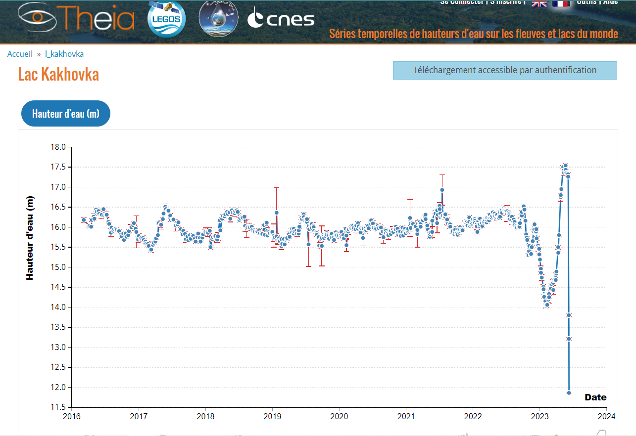
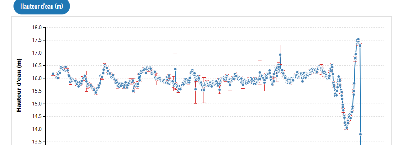
Theia Hydroweb time series for the Kakhovka reservoir. 2016-2023. Data available on hydroweb.theia-land.fr
On this dam, Hydroweb operates in operational mode, i.e. the data is processed as soon as it is acquired, with a very short delay (<2 days). However, in order to filter out potential errors, the automatic calculation programme manages thresholds based on historical variations. As soon as the level of this dam rose very sharply at the end of January, we modified these thresholds, because the measurements were automatically eliminated: the variations in level were far too sudden compared with anything we had seen up to that point.
Thanks to this adjustment, in the first few days after the dam was destroyed, we were able to document the very rapid fall in the reservoir level without this data being eliminated. However, as Hydroweb was not designed for this type of extreme case, another problem in processing the data arose when the dam dried up. Around June 17th, the recording made covered an area that was no longer occupied by water (following the dewatering), nevertheless providing us with a height, which no longer corresponded to the level of the water that was still flowing and was no longer consistent with other recordings (on June, 18th, for example) at other locations of what remained of the reservoir.
In other words, what used to be a large body of water with a given level has reverted to a river with a natural gradient, the level of which can no longer be measured and can be likened to that of a reservoir. As a result, we consider that the Kakhovka reservoir no longer exists, and we have interrupted the automatic calculation and removed from the time series the last two measurements that no longer reflected an interpretable level.
Hydroweb team and scientific expertise CNES/LEGOS
Further information
Download Hydroweb Data
To be able to download, you will need to register for a free account.