Tool Access
BioDispersal requires QGIS 3.4 (or superior version) and GRASS.
Go to plugins menu, Install/manage plugins, type BioDispersal and click on Install button. A dear icon should appear. Otherwise, it is available in plugins menu.
Presentation
BioDispersal is a QGIS 3 plugin.
Its purpose is to compute ecological continuities based on environments permeability and animals potential dispersal areas. BioDispersal has been designed as a 7-steps plugin from raw data preprocessing to the final dispersal areas computation. Parameters settings can be saved to and loaded from a configuration file.
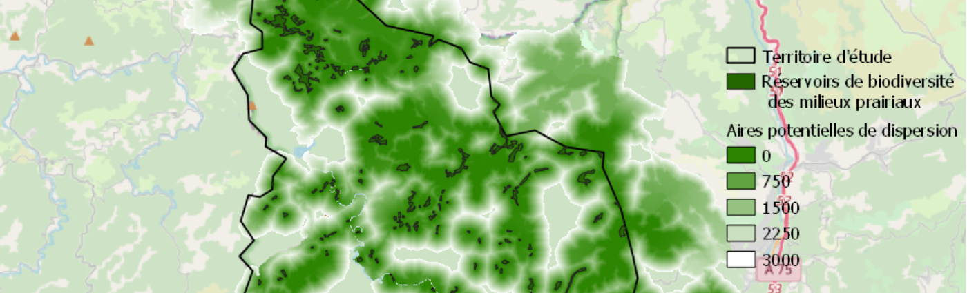
Below is an example of dispersal map created by BioDispersal:

BioDispersal has been developped by UMR TETIS – IRSTEA, on mission for the French ecological network resource center (driven by French ministry of ecology).
Contacts

Mathieu Chailloux
INRAE | Tetis
@M.Chailloux

Jennifer Amsallem
INRAE | Tetis
@J.Amsallem