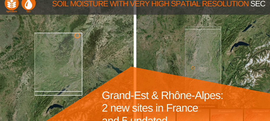
VHSR Soil Moisture: two new sites in France and 5 updated
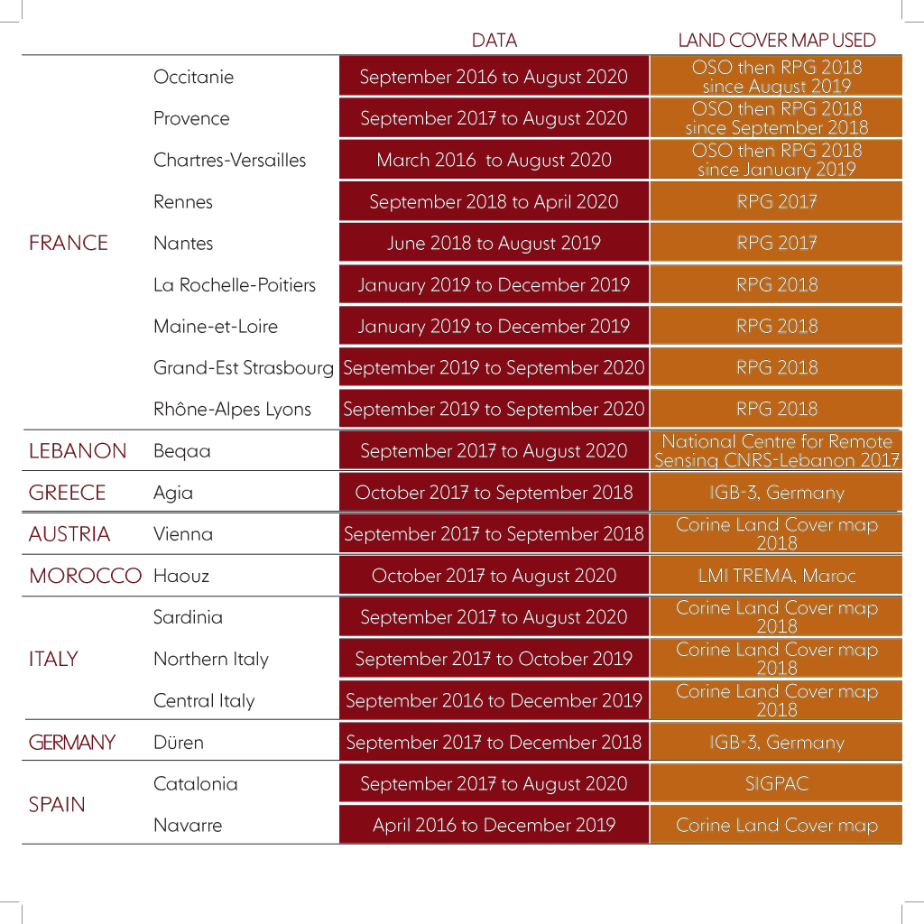
The Soil Moisture with Very High Spatial Resolution SEC offers now map series for two new sites in France: Rhône-Alpes (Lyons’ area) and Grand-Est (Strasbourg’s area). Beside 5 series have been recently updated: Catalonia (Spain), Beqaa (Lebanon), Provence (France), Sardinia (Italy), Haouz (Morocco). 19 sites are now documented at plot-scale using Sentinel-1 images.
Grand-Est & Rhône-Alpes series
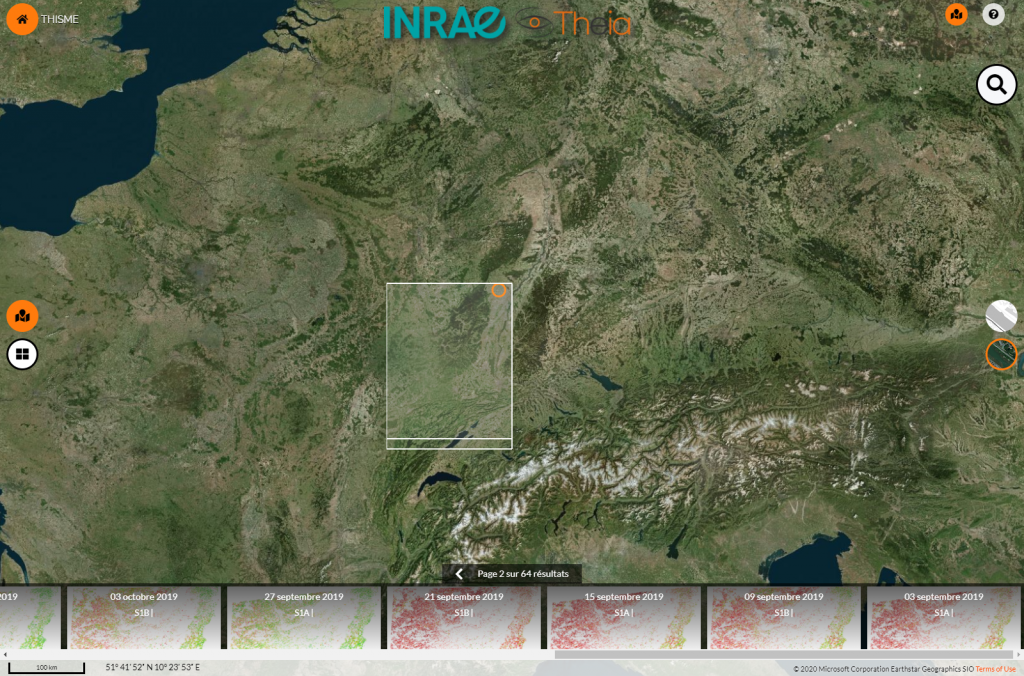
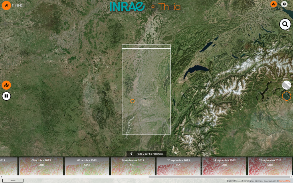
Grand-Est Strasbourg | The new series documents soil moisture in the areTwa with 64 maps at plot-scale from September 2019 to September 2020.
Rhône-Alpes Lyon | The new series documents soil moisture in the area with 63 maps at plot-scale from September 2019 to September 2020.
5 updated soil moisture series
Catalonia, Spain | Data have been updated for this site up to 31 of August 2020. The series now features 196 maps since September 2017.
/product-sm-catalogne
Beqaa, Lebanon | Data have been updated for this site up to 29 of August 2020. The series now features 294 maps since September 2017.
Provence (France) | Data have been updated for this site up to 28 of August 2020. The series now features 221 maps since September 2017.
Sardinia (Italy) | Data have been updated for this site up to 31 of August 2020. The series now features 196 maps since September 2017.
Haouz (Morocco) | Data have been updated for this site up to 31 of August 2020. The series now features 177 maps since October 2017.
Soil moisture at plot level every six days
The VHSR Soil Moisture product documents soil moisture at a plot scale every six days based on Sentinel-1 data. It is available for 19 sites in Europe and around the Mediterranean.
Registre parcellaire graphique (RPG)
National Center for Remote Sensing Lebanon
IBG-3 | Frank Hermann
Corine Land Cover | Copernicus
LMI TREMA Maroc | Vincent Simmoneaux
SIGPAC Espagne
Available data in October 2020
More about the product
Contact

Nicolas Baghdadi
INRAE | Tetis
ResearchGate
Contributions