MAJA ADAPTS TO CAMS’ EVOLUTION
The development of CAMS aerosol products requires MAJA to be adapted and has an impact on the production of Reflectance Theia products.
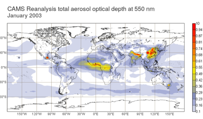
The development of CAMS aerosol products requires MAJA to be adapted and has an impact on the production of Reflectance Theia products.
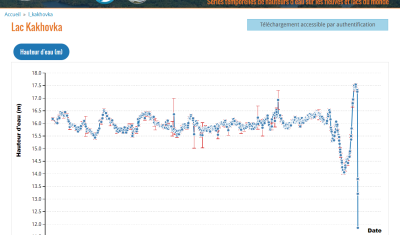
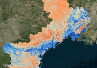
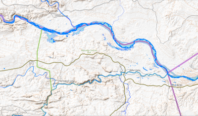
Hydroweb data is used to track the world’s major rivers and reservoirs. It documents the end of the Kakhovka reservoir.
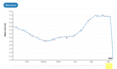
Theia Hydroweb data has been widely used to illustrate the recent variation in the Kakhovka dam reservoir on social networks, with comments sometimes going far beyond what the data can actually indicate.
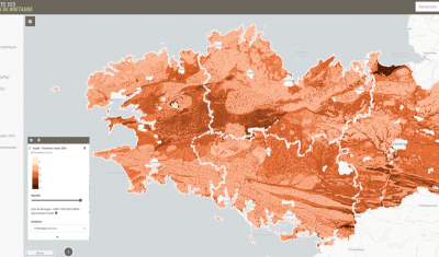
Theia Digital Soil Mapping experts group produces an interactive mapping of soil properties in Brittany, documenting the following variables: An online application allows you to view predictive maps of soil properties on: […]
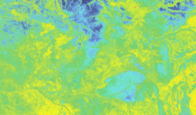
Theia Digital Soil Mapping CES produces Soil property prediction maps in Languedoc-Roussillon (east part of the Occitanie region). The soil properties concerned are the particle size fractions : For each of these […]
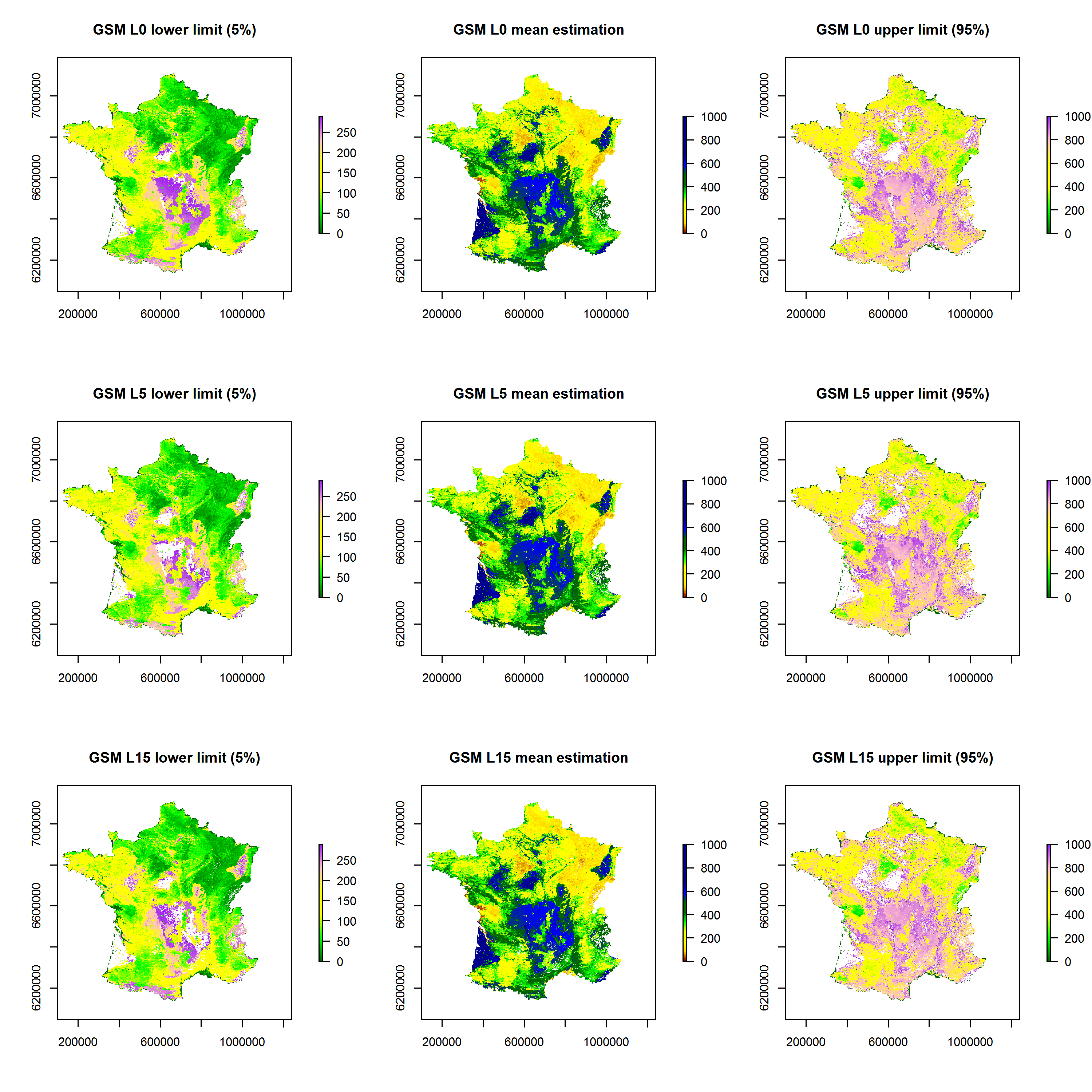
Theia Digital Soil Mapping CES produces a series of maps of soil particle size fractions (clay, silt, sand) and coarse element content for metropolitan France.
A Water Capacity calculated from a pedo-transfer function applied to soil characteristics estimated by digital mapping techniques.
Mapping of the distribution of Xenopsylla flea vectors of murine typhus, Reunion Island.
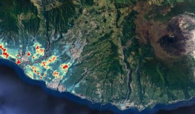
Geographic layers of monthly water surface changes for Hwangue, Gonarezhou and North Kruger National Parks in Zimbabwe, for modelling animal movements and predicting potential pathogen transmission.