[World Soil Day] THEIA tools for documenting soil-water interactions
On December 5th, the international community dedicates World Soil Day to raising awareness of the importance of soil quality and health for the proper functioning of ecosystems and agricultural production.
This year, the FAO is focusing on soil and water interactions as determining and interdependent factors in agricultural productivity. Rain-fed agricultural systems consume 30% of the planet’s fresh water and account for 80% of cultivated land (contributing to 60% of global food production). These systems are highly dependent on effective soil moisture management practices, and their constraints are increasing everywhere as a result of climate change.
Estimating soil water reserves
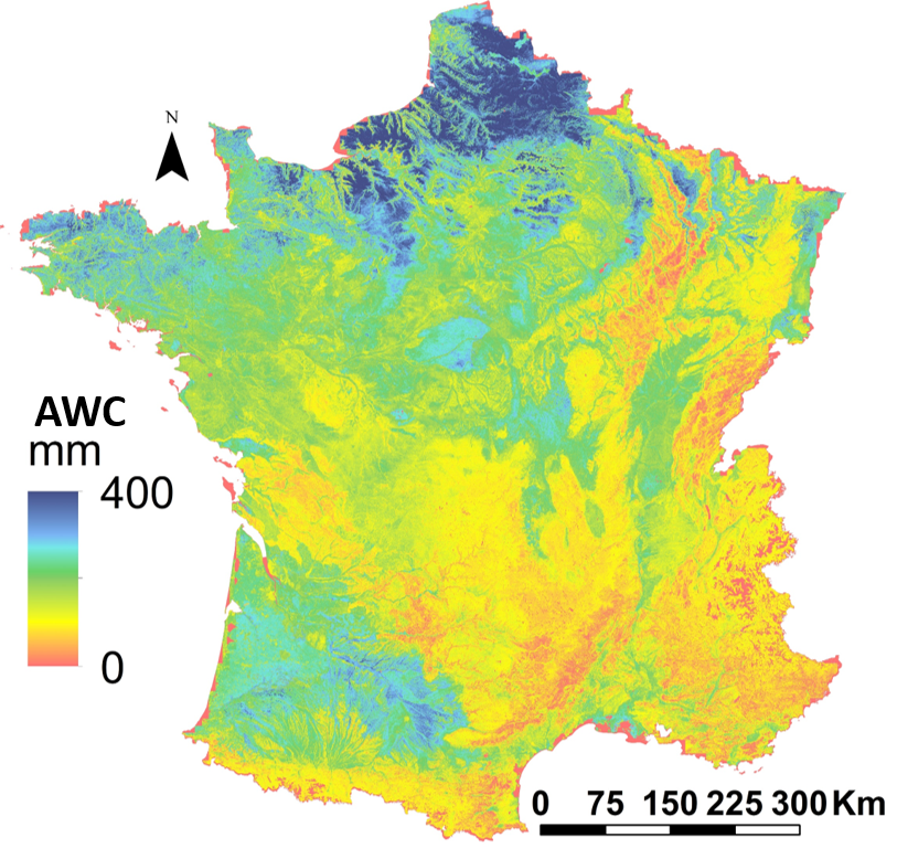
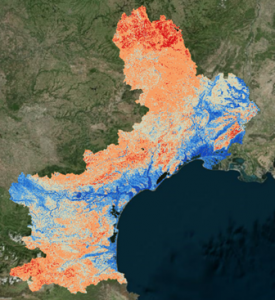
This day is a good opportunity to highlight the map of the useful water reservoir of soils in mainland France, produced by our Digital Soil Mapping experts. This corresponds to the maximum quantity that a soil can retain and return to plants, estimated from satellite and pedological data using modeling methods endorsed internationally by GIS Sol. Aimed to informing regional decision-makers, the product is available for the whole of mainland France. It has been adapted to a more precise scale for the Occitanie region.
Contact

Anne Richer-de-Forges
INRAE | Info&Sols
ResearchGate
Contributions FR
Monitoring plot humidity
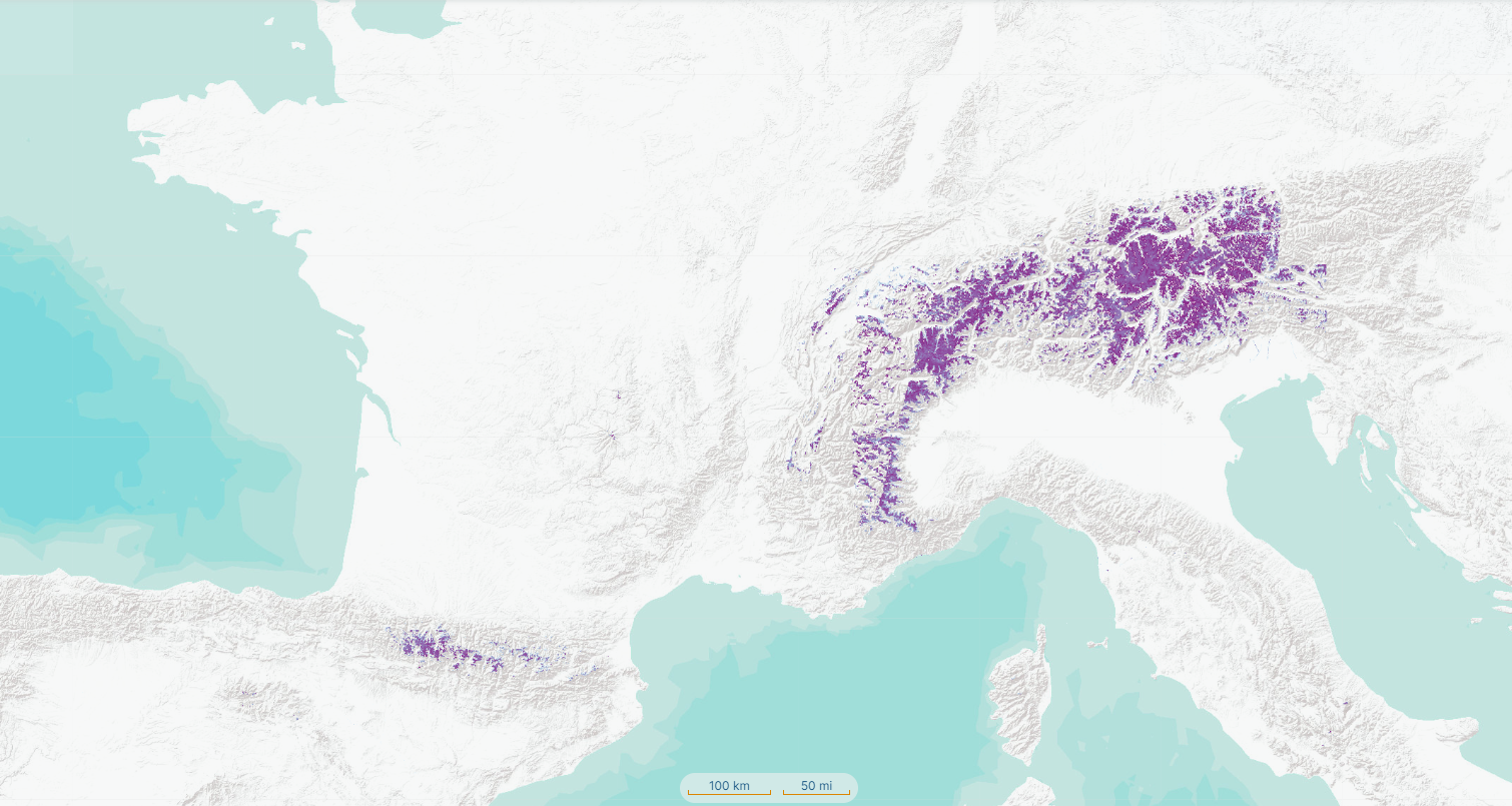
Soil water reserve capacities can be compared with plot-scale soil moisture information available on THEIA. Based on Sentinel-1 and -2 data, this product documents soil water status with precision and spatio-temporal resolutions tailored to the needs of scientific users and public policy-makers. In particular, it can be used to improve local water management and support irrigation decisions.
In on-demand production, the Moisture product can be updated every six days. It is available on a plot and intra-plot scale, starting at 0.2 hectare. It has been tested at various sites around the Mediterranean basin and elsewhere in Europe.
The THRS soil moisture product has been tested in a wide range of climatic and farming situations in France, Europe and around the Mediterranean.
Contact

Nicolas Baghdadi
INRAE | Tetis
ResearchGate
Contributions
Adapted and innovative THEIA products
The THEIA cluster continues to lead the national scientific community to support and promote the production of innovative and adapted continental surface observation products. Find out more about THEIA thematic products.