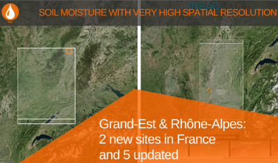
VHSR Soil Moisture: two new sites in France and 5 updated
Data at plot-scale are now available for 2 new sites in France: Grand-Est and Rhône-Alpes. 5 others have been updated.
Data at plot-scale are now available for 2 new sites in France: Grand-Est and Rhône-Alpes. 5 others have been updated.
Guillaume Rieu (TerraNIS) revisits the logic of Academic/Business cooperation lthat underlies the success of a tool like Sat’Irr.
Anne Fromage-Mariette, director of Open IG, a structure coordinating Theia Occitanie RAN, shares with us her vision of the stakes of animation and mediation for the promotion of the uses of space.
The Trishna mission being planned opens up new horizons for research and applications for Theia.
Discover the Copernicus FSC product and its links with Theia Snow product.
A first evaluation of the quality of the Lidar GEDI satellite measurements for water level monitoring carried out at Tetis has just been published.
Discover the content of Theia Bulletin n°13
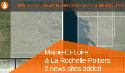
Check out the Maine-Et-Loire and La Rochelle-Poitiers series of the VHR soil moisture products
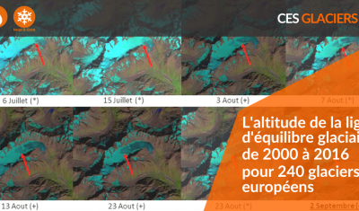
Discover the product Glacier equilibrium line altitude, documenting the evolution of 240 glaciers in the European Alps between 2000 and 2016.