GEOV2-AVHRR: the 2021 version is available
The GEOV2-AVHRR product documenting vegetation on a global scale since 1981 has been updated by CNES within the framework of the Vegetation Biophysical Variables SEC activities. It provides a time series of vegetation variables:
- Leaf Area Index (LAI),
- Fraction of Photosynthetically Active Radiation absorbed by vegetation (FAPAR)
- and fraction of vegetation cover (FCOVER).
These vegetation data are now available for the year 2021 on the website postel.theia.cnes.fr.
40 years of Essential Variables
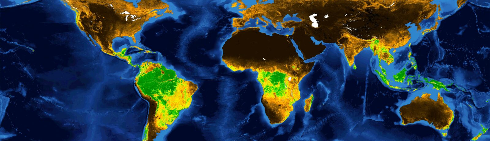
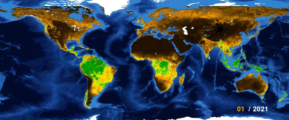
Computed from AVHRR data, these time series allow comparisons of vegetation at 4 km resolution, over forty consecutive years, on a global scale.
Global LAI value with a 4 km2 accuracy, every 15th of the month, since 1981. GEO2V-AVHRR series distributed by Theia offers 3 monthly images of vegetation at global scale since 1981.
These different data are part of the remotely sensed Essential Climate Variables (ECV) identified by the Global Climate Observing System (GCOS) in 2010. The importance and the content of the AVHRR archive have been precisely described in an article of the Theia Bulletin n°14. The archive is distributed under an Etalab V2.0 license.