Data Access
Description
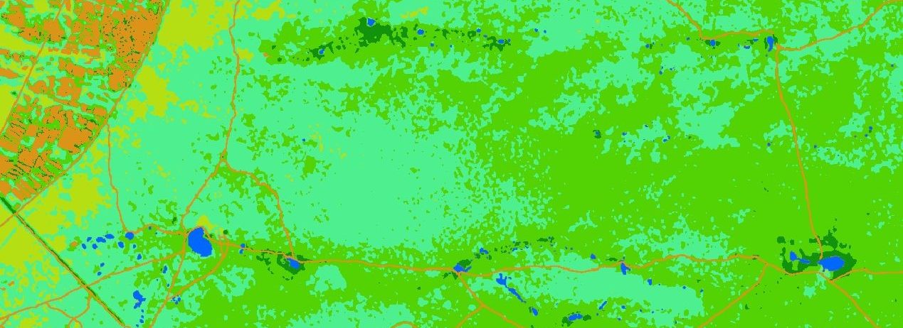
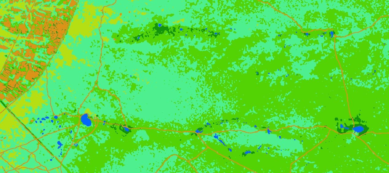
Theia Risks associated with infectious diseases SEC provides spatialized landcover raster layers, derived from a time series of Sentinel-2 satellite images (from the year 2018), for Hwange, Gonarezhou and North Kruger National Parks in Zimbabwe.
Vegetation and landcover are indeed main determinants of wild and domestic animal species movements in savanna environments. These landscape scales vegetation and landcover data (spatial resolution of 10 m) allow us to analyse and model buffalo and cattle movements, contact areas and potential inter and intra-species pathogen transmissions (foot-and-mouth disease and Rift Valley fever) in relation with their respective environments.
These spatialized raster data are used in the TEMPO project.
Format
GEOTIFF
Reference
Rumiano F., Wielgus E., Miguel E., Chamaille-Jammes S., Valls H., Cornélis D., De Garine-Wichatitsky M., Fritz H., Caron A., Tran A.. 2020. Remote sensing of environmental drivers influencing the movement ecology of sympatric wild and domestic ungulates in semi-arid savannas, a review. Remote Sensing, 12 : 37 p..
doi.org/10.18167/DVN1/BJJZJV
Rumiano F., Gaucherel C., Degenne P., Miguel E., Chamaille-Jammes S., Valls H., Cornélis D., De Garine-Wichatitsky M., Fritz H., Caron A., Tran A.. 2021. Combined use of remote sensing and spatial modelling: When surface water impacts buffalo (Syncerus caffer caffer) movements in savanna environments. ISPRS Archives of the Photogrammetry, Remote Sensing and Spatial Information Sciences, ISPRS, p. 631-638. doi.org/10.5194/isprs-archives-XLIII-B3-2021-631-2021
See also
TEMPO projet website
Data Quoting
Rumiano, Florent; Miguel, Eve; Valls-Fox, Hugo; Chamaillé-Jammes, Simon; Caron, Alexandre; Tran, Annelise, 2020, “Land cover map, Dete site, Hwangue National Park, Zimbabwe”, https://doi.org/10.18167/DVN1/BJJZJV, CIRAD Dataverse, V1
Rumiano, Florent; Miguel, Eve; Caron, Alexandre; Dupuy, Stephane; Tran, Annelise, 2022, “Land cover map, Malipati site, Gonarezhou National Park, Zimbabwe”, https://doi.org/10.18167/DVN1/2SFOA5, CIRAD Dataverse, V1
Rumiano, Florent; Miguel, Eve; Caron, Alexandre; Dupuy, Stéphane; Tran, Annelise, 2022, “Land cover map, Pesvi site, Kruger National Park, Zimbabwe”», https://doi.org/10.18167/DVN1/ZLIQIL, CIRAD Dataverse, V1