SWOT data that exceeds expectations
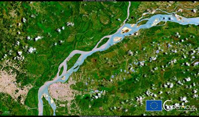
The SWOT space mission was launched at the end of 2022 by CNES and NASA to document the water masses of the entire planet – oceans and continental waters. Data […]
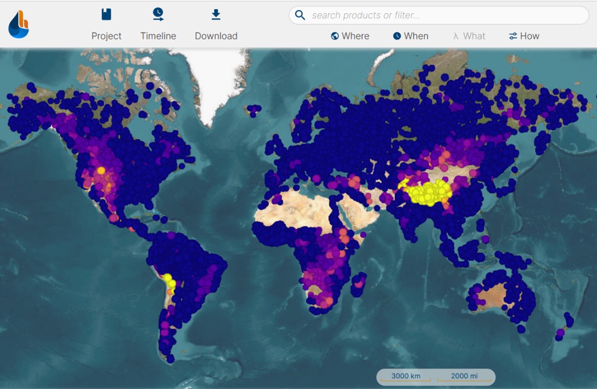
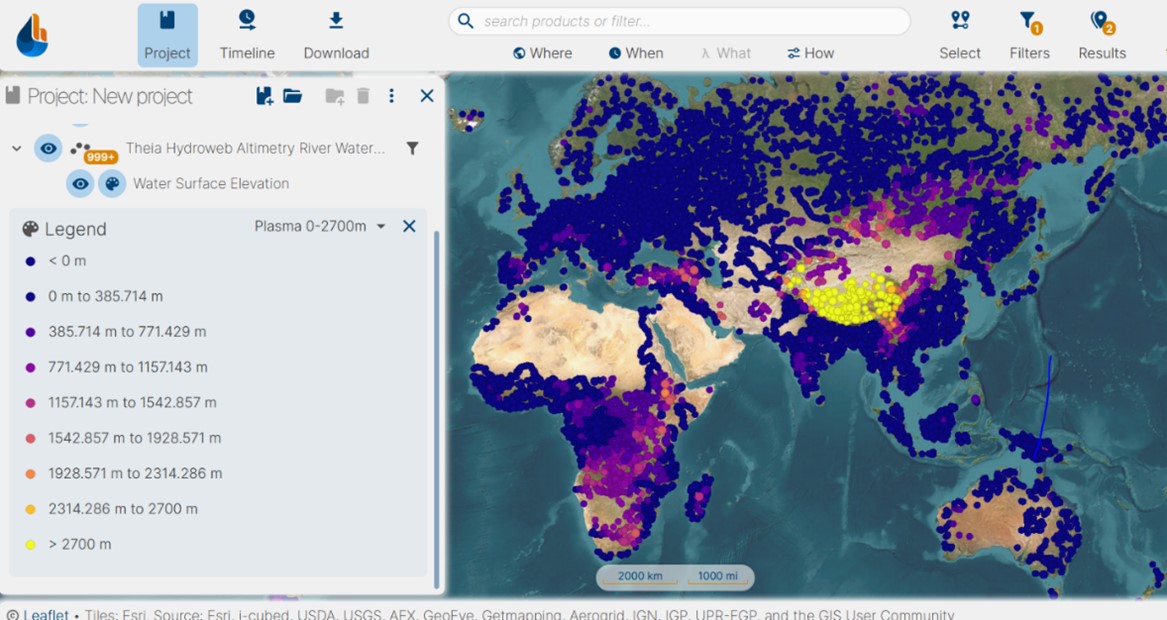
At the end of 2023, the distribution of THEIA river and lake level products derived from space altimetry will be transferred to the hydroweb.next.theia-land.fr portal, the new thematic portal for hydrology from the Theia, part of the French Research Infrastructure, Data Terra.
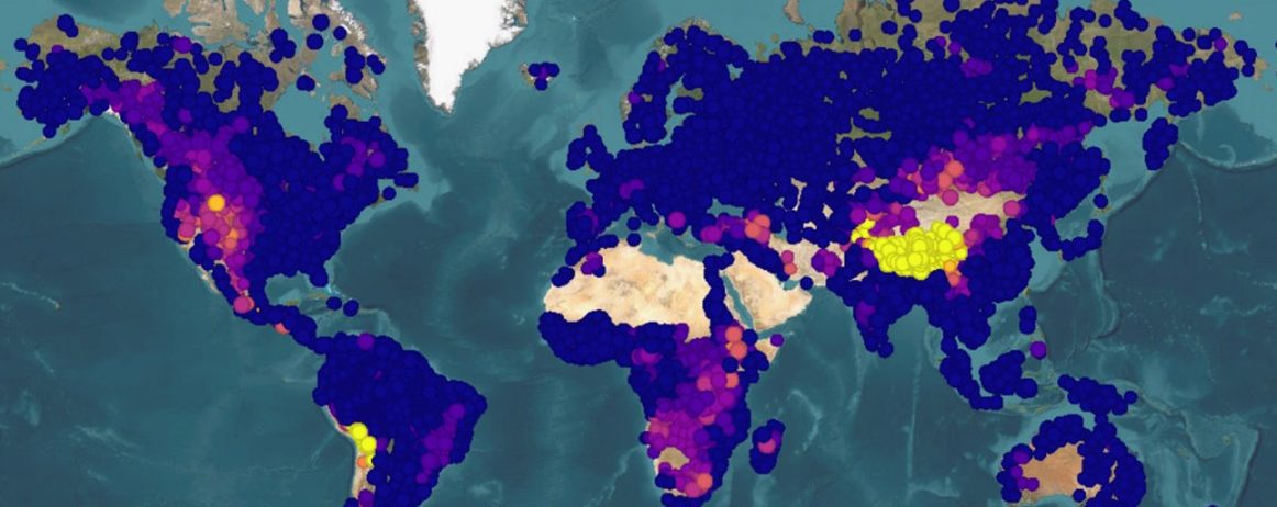
These time series provide continuous, long-term data (in some cases over 30 years) on the level of rivers, lakes, and reservoirs around the world. River products are provided at the point where a satellite repeatedly passes over the watercourses, thus defining ‘virtual stations’. For lake products, several satellite missions can provide information on the average height of a given lake and, for some of them, also the surface area and variation in volume.
Thanks to the joint efforts of CNES, LEGOS, CLS, the Copernicus and CCI programmes (ESA) and many other partners, the number of targets tracked is constantly increasing worldwide.
An overlay period between the historical dissemination portal and this new portal will be provided until 31 March 2024 to allow you to adapt to this change. After this date, the URL hydroweb.theia-land.fr will no longer be accessible.
This change has two main objectives :
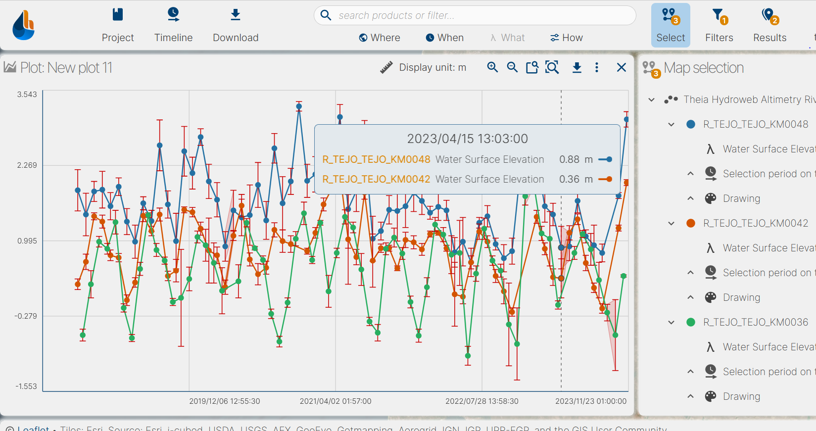
The principle remains the same, authentication with your THEIA account is required to download the products. New features are available, such as the ability to display several stations on the same graph.
You’ll find all the information you need to use the new interface in this tutorial:
However, some of Hydroweb’s existing functions will not be available until spring 2024 (search by basin, river, lake and display of catchment areas). So please be patient!
We let you discover this new portal and do not hesitate to send us your feedback to improve your user experience.
If you have any questions about connection and data distribution, please contact: exp.hysope2@cnes.fr
For any questions about Hydroweb altimetry data, the contact point remains the same: contact.hydroweb@groupcls.com
News
The SWOT space mission was launched at the end of 2022 by CNES and NASA to document the water masses of the entire planet – oceans and continental waters. Data […]
Products
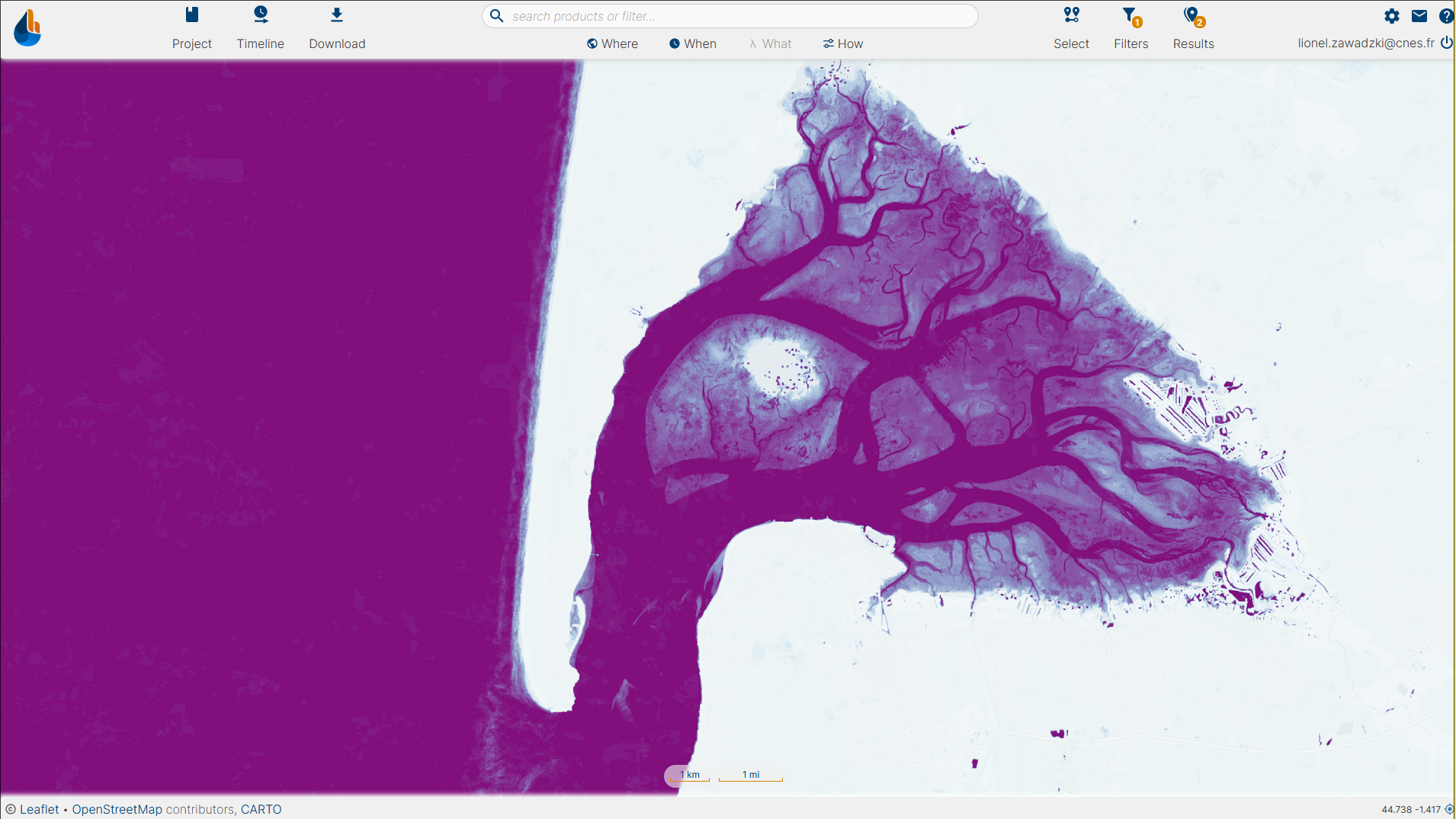
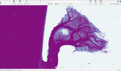
Discover Theia Surfwater Product now produced continuously for Sentinel-2 and available on hydroweb.next
Products
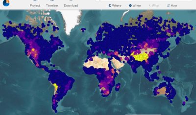
Discover the new hydroweb.next portal, which now include Theia Lake and River Water Level Products, Hydroweb
Products
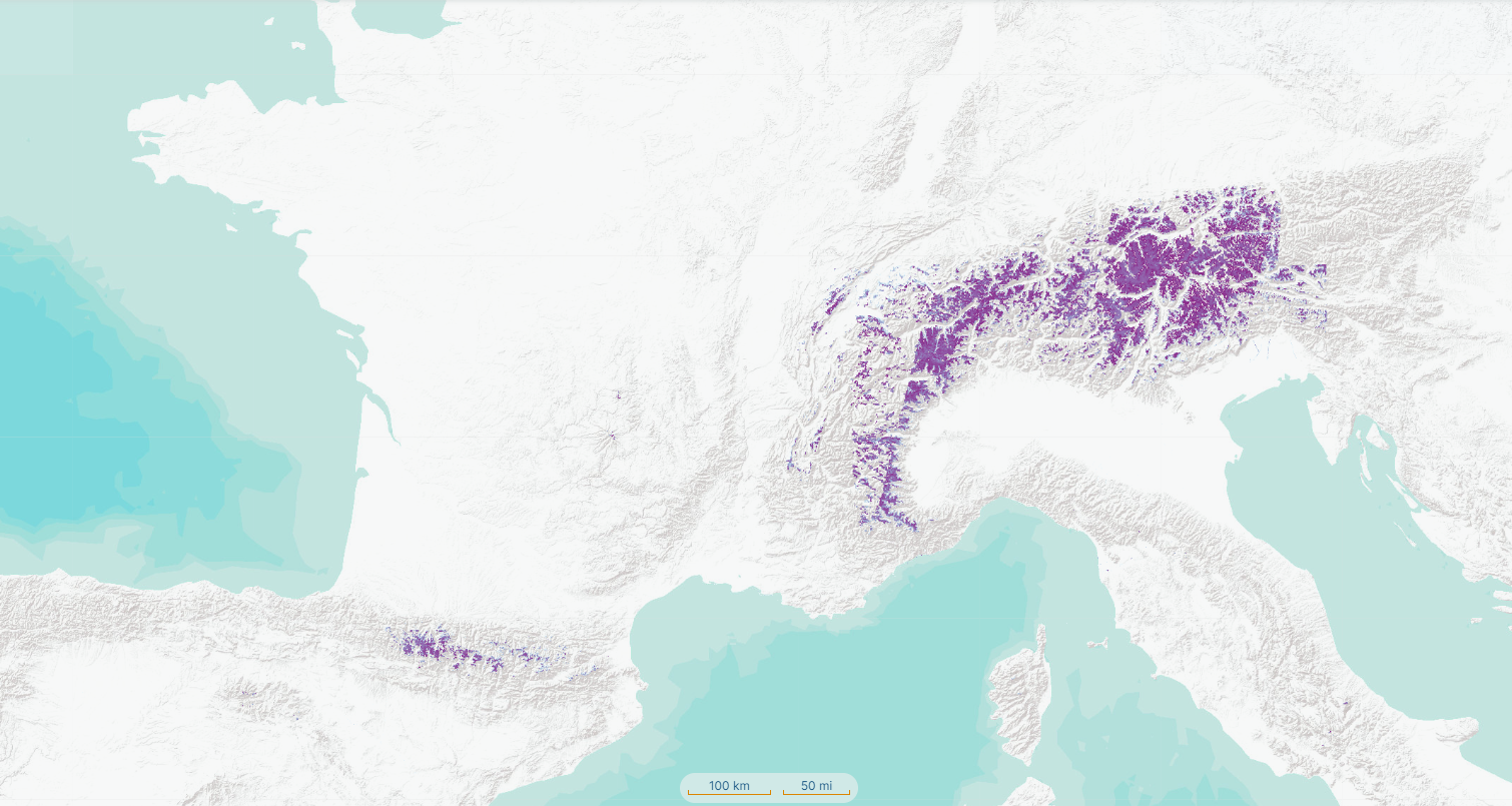
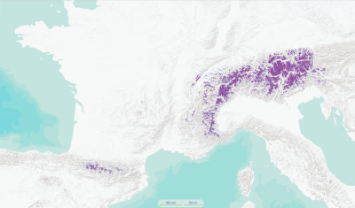
Find Theia Snow product on hydroweb.next along with other signifiative hydrological data and products.
Publications
Flavien GOUILLON & Lionel ZAWADZKI from CNES gave an update on the evolution of the Theia data and services infrastructure to meet the needs of hydrological data processing and dissemination.